Cleveland Street, Sydney
Cleveland Street | |
|---|---|
| Sydney | |
| General information | |
| Type | Street |
| Length | 2.8 km (1.7 mi)[1] |
| Maintained by | Roads & Maritime Services |
| Former route number |
|
| Major junctions | |
| West end | Camperdown, Sydney |
| |
| East end | Lang Road Moore Park, Sydney |
| Location(s) | |
| Suburb(s) | Chippendale, Darlington, Redfern, Surry Hills |
| Highway system | |
Cleveland Street is a busy thoroughfare near the central business district of Sydney in New South Wales, Australia. From west to east, it runs from City Road in Chippendale, across the railway lines between Central and Redfern stations and east through Surry Hills, crossing the Eastern Distributor and South Darling Street, to terminate at Anzac Parade, Centennial Park. The street is named after Captain Cleveland, an officer of the 73rd regiment.
Traffic volumes vary, depending on the segment of Cleveland Street. Near Prince Alfred Park the average traffic movements in 2016 for both east and west-bound vehicles was 17,500. Further east, between South Dowling Street and Anzac Parade, 2016 average traffic volumes peaked at 20,000 vehicles west-bound.[2]
Until 1958, electric trams ran down the length of Cleveland Street, when they were replaced by motor buses.[3] The area between Crown and Bourke Streets is home to several pubs and an increasing number of restaurants. Cleveland Street Intensive English High School was located on the corner of Cleveland and Chalmers Streets.
Gallery[]

Surry Hills Shopping Village, Cleveland Street

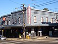
Former Art Deco cinema in Cleveland Street

Cleveland Street High School

The Kirk, Cleveland Street
Bar Cleveland, Cleveland Street
Norfolk Hotel, Cleveland Street

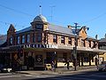
Alfred Park Hotel, Cleveland Street

Australia Post New South Wales head office


See also[]
![]() Australian Roads portal
Australian Roads portal
References[]
- ^ Google (9 September 2021). "Cleveland Street, Sydney" (Map). Google Maps. Google. Retrieved 9 September 2021.
- ^ "Cleveland Street: 02038". Traffic volume viewer. Roads & Maritime Services. 2016. Retrieved 3 October 2016.
- ^ Keenan, D. Tramways of Sydney. Transit Press 1979
Route map:

| ( • help)
|
This article related to the geography of Sydney is a stub. You can help Wikipedia by . |
This Australian road or road transport-related article is a stub. You can help Wikipedia by . |
- Streets in Sydney
- Surry Hills, New South Wales
- Sydney geography stubs
- Australia road stubs