Administrative divisions of Nepal
Politics of Nepal |
|---|
 |
|
The administrative divisions of Nepal (Nepali: नेपालको प्रशासनिक विभाजन, romanized: Nēpālakō praśāsanik vibhājana) are subnational administrative units of Nepal. The first level of country subdivision of Nepal are the provinces. Each province is further subdivided into districts, each district into municipalities and rural municipalities, and each of those municipalities into wards. Before 2015, instead of provinces, Nepal was divided into developmental regions and administrative zones.
Fulfilling the requirement of the new constitution of Nepal in 2015, all old municipalities and villages (which were more than 3900 in number) were restructured into 753 new municipalities and rural municipalities.[1][2] The former 75 district development committees (DDC) were also replaced by 77 new district coordination committees (DCC) which have much less power than the DDCs. At present there are 6 metropolitan cities, 11 sub-metropolitan cities, 276 municipalities, and 460 rural municipalities.
| Federal Government | |||||||||||||||||||||||||||||||||||
| 7 Provinces (e.g. Karnali) | |||||||||||||||||||||||||||||||||||
| 77 Districts (e.g. Nuwakot) | |||||||||||||||||||||||||||||||||||
| 6 Metro Cities (e.g. Kathmandu) | 11 Sub-Metro Cities (e.g. Dharan) | 276 Municipalities (e.g. Lamki Chuha) | 460 Rural Municipalities (e.g. Dordi) | ||||||||||||||||||||||||||||||||
Provinces[]

Nepal is composed of seven provinces.[3] They are defined by schedule 4 of the new constitution, by grouping together the existing districts. Two districts however are split in two parts ending up in two different provinces.
| Provinces | Capital | Area (km2) | Population (2011)[4] | |
|---|---|---|---|---|
| 1 | Province No. 1 | Biratnagar | 25,905 | 4,534,943 |
| 2 | Province No. 2 | Janakpur | 9,661 | 5,404,145 |
| 3 | Bagmati | Hetauda | 20,300 | 5,529,452 |
| 4 | Gandaki | Pokhara | 21,504 | 2,403,757 |
| 5 | Lumbini | Deukhuri | 22,288 | 4,741,716 |
| 6 | Karnali | Birendranagar | 27,984 | 1,327,957 |
| 7 | Sudurpashchim | Dhangadhi[a] | 19,539 | 2,552,517 |
Districts[]

Provinces are further divided into districts, of which there are 77 (as of 2017).[6] Each districts is governed by a District Coordination Committee.
| # | Province | District | Headquarters | Area (km2) | Population (2011)[4] |
|---|---|---|---|---|---|
| 1 | Province No. 1 | Taplejung District | Taplejung | 3,646 | 127,461 |
| 2 | Panchthar District | Phidim | 1,241 | 191,817 | |
| 3 | Ilam District | Ilam | 1,703 | 290,254 | |
| 4 | Jhapa District | Bhadrapur | 1,606 | 812,650 | |
| 5 | Morang District | Biratnagar | 1,855 | 965,370 | |
| 6 | Sunsari District | Inaruwa | 1,257 | 763,487 | |
| 7 | Dhankuta District | Dhankuta | 891 | 163,412 | |
| 8 | Terhathum District | Myanglung | 679 | 101,577 | |
| 9 | Sankhuwasabha District | Khandbari | 3,480 | 158,742 | |
| 10 | Bhojpur District | Bhojpur | 1,507 | 182,459 | |
| 11 | Solukhumbu District | Dudhkunda | 3,312 | 105,886 | |
| 12 | Okhaldhunga District | Siddhicharan | 1,074 | 147,984 | |
| 13 | Khotang District | Diktel | 1,591 | 206,312 | |
| 14 | Udayapur District | Triyuga | 2,063 | 317,532 | |
| 15 | Province No. 2 | Saptari District | Rajbiraj | 1,363 | 639,284 |
| 16 | Siraha District | Siraha | 1,188 | 637,328 | |
| 17 | Dhanusa District | Janakpur | 1,180 | 754,777 | |
| 18 | Mahottari District | Jaleshwar | 1,002 | 627,580 | |
| 19 | Sarlahi District | Malangwa | 1,259 | 769,729 | |
| 20 | Bara District | Kalaiya | 1,190 | 687,708 | |
| 21 | Parsa District | Birganj | 1,353 | 601,017 | |
| 22 | Rautahat District | Gaur | 1,126 | 686,722 | |
| 23 | Bagmati | Sindhuli District | Kamalamai | 2,491 | 296,192 |
| 24 | Ramechhap District | Manthali | 1,546 | 202,646 | |
| 25 | Dolakha District | Bhimeshwar | 2,191 | 186,557 | |
| 26 | Sindhupalchok District | Chautara | 2,542 | 287,798 | |
| 27 | Kavrepalanchok District | Dhulikhel | 1,396 | 381,937 | |
| 28 | Lalitpur District | Lalitpur | 385 | 468,132 | |
| 29 | Bhaktapur District | Bhaktapur | 119 | 304,651 | |
| 30 | Kathmandu District | Kathmandu | 395 | 1,744,240 | |
| 31 | Nuwakot District | Bidur | 1,121 | 277,471 | |
| 32 | Rasuwa District | Dhunche | 1,544 | 43,300 | |
| 33 | Dhading District | Nilkantha | 1,926 | 336,067 | |
| 34 | Makwanpur District | Hetauda | 2,426 | 420,477 | |
| 35 | Chitwan District | Bharatpur | 2,218 | 579,984 | |
| 36 | Gandaki | Gorkha District | Gorkha | 3,610 | 271,061 |
| 37 | Lamjung District | Besisahar | 1,692 | 167,724 | |
| 38 | Tanahun District | Byas | 1,546 | 323,288 | |
| 39 | Syangja District | Putalibazar | 1,164 | 289,148 | |
| 40 | Kaski District | Pokhara | 2,017 | 492,098 | |
| 41 | Manang District | Chame | 2,246 | 6,538 | |
| 42 | Mustang District | Jomsom | 3,573 | 13,452 | |
| 43 | Myagdi District | Beni | 2,297 | 113,641 | |
| 44 | Nawalpur District | Kawasoti | 1,043.1 | 311,604 | |
| 45 | Parbat District | Kusma | 494 | 146,590 | |
| 46 | Baglung District | Baglung | 1,784 | 268,613 | |
| 47 | Lumbini | Gulmi District | Resunga | 1,149 | 280,160 |
| 48 | Palpa District | Tansen | 1,373 | 261,180 | |
| 49 | Parasi District | Ramgram | 634.88 | 331,904 | |
| 50 | Rupandehi District | Siddharthanagar | 1,360 | 880,196 | |
| 51 | Kapilvastu District | Kapilvastu | 1,738 | 571,936 | |
| 52 | Arghakhanchi District | Sandhikharka | 1,193 | 197,632 | |
| 53 | Pyuthan District | Pyuthan | 1,309 | 228,102 | |
| 54 | Rolpa District | Liwang | 1,879 | 224,506 | |
| 55 | Eastern Rukum District | Rukumkot | 1,161.13 | 53,184 | |
| 56 | Banke District | Nepalganj | 2,337 | 491,313 | |
| 57 | Bardiya District | Gulariya | 2,025 | 426,576 | |
| 58 | Dang District | Tribhuwannagar | 2,955 | 552,583 | |
| 59 | Karnali | Western Rukum District | Musikot | 1,213.49 | 155,384 |
| 60 | Salyan District | Salyan | 1,462 | 242,444 | |
| 61 | Surkhet District | Birendranagar | 2,451 | 350,804 | |
| 62 | Dailekh District | Narayan | 1,502 | 261,770 | |
| 63 | Jajarkot District | Khalanga | 2,230 | 171,304 | |
| 64 | Dolpa District | Dunai | 7,889 | 36,700 | |
| 65 | Jumla District | Chandannath | 2,531 | 108,921 | |
| 66 | Kalikot District | Manma | 1,741 | 136,948 | |
| 67 | Mugu District | Gamgadhi | 3,535 | 55,286 | |
| 68 | Humla District | Simikot | 5,655 | 50,858 | |
| 69 | Sudurpashchim | Bajura District | Martadi | 2,188 | 134,912 |
| 70 | Bajhang District | Jayaprithvi | 3,422 | 195,159 | |
| 71 | Achham District | Mangalsen | 1,680 | 257,477 | |
| 72 | Doti District | Dipayal Silgadhi | 2,025 | 211,746 | |
| 73 | Kailali District | Dhangadhi | 3,235 | 775,709 | |
| 74 | Kanchanpur District | Bhimdatta | 1,610 | 451,248 | |
| 75 | Dadeldhura District | Amargadhi | 1,538 | 142,094 | |
| 76 | Baitadi District | Dasharathchand | 1,519 | 250,898 | |
| 77 | Darchula District | Api | 2,322 | 133,274 |
Municipalities of Nepal[]
Urban Municipalities[]
Municipalities are places having at least some minimum criteria of population and infrastructure and declared as a municipality by the government. There are 293 municipalities in Nepal.
Urban municipalities are categorized into 3 levels:
- Metropolitan city (Mahanagarpalika)
- Sub metropolitan city (Upmahanagarpalika)
- Municipality (Nagarpalika)
There are six metropolitan cities; the capital city Kathmandu, as well as Bharatpur, Biratnagar, Pokhara, Lalitpur and Birgunj. There are 11 sub-metropolitan cities and 276 municipalities.
| Rank | Name | Province | Pop. | Rank | Name | Province | Pop. | ||
|---|---|---|---|---|---|---|---|---|---|
 Kathmandu 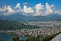 Pokhara |
1 | Kathmandu | Bagmati | 975,453 | 11 | Tulsipur | Lumbini | 141,528 |  Lalitpur 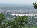 Bharatpur |
| 2 | Pokhara | Gandaki | 414,141 | 12 | Itahari | Province No. 1 | 140,517 | ||
| 3 | Lalitpur | Bagmati | 284,922 | 13 | Nepalgunj | Lumbini | 138,951 | ||
| 4 | Bharatpur | Bagmati | 280,502 | 14 | Butwal | Lumbini | 138,741 | ||
| 5 | Birgunj | Province No. 2 | 240,922 | 15 | Dharan | Province No. 1 | 137,705 | ||
| 6 | Biratnagar | Province No. 1 | 214,662 | 16 | Kalaiya | Province No. 2 | 123,659 | ||
| 7 | Janakpur | Province No. 2 | 159,468 | 17 | Jitpursimara | Province No. 2 | 117,496 | ||
| 8 | Ghorahi | Lumbini | 156,164 | 18 | Mechinagar | Province No. 1 | 111,797 | ||
| 9 | Hetauda | Bagmati | 152,875 | 19 | Budhanilkantha | Bagmati | 107,918 | ||
| 10 | Dhangadhi | Sudurpashchim | 147,741 | 20 | Gokarneshwar | Bagmati | 107,351 | ||
Rural Municipalities[]
Rural municipalities (Gaunpalikas) were established in 2017, replacing the village development committees (VDCs). The main purpose of a gaunpalika resembles that of a VDC, but it has more rights on collection of royalty and taxes and has a higher annual budget than the VDC. Several VDCs were usually combined into each new gaupalika. There are 460 gaunpalikas in Nepal.
Former development regions and zones[]
Prior to 10 September 2015, Nepal was divided into five developmental regions and fourteen administrative zones. At the time of the 2001 census, it was further subdivided into seventy-five districts. Districts were divided into village development committees and municipalities. In the 2001 census, there were 3,915 VDCs and fifty-eight municipalities.[7]
Development Regions:
- Far Western
- Mid-Western
- Karnali Zone
- Bheri Zone
- Rapti Zone
- Western
- Dhawalagiri Zone
- Gandaki Zone
- Lumbini Zone
- Central
- Eastern
See also[]
- Local self-government in Nepal
- List of Mayor of Nepal
Notes[]
References[]
- ^ "New local level structure comes into effect from today". www.thehimalayantimes.com. The Himalayan Times. 10 March 2017. Retrieved 17 July 2018.
- ^ "Govt prepares to add 9 more local levels in Province 2". www.kathmandupost.ekantipur.com. Kantipur Publication. 11 August 2017. Retrieved 15 August 2018.
- ^ "Nepal divided by new constitution - Foreign Policy News". foreignpolicynews.org. Retrieved 2018-04-07.
- ^ Jump up to: a b 2011 Census District Level Detail Report Archived 2018-09-02 at the Wayback Machine, Central Bureau of Statistics.
- ^ "Sudurpaschim Province crying for its permanent capital". The Himalayan Times. 5 March 2019. Retrieved 24 October 2020.
- ^ "There will be 77 districts in the country: Minister Thapa". My Republica. Retrieved 2018-04-07.
- ^ Administrative Divisions (Map). Kathmandu: Central Bureau of Statistics (CBS), Nepal. 2001. Archived from the original on 2 September 2018. Retrieved 21 September 2018.
| show Administrative divisions of Asia |
|---|
| show Subdivisions of Asia |
|---|
- Geography of Nepal