Dadeldhura District
Dadeldhura District
डडेलधुरा | |
|---|---|
District | |
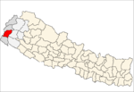
 Location of Dadeldhura District | |
| Country | Nepal |
| Province | Sudurpashchim Province |
| Admin HQ. | Amargadhi[1] |
| Government | |
| • Type | Coordination committee |
| • Body | DCC, Dadeldhura |
| Area | |
| • Total | 1,538 km2 (594 sq mi) |
| Population (2011)[2] | |
| • Total | 142,094 |
| • Density | 92/km2 (240/sq mi) |
| Time zone | UTC+05:45 (NPT) |
| Main Language(s) | Dotiyali |
Dadeldhura district (Nepali: डडेलधुरा जिल्ला![]() Listen (help·info)), a part of Sudurpashchim Province, is one of the seventy-seven districts of Nepal. The district, with Dadeldhura as its district headquarters, covers an area of 1,538 km2 (594 sq mi) and had a population of 126,162 in 2001[3] and 142,094 in 2011.[2]
Listen (help·info)), a part of Sudurpashchim Province, is one of the seventy-seven districts of Nepal. The district, with Dadeldhura as its district headquarters, covers an area of 1,538 km2 (594 sq mi) and had a population of 126,162 in 2001[3] and 142,094 in 2011.[2]
The region has a desert-mountainous landscape that contains many religious temples. The district is seldom visited by tourists but contains local routes to Mt Kailaish in Tibet, Ra Ra Lake in Humla district and the last remaining remnants of the Far Western Malla Kingdom. Nagi Malla was the last royal to live here before Nepalese unification.[citation needed]
The spoken language is Dotyal and the majority of inhabitants are Hindu. The district is rural but some modernization is occurring. Dadeldhura is the most developed district among the other hilly districts in far Western region.[citation needed]
Geography and climate[]
| Climate Zone[4] | Elevation range | % of Area |
|---|---|---|
| Lower Tropical | below 300 meters (1,000 ft) | 0.6% |
| Upper Tropical | 300 to 1,000 meters 1,000 to 3,300 ft. |
34.7% |
| Subtropical | 1,000 to 2,000 meters 3,300 to 6,600 ft. |
55.8% |
| Temperate | 2,000 to 3,000 meters 6,400 to 9,800 ft. |
8.9% |
Demographics[]
At the time of the 2011 Nepal census, Dadeldhura District had a population of 142,094. Of these, 92.3% spoke Doteli, 5.8% Nepali and 1.1% Magar as their first language.[5] The largest ethnic group is Khas/Chhetri makes 52% of total population. Khas Thakuris make 20% of population. And Bahun and Sanyasi/Giris make 17% of total population. Khas dalits make 10% of population and Magars make 1% of population.
Administration[]
The district consists of seven municipalities, out of which two are urban municipalities and five are rural municipalities. These are as follows:[6]
- Amargadhi municipality
- Parshuram municipality
- Aalitaal Rural Municipality
- Bhageshwar Rural Municipality
- Navadurga Rural Municipality
- Ajaymeru Rural Municipality
- Ganyapadhura Rural Municipality
Former village development committees[]
Prior to the restructuring of the district, Dadeldhura District consisted of the following Village development committees:

See also[]
References[]
- ^ "Amargadhi Municipality". The Government of Nepal. Retrieved 1 September 2018.
- ^ Jump up to: a b "National Population and Housing Census 2011(National Report)" (PDF). Central Bureau of Statistics. Government of Nepal. November 2012. Archived from the original (PDF) on 18 April 2013. Retrieved 1 November 2012.
- ^ "Nepal Census 2001". Nepal's Village Development Committees. Digital Himalaya. Archived from the original on 12 October 2008. Retrieved 12 December 2008.
- ^ The Map of Potential Vegetation of Nepal – a forestry/agroecological/biodiversity classification system (PDF), Forest & Landscape Development and Environment Series 2-2005 and CFC-TIS Document Series No. 110., 2005, ISBN 87-7903-210-9, retrieved 22 November 2013
- ^ 2011 Nepal Census, Social Characteristics Tables
- ^ "स्थानिय तह" (in Nepali). Ministry of Federal Affairs and General Administration. Archived from the original on 31 August 2018. Retrieved 1 September 2018.
- "Districts of Nepal". Statoids.
| show Places adjacent to Dadeldhura District |
|---|
Coordinates: 29°18′0″N 80°35′0″E / 29.30000°N 80.58333°E

| Wikimedia Commons has media related to Dadeldhura District. |
| show Authority control |
|---|
This article about a location in Sudurpashchim Province of Nepal is a stub. You can help Wikipedia by . |
- Dadeldhura District
- Districts of Nepal established during Rana regime or before
- Sudurpashchim Province geography stubs