Salyan District, Nepal
Salyan District
सल्यान जिल्ला | |
|---|---|
District | |
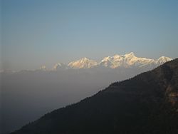 View of the Himalayas from Chhayachhetra | |
 Location of Salyan District (dark yellow) in Karnali | |
| Country | |
| Admin HQ. | Salyan (today part of Shaarda Municipality) |
| Government | |
| • Type | Coordination committee |
| • Body | DCC, Salyan |
| Area | |
| • Total | 1,462 km2 (564 sq mi) |
| Population (2011[1]) | |
| • Total | 241,716 |
| • Density | 170/km2 (430/sq mi) |
| Time zone | UTC+05:45 (NPT) |
| Main Language(s) | Nepali,english,newari |
| Website | ddcsalyan |
Salyan District (Nepali: सल्यान जिल्ला![]() Listen (help·info)), a part of Karnali province, is one of the seventy-seven districts of Nepal. Salyan covers an area of 1,462 km2 (564 sq mi) with a population of 213,500 in 2001 and 241,716 in 2011. The district's administrative center is named Salyan or Salyan Khalanga, today it is part of Shaarada Municipality.
Listen (help·info)), a part of Karnali province, is one of the seventy-seven districts of Nepal. Salyan covers an area of 1,462 km2 (564 sq mi) with a population of 213,500 in 2001 and 241,716 in 2011. The district's administrative center is named Salyan or Salyan Khalanga, today it is part of Shaarada Municipality.
The district is known for its Hindu temples including Shiva temples in Chhayachhetra and Laxmipur, and the Devi temple at Khairabang in Shaarada municipality, one of nine in Nepal.
History[]
Salyan was one of the Baise Rajya, a confederation of 22 petty kingdoms in the Karnali (Ghagra) region. About 1760 CE all these kingdoms were annexed by the Shah Dynasty during the unification of Nepal.[citation needed]
Etymology[]
Salyan derives from the Nepali word sallo which means pine tree or conifer.
Geography and climate[]
Although Salyan is considered a hilly district, its southwest salient is actually outside the Pahari-inhabited hill region, in the lower Siwalik Hills that are more an extension of the Terai.
The Babai River flows through the southwestern Siwaliks section after draining Dang Valley. A tributary Sharad Khola drains the eastern half of Salyan's hill region—including the district center, then exits these hills by cutting through the Mahabharat Range to its confluence with the Babai. The western half of Salyan's hill region is drained by the Bheri.
| Climate zone[2] | Elevation range | % of area |
|---|---|---|
| Upper tropical | 300 to 1,000 meters 1,000 to 3,300 ft. |
28.6% |
| Subtropical | 1,000 to 2,000 meters 3,300 to 6,600 ft. |
68.3% |
| Temperate | 2,000 to 3,000 meters 6,400 to 9,800 ft. |
3.0% |
Demographics[]
At the time of the 2011 Nepal census, Salyan District had a population of 242,444. Khas Chhetris are the largest caste in the district making up 57% of the population, while Magars are the second largest group and make up 15.1% of the population. 11.8% is Kami, while Sanyasis and Thakuris are both 3.5% of the population. 3% is Damai, 2.6% Bahun and 1.8% Sarki.[3]
99.4% spoke Nepali as their first language.[3]
Population by census 1971–2011[4][5][]

Administration[]
The district consists of ten municipalities, out of which three are urban municipalities and sevenare rural municipalities. These are as follows:[6]
- Shaarda Municipality
- Bagchaur Municipality
- Bangad Kupinde Municipality
- Kalimati Rural Municipality
- Tribeni Rural Municipality
- Kapurkot Rural Municipality
- Chatreshwari Rural Municipality
- Kumakh Rural Municipality
- Siddha Kumakh Rural Municipality
- Darma Rural Municipality
Former Village Development Committees[]
Prior to the restructuring of the district, Saylan District consisted of the following municipalities and Village development committees:

- Badagaun
- Bafukhola
- Bajh Kanda
- Bame Banghad
- Bhalchaur
- Chande
- Chhayachhetra
- Damachaur
- Dandagaun
- Darmakot
- Devasthal
- Dhakadam
- Dhanwang
- Hiwalcha
- Jhimpe
- Jimali
- Kabhrechaur
- Kajeri
- Kalagaun
- Kalimati Kalche
- Kalimati Rampur
- Kavra
- Khalanga
- Korbang Jhimpe
- Kotbara
- Kotmala
- Kubhinde
- Laxmipur
- Lekhpokhara
- Majh Khanda
- Marke
- Mulkhola
- Nigalchula
- Phalawang
- Rim
- Saijuwal Takura
- Sarpani Garpa
- Sibaratha
- Siddheswar
- Sinwang
- Suikot
- Syanikhal
- Tharmare
- Tribeni
Maps[]
Besides the United Nations/Nepal map of districts and VDCs shown above, their Map Centre[7] has a downloadable PDF version adding municipalities, roads and water detail:
- "Salyan District" (PDF) (Map). Retrieved 6 February 2014. Missing or empty
|title=(help)
From 1992 to 2002 a definitive series of large scale topographic maps were surveyed and published through a joint project by Government of Nepal Survey Department[8] and Finland's Ministry for Foreign Affairs contracting through the FinnMap consulting firm.[9] Japan International Cooperation Agency[10] substituted for FinnMap in Lumbini Zone. Topographic sheets at 1:25,000 scale covering 7.5 minutes latitude and longitude map the Terai and Middle Mountains. Less populated high mountain regions are on 15 minute sheets at 1:50,000. JPG scans can be downloaded here:[11] These sheets cover Salyan District:
- 2881 08D Bajedichaur (1999)
- 2881 11D Chisapani Mulatati (1997)
- 2881 12A Mehelkuna (1999)
- 2881 12B Botechaur (1999)
- 2881 12C Ghuiyabari (1998)
- 2881 12D Baluwa (1998)
- 2881 16A Dhakeri (1997)
- 2881 16B Dhobaghat (1997)
- 2882 05A Karkigau (1999)
- 2882 05C Salli Bajar (1999)
- 2882 05D Swikot (1999)
- 2882 06C Pharulachaur (1999)
- 2882 06D Simruth (1999)
- 2882 09A Kubhinde Daha (1999)
- 2882 09B Khalanga (1999)
- 2882 09C Suketal (1999)
- 2882 09D Shitalpati (1998)
- 2882 10A Tharmare (1999)
- 2882 10B Sukhaodar (1999)
- 2882 10C Luham (1998)
- 2882 10D Nerpa (1999)
- 2882 13A Hamsapur (1998)
- 2882 13B Panchakule (1998)
- 2882 14A Tulsipur (1999)
- 2882 14B Dubrin (1999)
References[]
- ^ Central Bureau of Statistics, Kathmandu, Nepal, Jan. 2014
- ^ The Map of Potential Vegetation of Nepal - a forestry/agroecological/biodiversity classification system (PDF), Forest & Landscape Development and Environment Series 2-2005 and CFC-TIS Document Series No.110., 2005, ISBN 87-7903-210-9, retrieved 22 November 2013
- ^ Jump up to: a b 2011 Nepal Census, Social Characteristics Tables
- ^ "Districts of Nepal". Statoids. Gwillim Law. Retrieved 23 January 2014.
- ^ #National Population and Housing Census 2011, Volume 3 (PDF). Kathmandu, Nepal: Government of Nepal, Central Bureau of Statistics. January 2014. Archived from the original (PDF) on 25 May 2013. Retrieved 23 January 2014.
- ^ "स्थानिय तह" (in Nepali). Ministry of Federal Affairs and General Administration. Retrieved 1 September 2018.
- ^ "Map Centre". United Nations, Nepal Information Platform. Retrieved 4 February 2014.
- ^ "Government of Nepal, Survey Department". Archived from the original on 22 February 2014. Retrieved 4 February 2014.
- ^ "Land Administration & Management, Mapping, Surveying and Aerial Photography, Major Reference Projects" (PDF). FinnMap. Archived from the original (PDF) on 22 February 2014. Retrieved 4 February 2014.
- ^ "Japan International Cooperation Agency". Retrieved 4 February 2014.
- ^ "Nepal-Topo Maps". PAHAR Mountains of Central Asia Digital Dataset. MyPublisher. Retrieved 31 January 2014.
External links[]
| Wikimedia Commons has media related to Salyan District. |
- "Districts of Nepal". Statoids.

| show Authority control |
|---|

- Salyan District, Nepal
- Districts of Nepal established during Rana regime or before
- Districts of Karnali Province