Saptari District
Saptari District
सप्तरी जिल्ला | |
|---|---|
District | |
 Paddy fields near Chinnamasta | |
 Saptari District (dark yellow) in Province No. 2 | |
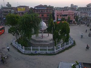
 Saptari District with local level body | |
| Country | Nepal |
| Province | Province No. 2 |
| Admin HQ. | Rajbiraj |
| Government | |
| • Type | Coordination committee |
| • Body | DCC, Saptari |
| Area | |
| • Total | 1,363 km2 (526 sq mi) |
| Population (6,39,228 2011[1]) | |
| • Total | 735,000 |
| • Density | 540/km2 (1,400/sq mi) |
| Time zone | UTC+05:45 (NPT) |
| Telephone Code | 031 |
| Main Language(s) | Maithili, Hindi, Tharu, Nepali Magahi. |
| Website | www |
Saptari (Nepali: सप्तरी जिल्ला![]() Listen (help·info)), a part of Province No. 2, is one of the seventy-seven districts of Nepal. Its district headquarter is Rajbiraj. Saptari is an Outer Terai district. This district covers an area of 1,363 km2 (526 sq mi) and has a population (2011) of 639,284[1] which makes it the 10th most populated district of Nepal. Saptari is renowned for its agricultural output, and is bordered on the east by the massive Sapta Koshi river.
Listen (help·info)), a part of Province No. 2, is one of the seventy-seven districts of Nepal. Its district headquarter is Rajbiraj. Saptari is an Outer Terai district. This district covers an area of 1,363 km2 (526 sq mi) and has a population (2011) of 639,284[1] which makes it the 10th most populated district of Nepal. Saptari is renowned for its agricultural output, and is bordered on the east by the massive Sapta Koshi river.
There are nine municipalities in Saptari: Dakneshwori, Rajbiraj, Bodebarsain, Hanumannagar Yoginimai, Kanchanrup, Saptakoshi, surunga, Shambhunath and Khadak. Other small towns include Mahuli, Kathauna Bazar, Pato and Itahari Bishnupur with the area government "Machha Palan Kendra" fish farming centre.
The famous Chhinnamasta temple is one of the Shakti Peeths and Kankalini Temple are also located in Saptari District. Saptari has highest growth in Maithili literature.[2] Various local and national newspapers and intellectuals have requested the Nepal government act swiftly and punish all those who are involved in corruption and delay in infrastructure creation so that the work can start as soon as possible.

Temples[]
Chinnamasta Bhagawati[]

Chinnamasta Bhagawati (छिन्नमस्ता भगवती) is a temple of Eastern Nepal. It is situated in Chinnamasta VDC, Saptari, 10 km (6.2 mi) from Rajbiraj and also near to Indian Border. It is a main attraction for Indian pilgrims. People are likely to come here in Bada Dashain. Some thousands of goats are sacrificed here during dashain.[3]
Shambhunath[]
Shambhunath (शम्भुनाथ) is another one of the famous temples of Eastern Nepal. It is situated in Shambhunath, 12 km (7.5 mi) from Rajbiraj and also near Mahendra Highway. This temple is a main attraction for Indian pilgrims. People are likely to come here in Siruwa Mela during month of Baisakh (the first month of Bikram Sambat).
Kankalini Temple[]

Kankalini Temple (कंकालिनी) is another temple situated in this district; it is located in Bhardah-1 of Hanumannagar Kankalini Municipality. This temple is main attraction for Indian pilgrims. Kankalini Temple has great religious importance. Like most of the other Shakti Peethas in Nepal, this temple, too, has a legend attached to it. According to the legend, the people settled in Bhardaha village had started to use the land for farming, however, while digging, some farmers had found a stone statue carved beautifully with the image of Goddess Durga and in that very place, this temple is said to have been built. It is believed that when a devotee worships with great devotion and true heart in the temple, their wish comes true. So, thousands of peoples from many part of the country come to this temple to worship the avatar of Goddess Durga, known famously as goddess Kankalini.[4]
Geography and climate[]
| Climate Zone[5] | Elevation Range | % of Area |
|---|---|---|
| Lower Tropical | below 300 m (980 ft) | 94.7% |
| Upper Tropical | 300 to 1,000 m (980 to 3,280 ft) | 2.3% |
Education[]
- Mahendra Bindeshwari Multiple Campus- TU Affiliated Public Campus located in Rajbiraj offering LLB, BBS, BA, MBS, M.Ed.
- National People College- TU Affiliated Private College established in 2013 AD Offers Masters and Bachelors level of Programs in Management and Humanities Faculties. It is the 1st Private College of Saptari District Offering the Subjects of Study like MA-SOCIOLOGY, MBS, BA-RD and SOCIOLOGY. The college is Ultramodern and is Located in Kanchanrup Munacipality.
HSEB affiliated +2 colleges are:
- Happyland HSS and college
- Laligurans EBHSS or Paradise Campus
- Caliber International College
- Mission College
- Kshitiz Edu. Foundation
- Chinnamasta College
- Annapurna Multiple College, Kanchanpur Beriyar, Saptari - just the east of UTL Tower
- Rajbiraj Model Campus[6]
Demographics[]
At the time of the 2011 Nepal census, Saptari District had a population of 639,284. Of these, 79.1% spoke Maithili, 10.4% Tharu, 4.1% Nepali and 3.9% Urdu as their first language.
40.5% of the population in the district spoke Nepali, 5.9% Hindi, 3.0% Maithili, 1.3% Tharu and 0.9% Urdu as their second language.[7]
Administration[]
The district consists of eighteen municipalities, out of which nine are urban municipalities and nine are rural municipalities.[8] These are as follows:
- Bodebarsain Municipality
- Dakneshwori Municipality
- Hanumannagar Kankalini Municipality
- Kanchanrup Municipality
- Khadak Municipality
- Sambhunath Municipality
- Saptakoshi Municipality
- Surunga Municipality
- Rajbiraj Municipality
- Agnisaira Krishnasavaran Rural Municipality
- Balan-Bihul Rural Municipality
- Rajgadh Rural Municipality
- Bishnupur Rural Municipality
- Chhinnamasta Rural Municipality
- Mahadeva Rural Municipality
- Rupani Rural Municipality
- Tilathi Koiladi Rural Municipality
- Tirhut Rural Municipality
Former Village Development Committees (VDCs) and Municipalities[]
- Arnaha
- Aurahi, now Dakneshwori Municipality ward No. 6
- Badgama, now Kanchan Rup Mun.
- Bainiya
- Bairawa, now Kanchanrup Municipality ward no. 1
- Bakdhauwa
- Banarjhula
- Banaula, now Dakneshwori Municipality ward No. 10
- Banauli
- Baramjhiya, now Kanchan Rup Mun.
- Barhmapur
- Barsain
- Basbiti
- Bathnaha
- Belhi now Khadk Mun ward No 2
- Belhi Chapena
- Bhagawatpur
- Bhardaha, now Hanumannagar Kankalini Mun.
- Bhutahi, now Dakneshwori Municipality ward No. 4
- Birpur Barahi
- Bodebarsain Municipality
- Boriya
- , now Dakneshwori Municipality ward No. 7
- Chhinnamasta
- Dakneshwori Municipality
- Dauda
- Deuri
- Deurimaruwa
- Dhanagadi
- Dharampur, now Kanchan Rup Mun.
- Dhodhanpur, now Kanchan Rup Mun.
- Didhawa
- Diman
- Gamhariya Parwaha
- Gobargada, now Hanumannagar Kankalini Mun.
- Goithi
- Hanumannagar, now Municipality
- Hanumannagar Kankalini Municipality
- Hardiya Now surunga Mun Wada No 2
- Hariharpur
- Haripur Now surunga Mun wada No 7
- Inarwa, now Hanumannagar Kankalini Mun.
- Inarwa Phulbariya
- Itahari Bishnupur
- Jagatpur, now Kanchan Rup Mun.
- Jamuni Madhapura
- Jandaul
- Jhutaki
- Joginiya-1, now Hanumannagar Kankalini Mun.
- Joginiya-2, now Hanumannagar Kankalini Mun.
- Kabilasha, now Dakneshwori Municipality ward No. 1
- Kachan
- Kanchan Rup Municipality
- Kalyanpur Khadk Mun 6, 7, 8
- Kamalpur, now Saptaskoshi Mun.
- Kanchanpur
- Kataiya, Now Rupani Gaunpalika
- Kathauna
- Khadgapur, included in Bodebarsain Mun.
- Khojpur
- Ko. Madhepura
- Kochabakhari
- Koiladi
- Kushaha
- Lalapati
- Launiya
- Lohajara
- Madhawapur, now Hanumannagar Kankalini Mun.
- Madhupati now surunga mun Wada no 4
- Mahadeva
- Maina Kaderi
- Maina Sahasrabahu
- Malekpur
- Maleth
- Malhanama
- Malhaniya, now Hanumannagar Kankalini Mun.
- Manraja, included in Bodebarsain Mun.
- Mauwaha
- Mohanpur
- Nargho
- Negada
- Odraha
- Pakari
- Pansera
- Jandaul
- Parasbani
- Paterwa
- Pato, now Dakneshwori Municipality ward No. 5
- Patthargada, now Dakneshwori Municipality ward No. 9
- Phakira
- Pharseth
- Phattepur, now Saptakoshi Mun.
- Phulkahi
- (Parwaha)
- Pipra (Purba), now Kanchan Rup Mun.
- Pipra (West) surunga mun wada No 1
- Portaha, now Hanumannagar Kankalini Mun.
- Rajbiraj Municipality
- Rajgadh Rural Municipality
- Ramnagar
- Rampur Jamuwa
- Rampur Malhaniya, now Hanumannagar Kankalini Mun.
- Rautahat
- Rayapur
- Rupnagar, now Kanchan Rup Mun.
- Shambhunath Municipality
- Sankarpura
- Saptakoshi Municipality
- Sarashwar
- Simraha Sigiyaun
- Siswa Beihi now khadak Mun Wada No 1,2
- Sitapur
- Tarahi, now Dakneshwori Municipality ward No. 3
- Terahota
- Theliya, now Kancha
- Tilathi
- Trikola
Notable persons[]
- Mehboob Alam, cricketer who became the first bowler to take all ten wickets[9] in an innings in an ICC recognized international tournament match.
- Parmanand Jha, first Vice President of Nepal and ex Supreme Court Judge
- C. K. Raut, computer scientist and author
- Gajendra Narayan Singh, Founder of Nepal Sadbhawana Party Nepal
- Ram Raja Prasad Singh, Politician
- Upendra Yadav, Founder of Nepal, Ex foreign minister of Nepal, present Health and Population minister of Nepal.
See also[]
- Chandra Nahar Canal
- Zones of Nepal
References[]
- ^ Jump up to: a b Household and population by districts, Central Bureau of Statistics (CBS) Nepal Archived 2013-07-31 at the Wayback Machine
- ^ "Maithili Literature Development in Saptari". I Love Mithila. Retrieved 2020-07-09.
- ^ "The Goddess with Severed Head". Boss Nepal.
- ^ "Kankalini Temple". Boss Nepal.
- ^ The Map of Potential Vegetation of Nepal - a forestry/agroecological/biodiversity classification system (PDF), Forest & Landscape Development and Environment Series 2-2005 and CFC-TIS Document Series No.110., 2005, ISBN 978-87-7903-210-1, retrieved Nov 22, 2013
- ^ "National People College". National People College. Retrieved 2016-02-07.
- ^ 2011 Nepal Census, Social Characteristics Tables
- ^ "स्थानिय तह". 103.69.124.141. Retrieved 2018-12-04.
- ^ "BBC SPORT - Cricket - Alam takes 10 wickets in Jersey". bbc.co.uk. 2008-05-26.
- "Districts of Nepal". Statoids.
| Wikimedia Commons has media related to Saptari District. |
| show Places adjacent to Saptari District |
|---|
| show Authority control |
|---|

- Saptari District
- Districts of Nepal established during Rana regime or before
- Districts of Province No. 2