Aghavnavank
Aghavnavank
Աղավնավանք | |
|---|---|
 A view of Aghavnavank | |
 Aghavnavank | |
| Coordinates: 40°43′51″N 45°05′36″E / 40.73083°N 45.09333°ECoordinates: 40°43′51″N 45°05′36″E / 40.73083°N 45.09333°E | |
| Country | |
| Province | Tavush |
| Elevation | 1,443 m (4,734 ft) |
| Population | |
| • Total | 337 |
| Time zone | UTC+4 (AMT) |
| Aghavnavank at GEOnet Names Server | |

Aghavnavank (Armenian: Աղավնավանք; Azerbaijani: Salah) is a village in the Dilijan Municipality of the Tavush Province in Armenia. The village was populated by Azerbaijanis before the exodus of Azerbaijanis from Armenia after the outbreak of the Nagorno-Karabakh conflict.[2]
A hiking trail featuring the 12th/13th-century Aghavnavank Monastery, and a yew grove of the Dilijan National Park is located near the village.[3]
Notable people[]
- Ramazan Abbasov, Azerbaijani footballer born here in 1983.
Gallery[]

Aghavnavank Yew Grove, Dilijan National Park
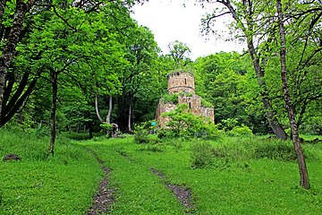
Aghavnavank Monastery

Scenery around Aghavnavank
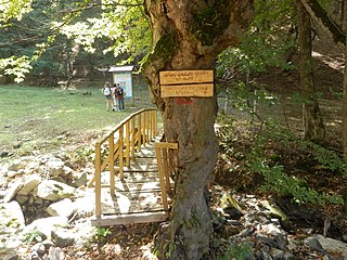
Dilijan National Park Hiking Trail

Aerial view of Aghavnavank Monastery


References[]
- ^ Statistical Committee of Armenia. "The results of the 2011 Population Census of the Republic of Armenia" (PDF).
- ^ "Հայաստանով մեկ. Աղավնավանք". 1tv.am. 28 November 2018. Retrieved 14 February 2021.
{{cite web}}: CS1 maint: url-status (link) - ^ "Yew Grove, Aghavnavank, Gandzakar Church Hiking Trail". All Trails.
External links[]
| Wikimedia Commons has media related to Aghavnavank. |
Capital: Ijevan | ||
| Urban communities | 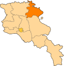 | |
| Rural communities |
| |
| Non-community settlements | ||
| Abandoned settlements | ||
This article about a location in Tavush Province, Armenia is a stub. You can help Wikipedia by . |
Categories:
- Populated places in Tavush Province
- Tavush geography stubs