Geghatap
Coordinates: 40°41′N 45°00′E / 40.683°N 45.000°E

Geghatap
Գեղատափ | |
|---|---|
 Geghatap | |
| Coordinates: 40°41′N 45°00′E / 40.683°N 45.000°E | |
| Country | Armenia |
| Marz (Province) | Tavush |
| Population (2017) | |
| • Total | 0 |
| Time zone | UTC+4 ( ) |
| • Summer (DST) | |
Geghatap (Armenian: Գեղատափ; Azerbaijani: Murteyl) is an abandoned village in the Dilijan municipality of the Tavush Province of Armenia. The village was populated by Azerbaijanis before the exodus of Azerbaijanis from Armenia after the outbreak of the Nagorno-Karabakh conflict.[1]
Etymology[]
The village was formerly known as Chichakbulag (Azerbaijani: Çiçəkbulaq, lit. 'flower spring') and was renamed Geghatap in 1991.
References[]
- ^ "Աղավնավանք (Սալահ), Հովք (Հախկխլու, Վուրղուն), Խաչարձան (Փոլադ) գյուղերը". aniarc.am. 25 October 2017. Retrieved 14 February 2021.
{{cite web}}: CS1 maint: url-status (link)
External links[]
- Report of the results of the 2001 Armenian Census, Statistical Committee of Armenia
- Brady Kiesling, Rediscovering Armenia, p. 111; original archived at Archive.org, and current version online on Armeniapedia.org.
Capital: Ijevan | ||
| Urban communities | 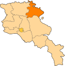 | |
| Rural communities |
| |
| Non-community settlements | ||
| Abandoned settlements | ||
This article about a location in Tavush Province, Armenia is a stub. You can help Wikipedia by . |
Categories:
- Former populated places in Tavush Province
- Tavush geography stubs