Berdavan, Armenia
Coordinates: 41°12′10″N 45°00′12″E / 41.20278°N 45.00333°E

Berdavan
Բերդավան | |
|---|---|
 A view of Berdavan | |
 Berdavan | |
| Coordinates: 41°12′10″N 45°00′12″E / 41.20278°N 45.00333°E | |
| Country | |
| Province | Tavush |
| Government | |
| Population | |
| • Total | 2,987 |
| Time zone | UTC+4 (AMT) |
| Berdavan, Armenia at GEOnet Names Server | |
Berdavan (Armenian: Բերդավան) is a village in the Tavush Province of Armenia. The village is located about 2 km north of the town of Noyemberyan, and near the villages of Dovekh, Koghb and Zorakan. Berdavan Fortress is located on a nearby hilltop.
Toponymy[]
Historically, the village was called Tkhadzor, then Ghalacha, and in 1978 it was renamed Berdavan.
History[]
The village of Ghalacha was relocated in 1893 – 1900. The relocation was due to the presence of mosquitos which were thought to bring malaria, but at the new site there were problems with access to drinking water.[citation needed] The school in Ghalacha was opened in 1906, after a period when there were no official schools in the area.[citation needed]
During the Second World War, Berdavan lost more than half of its male population, and during the First Nagorno-Karabakh War the village was heavily shelled. The village has a monument dedicated to the people who died in World War II.
Gallery[]
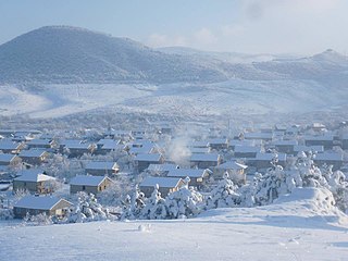
Berdavan in winter
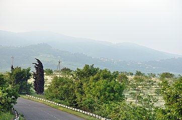
Scenery around the village
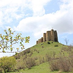
Berdavan Fortress

St. Nshan Church near Berdavan


References[]
External links[]
| Wikimedia Commons has media related to Berdavan, Tavush. |
- World Gazeteer: Armenia[dead link] – World-Gazetteer.com
- Report of the results of the 2001 Armenian Census, Statistical Committee of Armenia
| hide | ||
|---|---|---|
Capital: Ijevan | ||
| Urban communities | 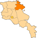 | |
| Rural communities |
| |
| Non-community settlements | ||
| Abandoned settlements | ||
This article about a location in Tavush Province, Armenia is a stub. You can help Wikipedia by . |
- Populated places in Tavush Province
- Tavush geography stubs