Koti, Armenia
Koti
Կոթի | |
|---|---|
 | |
 Koti | |
| Coordinates: 41°08′08″N 45°07′30″E / 41.13556°N 45.12500°ECoordinates: 41°08′08″N 45°07′30″E / 41.13556°N 45.12500°E | |
| Country | |
| Province | Tavush |
| Population | |
| • Total | 2,014 |
| Time zone | UTC+4 (AMT) |
| Koti, Armenia at GEOnet Names Server | |


Koti (Armenian: Կոթի) is a village in the Tavush Province of Armenia near the border with Azerbaijan. The village is located 5 kilometres east of Saint Sargis Monastery.[2]
Etymology[]
The village was known in 1920 as Kotikend (Կոթիքենդ) or Kotigegh (Կոթիգեղ), later being renamed to Shavarshavan (Շավարշավան) in 1961 in honour of Armenian revolutionary who hailed from the village. Following the independence of Armenia, the village was finally renamed Koti.[3][4][5]
Education[]
Children of Armenia Fund (COAF) started its activities in Tavush in 2016, including education and health programs, shelter from shelling and other potential use of weapons in areas along the border with Azerbaijan.[6]
Economy[]
The population is engaged cattle breeding, fruit growing, tobacco growing, cultivation of grain and fodder crops.[2]
History[]
Koti in the Russian Empire from 1828–1840 formed a part of the Georgian Governorate, and later of the Georgia-Imeretia Governorate 1840–1845, then of the Tiflis Governorate until it finally became part of the Kazakh Uyezd of the Elisabethpol Governorate in 1868.[5]
In 1918, the First Republic of Armenia declared its independence from the Russian SFSR and became the controller of Koti, then known as Kotikend or Kotigegh.[2] During the Armenian–Azerbaijani war, Koti and Kalacha (Berdavan) were occupied by the Azerbaijan Democratic Republic on 7 April 1920 as a result of the hostilities in Nagorno-Karabakh; later after a brief ceasefire on 9 April, Koti and Kurumsulu (Barekamavan) were burned.[7] After the Soviet invasion of Azerbaijan, the Russian SFSR and Armenia concluded an agreement on 10 August 1920 to delineate Soviet Azerbaijan's border—in which Koti was confirmed within the bounds of Armenia.[5]
In 1930, the Armenian SSR experienced an administrative reorganisation that transformed its uezds into raions. Koti which was formerly part of the Dilijan Uyezd subsequently became a part of the .[5][8]
Demographics[]
| Year | Population |
|---|---|
| 1831 | 777 |
| 1873 | 1,216 |
| 1886 | 1,507 |
| 1897 | 1,769 |
| 1926 | 1,889 |
| 1931 | 2,277 |
| 1939 | 2,529 |
| 1959 | 1,950 |
| 1970 | 2,408 |
| 1979 | 2,311 |
| 1989 | 3,556 |
| 2001 | 2,225 |
| 2011 | 2,014 |
Notable people[]
- Khoren Bayramyan, professional footballer
- Vano Siradeghyan, writer and politician
Gallery[]


References[]
- ^ Statistical Committee of Armenia. "The results of the 2011 Population Census of Armenia" (PDF).
- ^ Jump up to: a b c Հայաստանի Հանրապետության բնակավայրերի բառարան [Republic of Armenia settlements dictionary] (PDF) (in Armenian). Yerevan: Cadastre Committee of the Republic of Armenia. 2008. p. 187. Archived from the original (PDF) on 11 March 2018.
- ^ Հայաստանի Հանրապետության բնակավայրերի բառարան [Republic of Armenia settlements dictionary] (PDF) (in Armenian). Yerevan: Cadastre Committee of the Republic of Armenia. 2008. p. 156. Archived from the original (PDF) on 11 March 2018.
- ^ Hovannisian, Richard G. (1971–1996). The Republic of Armenia. Vol. 3. Berkeley: University of California Press. p. 444. ISBN 0-520-01805-2. OCLC 238471.
- ^ Jump up to: a b c d "Կոթի գյուղի բնակչությունը 1831-1931 թվականներին". ANI Armenian Research Center (in Armenian). 2021-02-26. Retrieved 2022-05-28.
- ^ Ani, Rapyan (6 May 2017). "Տավուշի սմարթ սենյակները նաեւ ապահով են". Yerkir Media.
- ^ Hovannisian, Richard G. (1971–1996). The Republic of Armenia. Vol. 3. Berkeley: University of California Press. p. 163. ISBN 0-520-01805-2. OCLC 238471.
- ^ Tsutsiev, Arthur (2014), Atlas of the Ethno-Political History of the Caucasus, New Haven and London, p. 84, ISBN 978-0-300-15308-8, OCLC 884858065, retrieved 2021-12-25
- ^ Հայաստանի Հանրապետության բնակավայրերի բառարան [Republic of Armenia settlements dictionary] (PDF) (in Armenian). Yerevan: Cadastre Committee of the Republic of Armenia. 2008. p. 112. Archived from the original (PDF) on 11 March 2018.
- ^ Korkotyan, Zaven (1932). Խորհրդային Հայաստանի բնակչությունը վերջին հարյուրամյակում (1831-1931) [The population of Soviet Armenia in the last century (1831-1931)] (PDF) (in Armenian). Yerevan: Pethrat. Archived from the original (PDF) on 2 February 2022.
External links[]
| hide | ||
|---|---|---|
Capital: Ijevan | ||
| Urban communities | 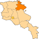 | |
| Rural communities |
| |
| Non-community settlements | ||
| Abandoned settlements | ||
This article about a location in Tavush Province, Armenia is a stub. You can help Wikipedia by . |
- Populated places in Tavush Province
- Tavush geography stubs