Arakawa River (Kantō)
| Arakawa River | |
|---|---|
 A bend in the Arakawa River | |
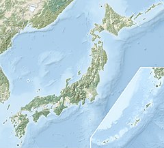 Location of mouth in Japan | |
| Native name | 荒川 (Japanese) |
| Location | |
| Country | Japan |
| Physical characteristics | |
| Source | |
| • location | Mount Kobushi (甲武信ヶ岳) |
| • elevation | 2,475 m (8,120 ft) |
| Mouth | |
• location | Tokyo Bay |
| Length | 173 km (107 mi) |
| Basin features | |
| River system | Arakawa |
The Arakawa River (荒川, Arakawa) is a 173-kilometre (107 mi) long river that flows through Saitama Prefecture and Tokyo.[1] Its average flow in 2002 was 30m³/s.
It originates on Mount Kobushi in Saitama Prefecture, and empties into Tokyo Bay.[2] It has a total catchment area of 2,940 km2 (1,140 sq mi).
The river is one of Tokyo's major sources of tap water, and together with the Tone River, accounts for around 80% of Tokyo's water supply as of 2018.[3] The Okubo water purification plant takes water from the river.
History[]
Attempts to control flooding of the Arakawa River have been made since the area that is now Tokyo became the de facto capital of Japan during the Edo period. Following a major flood in 1910 that damaged a large part of central Tokyo, a 22-kilometre (14 mi) long drainage canal was constructed between 1911 and 1924. In 1996 an agreement was signed to make it a "sister river" of the Potomac River in the eastern United States.[2] This means that officials and volunteers from both river areas collaborate with each other.[4]
Media[]
This river is also depicted in many anime such as Toaru Kagaku no Railgun
See also[]
- Sumida River
- Arakawa Under the Bridge, an anime set under a bridge on the river.
References[]
- ^ "Our Planet: Arakawa River". Planet Labs. Archived from the original on 11 March 2016. Retrieved 2 November 2015.
- ^ Jump up to: a b "(Arakawa - Potomac sister rivers)". Interstate Commission on the Potomac River Basin. 27 January 2012. Archived from the original on December 27, 2013. Retrieved 27 December 2013.
- ^ "水系別貯水量の推移 | 水源・水質 | 東京都水道局". www.waterworks.metro.tokyo.jp (in Japanese). Retrieved 2018-08-27.
- ^ "Potomac Basin Reporter". msa.maryland.gov. Retrieved 2020-11-25.
External links[]
 Media related to Arakawa River (Saitama and Tokyo) at Wikimedia Commons
| show |
|---|
Coordinates: 36°08′10″N 139°22′06″E / 36.13611°N 139.36833°E

This Saitama Prefecture location article is a stub. You can help Wikipedia by . |
This article related to a river in Japan is a stub. You can help Wikipedia by . |
- Rivers of Saitama Prefecture
- Rivers of Tokyo
- Rivers of Japan
- Saitama geography stubs
- Japan river stubs