Başakşehir
Başakşehir | |
|---|---|
District | |
 Location of Başakşehir in Istanbul | |
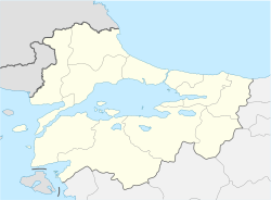 Başakşehir Location of Başakşehir in Istanbul | |
| Coordinates: 41°05′N 28°49′E / 41.083°N 28.817°ECoordinates: 41°05′N 28°49′E / 41.083°N 28.817°E | |
| Country | |
| Region | Marmara |
| Province | İstanbul Province |
| District | Başakşehir |
| Named for | Private residents with the same name placed in the district |
| Government | |
| • Mayor | Yasin Kartoğlu (AKP) |
| Elevation | 70 m (230 ft) |
| Population (2012)[1] | |
| • Urban | 311,095 |
| • District | 316,176 |
| Time zone | UTC+3 (TRT) |
| Postal code | 34488-34494 |
| Area code(s) | 0212 |
| Licence plate | 34 |
| Website | www |


Başakşehir is one of the 39 second-level districts in Greater Istanbul, Turkey. The population of Başakşehir is 311,095 as of 2012.[3] It is in the European part of Istanbul.
Geography[]
Başakşehir is situated in the European portion (Rumeli) of İstanbul at 41°05′N 28°49′E / 41.083°N 28.817°E. Sazlıdere Dam reservoir is to the northwest and Sea of Marmara is to the south. It is surrounded by other second-level districts of Istanbul, such as Eyüp, Sultangazi, Esenler, Bağcılar, Küçükçekmece, Avcılar, Esenyurt and Arnavutköy. (Istanbul is one of the 30 metropolitan centers in Turkey with more than one municipality within city borders.)
The Europe Motorway ![]() O-3 (
O-3 (![]() E 80) starts at Mahmutbey in Başakşehir, and runs through the district in west direction to Edirne.
E 80) starts at Mahmutbey in Başakşehir, and runs through the district in west direction to Edirne.
Climate[]
Başakşehir experiences a relatively cool Mediterranean climate (Csa/Cs) according to both Köppen and Trewartha climate classifications, with cool winters and warm to hot summers. It is in USDA hardiness zone 9a and AHS heat zone 4.[4]
| Climate data for Başakşehir | |||||||||||||
|---|---|---|---|---|---|---|---|---|---|---|---|---|---|
| Month | Jan | Feb | Mar | Apr | May | Jun | Jul | Aug | Sep | Oct | Nov | Dec | Year |
| Average high °C (°F) | 8.2 (46.8) |
8.4 (47.1) |
10.4 (50.7) |
15.5 (59.9) |
20.4 (68.7) |
25.0 (77.0) |
27.3 (81.1) |
27.2 (81.0) |
24.0 (75.2) |
19.2 (66.6) |
14.6 (58.3) |
10.7 (51.3) |
17.6 (63.6) |
| Daily mean °C (°F) | 5.4 (41.7) |
5.5 (41.9) |
7.0 (44.6) |
11.3 (52.3) |
15.9 (60.6) |
20.3 (68.5) |
22.7 (72.9) |
22.9 (73.2) |
19.7 (67.5) |
15.5 (59.9) |
11.4 (52.5) |
7.9 (46.2) |
13.8 (56.8) |
| Average low °C (°F) | 2.6 (36.7) |
2.6 (36.7) |
3.5 (38.3) |
7.1 (44.8) |
11.4 (52.5) |
15.5 (59.9) |
18.1 (64.6) |
18.5 (65.3) |
15.3 (59.5) |
11.8 (53.2) |
8.1 (46.6) |
5.0 (41.0) |
10.0 (49.9) |
| Average precipitation mm (inches) | 104 (4.1) |
72 (2.8) |
72 (2.8) |
53 (2.1) |
36 (1.4) |
35 (1.4) |
25 (1.0) |
33 (1.3) |
46 (1.8) |
72 (2.8) |
93 (3.7) |
126 (5.0) |
767 (30.2) |
| Source: [5] | |||||||||||||
History[]
Former name of the area was Azatlık. The area specialized in providing gunpowder to the Ottoman army. Later a farm was established in place of Azatlık; the farm was known as Resneli farm referring to Resneli Niyazi, a military officer from Resen, North Macedonia (then a part of Ottoman Empire), who was a hero of Young Turk Revolution in 1908.[6] Up to 2009 most of Başakşehir was a quarter in Küçükçekmece district. Then it was declared a district seat.[7]
Notable buildings[]
References[]
- ^ "Population of province/district centers and towns/villages by districts - 2012". Address Based Population Registration System (ABPRS) Database. Turkish Statistical Institute. Retrieved 2013-02-27.
- ^ "Area of regions (including lakes), km²". Regional Statistics Database. Turkish Statistical Institute. 2002. Retrieved 2013-03-05.
- ^ Statistical Institute
- ^ "Bitki Soğuğa ve Sıcağa Dayanıklılık". www.mgm.gov.tr. Retrieved 2021-04-28.
- ^ "Başakşehir - Weather History & Climate Data - Meteostat". meteostat.net. Retrieved 2021-06-22.
- ^ "A page of Başakşehir citizens" (in Turkish). Archived from the original on 2018-10-02. Retrieved 2011-12-14.
- ^ Mayor's page (in Turkish) Archived December 11, 2011, at the Wayback Machine
| European side | 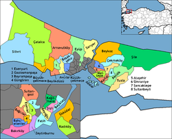 | |
|---|---|---|
| Asian side | ||
- Başakşehir
- Populated places in Istanbul Province
- Districts of Istanbul Province