Maltepe, Istanbul
hideThis article has multiple issues. Please help or discuss these issues on the talk page. (Learn how and when to remove these template messages)
|
Maltepe | |
|---|---|
District | |
 | |
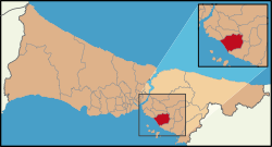 Location of Maltepe in Istanbul | |
 Maltepe Location of Maltepe in Turkey | |
| Coordinates: 40°55′30″N 29°09′06″E / 40.92500°N 29.15167°ECoordinates: 40°55′30″N 29°09′06″E / 40.92500°N 29.15167°E | |
| Country | |
| City | Istanbul |
| Government | |
| • Mayor | Ali Kılıç (CHP) |
| • Governor | Meftun Dallı |
| Area | |
| • District | 123.41 km2 (47.65 sq mi) |
| Population (2018)[2] | |
| • District | 497.034 |
| • District density | 4.0/km2 (10/sq mi) |
| Time zone | UTC+2 (EET) |
| • Summer (DST) | UTC+3 (EEST) |
| Area code(s) | 0-216 |
| Website | www www |

Maltepe is a district in the Asian side of Istanbul, Turkey, on the northern shore of the Sea of Marmara. Its neighbouring districts are Kadıköy to the west, Kartal to the east and Ataşehir to the northwest. The mayor of Maltepe is Ali Kılıç (CHP).
History[]
In Byzantine times, the area was known as Bryas (Greek: Βρύας). In ca. 837, the emperor Theophilos (r. 829–842) erected here a palace in Arab style, inspired by the palaces of the Abbasids in Baghdad, described to him by his ambassador to the Abbasid court, John Grammatikos. A ruin in nearby Küçükyalı has been identified as it.[3]
This coast has been a retreat from the city since Byzantine and Ottoman times, and right up until the 1970s was a rural area peppered with summer homes for wealthy Istanbul residents. Being on the suburban railway line Maltepe was a favourite spot for day-trippers or weekenders to visit the beach and many summer houses were built there. Many of these houses remain but Maltepe is no longer a beach retreat: the Marmara sea is no longer clean enough to swim in, although the sea-front is still pleasant to sit, drink tea and enjoy the views of the Princes Islands.
Maltepe today[]
The population grew rapidly from the 70's onwards when, following the building of the Bosphorus Bridge, it became possible to commute from here to the city. Buses along the D100 highway to the bridge, and minibuses to the ferry docks at Kadıköy now carry lower-middle class commuters (the wealthier preferring to live in smarter areas nearer the city, in Kadıköy itself). These people live either in quiet tree-lined streets of four- to six-storey apartment building with gardens around them, or in modern housing complexes with tennis-courts, children's playgrounds and security guards on the gate.
Being generally cheaper than Kadıköy, Maltepe is popular with young-families and newlyweds. During the earthquake of 1999 Maltepe suffered badly and many tall apartment blocks needed structural repair, some still bear the cracks of structural damage, something which reduced the price of property in Maltepe considerably. Over the past two years however, prices have risen again despite warnings that Maltepe is always under threat from earthquakes in the future.
The E5 highway cuts through Maltepe and north of the highway is the poorer area of Başıbüyük, a tree-covered hill with a hospital on it (formerly Istanbul's tuberculosis isolation hospital) and also a large cemetery. But it does have a great view of the coastline and the islands. A large proportion of the residents are from the Black Sea coast and there are some excellent bakeries and Akçaabat kofte restaurants (traditional to that area of Turkey). Maltepe used to border Ümraniye from the northwest between 1992 and 2004. However, the Yeni Çamlıca quarter changed to Ümraniye in 1994 and the Ferhatpaşa quarter passed to Samandıra where bounded to Kartal district in 2004. Ferhatpaşa's secession led to ending of neighbourhood between Maltepe and Ümraniye.
Maltepe is also home to one of the largest mosques in Istanbul, recently built (and caused much criticism due to the cost) by the AK Parti municipality. Below the mosque there is a bookshop and supermarket. This has changed since the renting of below grounds to several enterprises, including a polyclinics and a supermarket as well as underground carpark.
The Mosque has been built according to the traditional standard shape of a Turkish Mosque (rounded shape with 4 minarets) but internally it is particularly impressive with a tall high dome, a large gallery and balcony where women may pray (which many do 5 times a day, it is now becoming more and more common to find women attending the Mosque to pray particularly on Fridays but more and more for all of the five daily prayers especially amongst the young) The galleries have carved wood frames and there are several large tiled mosaics around the Mosque of various sights of importance to Islam and Muslims (for example the al-Aqsa Mosque in Jerusalem. The Mosque has become something of a central point for Maltepe as it both can be seen from a considerable distance and is a central stop for buses and minibuses taking commuters from Kadikoy to the outskirts of the city.
Maltepe was in the past also famous for its coastline and it does command an excellent view of the Princes' Islands. Nearer to the sea can be found almost a 'village' within the city where there are many small winding streets and quaint old houses generally referred to as 'old Maltepe'. Here there are also several bars and restaurants.
Geography[]
Maltepe is located in the southwestern part of the Kocaeli Peninsula, on the Marmara Sea coast of Istanbul. Maltepe has approximately 7 km of coastline to the Marmara Sea. The district is quite hilly, with a highest peak at 440m. The seaside is covered with sand and clay and silica from the coast.
Climate[]
Maltepe experiences a Mediterranean climate (Csa/Cs) according to both Köppen and Trewartha climate classifications, with cool winters and warm to hot summers. Its position in the south of Istanbul gives it a relatively warm climate, and places it in the 9a USDA hardiness zone, as well as AHS heat zone 4. It is, however, considerably cooler than Kartal, the district to its southeast.
| hideClimate data for Maltepe | |||||||||||||
|---|---|---|---|---|---|---|---|---|---|---|---|---|---|
| Month | Jan | Feb | Mar | Apr | May | Jun | Jul | Aug | Sep | Oct | Nov | Dec | Year |
| Average high °C (°F) | 8.4 (47.1) |
9.0 (48.2) |
10.9 (51.6) |
16.2 (61.2) |
21.0 (69.8) |
25.6 (78.1) |
28.0 (82.4) |
27.7 (81.9) |
24.4 (75.9) |
19.3 (66.7) |
14.9 (58.8) |
10.8 (51.4) |
18.0 (64.4) |
| Daily mean °C (°F) | 5.5 (41.9) |
5.9 (42.6) |
7.3 (45.1) |
11.8 (53.2) |
16.2 (61.2) |
20.5 (68.9) |
22.9 (73.2) |
22.9 (73.2) |
19.8 (67.6) |
15.4 (59.7) |
11.5 (52.7) |
7.9 (46.2) |
14.0 (57.1) |
| Average low °C (°F) | 2.5 (36.5) |
2.8 (37.0) |
3.6 (38.5) |
7.3 (45.1) |
11.3 (52.3) |
15.4 (59.7) |
17.9 (64.2) |
18.1 (64.6) |
15.1 (59.2) |
11.5 (52.7) |
8.0 (46.4) |
4.9 (40.8) |
9.9 (49.7) |
| Average precipitation mm (inches) | 105 (4.1) |
72 (2.8) |
69 (2.7) |
52 (2.0) |
35 (1.4) |
27 (1.1) |
24 (0.9) |
33 (1.3) |
48 (1.9) |
77 (3.0) |
92 (3.6) |
124 (4.9) |
758 (29.7) |
| Source: [4] | |||||||||||||
Amenities[]
Maltepe is just a little far from the city. There is a busy shopping district and some big supermarkets with Burger Kings, branches of some pastry shops and all the other modern amenities. Maltepe has cinemas, fast-food places, and kebab houses. And there is the sea shore, where there are cafes and some bars and cafes with live music similar (but on a much smaller scale) to those found in Kadıköy or in Taksim (on the European side of the city). The public transport is mainly for commuters and doesn't run into the night for party-goers though mini buses or 'dolmuses do run late into the night, often until at least 3am depending on destination.
Politics[]
Maltepe, which became a separate district after leaving Kartal district on 1 November 1992, experienced its first local election in 1994. At the end of this election, ANAP candidate Bahtiyar Uyanık was elected as the first mayor of Maltepe with 32.98% of the votes. In the later 1999 elections, although his votes fell to 24.07%, he was re-elected mayor. He transferred his seat to AK Party candidate Fikri Köse, who received 43.01% of the votes in the 2004 elections. In the 2009 elections, with 51.39% of the votes, Prof. Dr. Mustafa Zengin was elected mayor. In the 2014 elections, Ali Kılıç, the CHP candidate, was elected mayor with 49.34% of the votes. In 2019 local election, Ali Kılıç was nominated again. And it took 52.74% of the votes and elected a mayor for the second time.[5]
Transport[]
- M4 Kadıköy-Tavşantepe (extension to Sabiha Gökçen International Airport is under construction)
- Ferryboat[8]
References[]
- ^ "Area of regions (including lakes), km²". Regional Statistics Database. Turkish Statistical Institute. 2002. Retrieved 2013-03-05.
- ^ "Population of province/district centers and towns/villages by districts - 2012". Address Based Population Registration System (ABPRS) Database. Turkish Statistical Institute. Retrieved 2013-02-27.
- ^ Mango, Cyril (1991). Kazhdan, Alexander (ed.). Oxford Dictionary of Byzantium. Oxford University Press. p. 328. ISBN 978-0-19-504652-6.
- ^ "Maltepe - Weather History & Climate Data - Meteostat". meteostat.net. Retrieved 2021-06-03.
- ^ "Istanbul Maltepe Election Results – Maltepe Local Election Results". 7 July 2021.
- ^ https://www.metro.istanbul/en/Hatlarimiz/HatDetay?hat=M4
- ^ http://marmaray.gov.tr/
- ^ https://www.ido.com.tr/en
External links[]
| show Maltepe, Istanbul in Istanbul Province of Turkey |
|---|

| Authority control |
|---|
- Maltepe, Istanbul
- Populated places in Istanbul Province
- Districts of Istanbul Province