Baoji
This article needs additional citations for verification. (May 2020) |
Baoji
宝鸡市 Pao-chi, Paoki | |
|---|---|
 Baoji | |
 Location of Baoji Prefecture within Shaanxi | |
| Coordinates (Baoji government): 34°21′47″N 107°14′17″E / 34.363°N 107.238°ECoordinates: 34°21′47″N 107°14′17″E / 34.363°N 107.238°E | |
| Country | People's Republic of China |
| Province | Shaanxi |
| Founded | 2000 BC |
| Municipal seat | Jintai District |
| Area | |
| • Prefecture-level city | 18,712 km2 (7,225 sq mi) |
| • Urban (2018)[1] | 3,577 km2 (1,381 sq mi) |
| • Metro | 3,577 km2 (1,381 sq mi) |
| Elevation | 570 m (1,870 ft) |
| Population (2010)[2] | |
| • Prefecture-level city | 3,716,731 |
| • Density | 200/km2 (510/sq mi) |
| • Urban (2018)[1] | 1,437,802 |
| • Urban density | 400/km2 (1,000/sq mi) |
| • Metro | 1,437,802 |
| • Metro density | 400/km2 (1,000/sq mi) |
| Time zone | UTC+8 (China Standard) |
| Postal code | 721000 |
| Area code(s) | 0917 |
| ISO 3166 code | CN-SN-03 |
| License Plate Prefix | 陕C |
| Website | www |

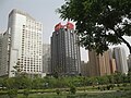
![]() Baoji (help·info) (simplified Chinese: 宝鸡; traditional Chinese: 寶雞; pinyin: Bǎojī) is a prefecture-level city in western Shaanxi province, People's Republic of China. Since the early 1990s, Baoji has been the second largest city in Shaanxi.[3]
Baoji (help·info) (simplified Chinese: 宝鸡; traditional Chinese: 寶雞; pinyin: Bǎojī) is a prefecture-level city in western Shaanxi province, People's Republic of China. Since the early 1990s, Baoji has been the second largest city in Shaanxi.[3]
Geography[]
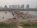
The prefecture-level city of Baoji has a population of 3,716,731 according to the 2010 Chinese census, inhabiting an area of 18,172 km2 (7,016 sq mi). The built-up area made of 3 urban districts had a population of approximately 1,437,802 inhabitants as of the 2010 census. Surrounded on three sides by hills, Baoji is in a valley opening out to the east. Its location is strategic, controlling a pass on the Qin Mountains between the Wei River valley and the Jialing River.
History[]
Thriving early in the Tang dynasty, it has roots to 2000 BC.[4] Today it is a large industrial center. Railways first reached Baoji in 1937 and have been key to its modern growth.

Passing through Baoji is the ancient Northern Silk Road, the northernmost route of about 2,600 kilometres (1,616 miles) in length, which connected the ancient Chinese capital of Chang'an to the West over the Wushao Ling Mountain to Wuwei and emerging in Kashgar before linking to ancient Parthia.[5]
Baoji is considered the gateway between western and eastern China since most trains from Beijing, Shanghai and Xi'an pass through here on their way to Gansu, Sichuan, Xinjiang and Tibet (Lhasa). Famen temple, home to one of Buddha's finger bones, is in Baoji County. The Baoji area was home to the legendary Yandi, one of the Han Chinese forefathers. His tomb is in the southern part of the city and his temple is in the north.
People who are interested in the Three Kingdoms of ancient China can visit Zhuge Liang's Memorial Temple, about 20 km (12 mi) from Baoji.
Ancient trackways[]
Mount Taibai still has some remaining traces of roadways built during the Three Kingdoms Period (220−280 CE) which are all generally unusable due to decay. They remain a popular attraction because they were built by making wood plank bridges along the side of the mountain.
To the South of Baoji lies the beginning of the plank road into the Qin Mountains. There are also several natural sites such as the with its small waterfalls and forests. To the north is Bei Puo, a giant hill made of loess with a panoramic view of the city and a landscape dotted with small farming villages that offer local cuisine.
A number of Longshan archaeological sites have been found north of the Wei River near the North Silk Road.[6]
Baoji Bronze Museum[]
Baoji is home to the Baoji Bronze Museum which holds more than 120,000 pieces of cultural relics, primarily of Zhou dynasty descent.[7]
Administrative divisions[]

| Map | |||||
|---|---|---|---|---|---|

Mei
County Qianyang
County | |||||
| Name | Hanzi | Hanyu Pinyin | Population (2010) | Area (km²) | Density (/km²) |
| Weibin District | 渭滨区 | Wèibīn Qū | 448,189 | 728 | 616 |
| Jintai District | 金台区 | Jīntái Qū | 394,538 | 332 | 1,188 |
| Chencang District | 陈仓区 | Chéncāng Qū | 595,075 | 2,517 | 236 |
| Fengxiang County | 凤翔县 | Fèngxiáng Xiàn | 483,471 | 1,179 | 410 |
| Qishan County | 岐山县 | Qíshān Xiàn | 459,064 | 855 | 537 |
| Fufeng County | 扶风县 | Fúfēng Xiàn | 416,398 | 751 | 554 |
| Mei County | 眉县 | Méi Xiàn | 299,988 | 863 | 348 |
| Long County | 陇县 | Lǒng Xiàn | 248,901 | 2,418 | 103 |
| Qianyang County | 千阳县 | Qiānyáng Xiàn | 123,959 | 959 | 129 |
| Linyou County | 麟游县 | Línyóu Xiàn | 90,728 | 1,806 | 50 |
| Feng County | 凤县 | Fèng Xiàn | 105,492 | 3,187 | 33 |
| Taibai County | 太白县 | Tàibái Xiàn | 50,928 | 2,780 | 18 |
Climate[]
| hideClimate data for Baoji (1971−2000) | |||||||||||||
|---|---|---|---|---|---|---|---|---|---|---|---|---|---|
| Month | Jan | Feb | Mar | Apr | May | Jun | Jul | Aug | Sep | Oct | Nov | Dec | Year |
| Record high °C (°F) | 20.7 (69.3) |
25.5 (77.9) |
28.0 (82.4) |
36.2 (97.2) |
37.8 (100.0) |
40.2 (104.4) |
40.9 (105.6) |
41.6 (106.9) |
40.0 (104.0) |
33.0 (91.4) |
25.8 (78.4) |
23.2 (73.8) |
41.6 (106.9) |
| Average high °C (°F) | 5.1 (41.2) |
7.8 (46.0) |
12.8 (55.0) |
20.1 (68.2) |
25.2 (77.4) |
29.7 (85.5) |
30.9 (87.6) |
29.4 (84.9) |
23.7 (74.7) |
18.4 (65.1) |
12.0 (53.6) |
6.7 (44.1) |
18.5 (65.3) |
| Daily mean °C (°F) | 0.1 (32.2) |
2.7 (36.9) |
7.7 (45.9) |
14.2 (57.6) |
19.2 (66.6) |
23.6 (74.5) |
25.4 (77.7) |
24.3 (75.7) |
18.9 (66.0) |
13.3 (55.9) |
6.8 (44.2) |
1.5 (34.7) |
13.1 (55.6) |
| Average low °C (°F) | −3.5 (25.7) |
−0.9 (30.4) |
3.5 (38.3) |
9.3 (48.7) |
13.9 (57.0) |
18.2 (64.8) |
21.1 (70.0) |
20.2 (68.4) |
15.3 (59.5) |
9.6 (49.3) |
3.1 (37.6) |
−2.2 (28.0) |
9.0 (48.1) |
| Record low °C (°F) | −13.9 (7.0) |
−11.4 (11.5) |
−5.3 (22.5) |
−1.7 (28.9) |
4.8 (40.6) |
10.0 (50.0) |
12.9 (55.2) |
13.2 (55.8) |
6.0 (42.8) |
−2 (28) |
−8 (18) |
−16.1 (3.0) |
−16.1 (3.0) |
| Average precipitation mm (inches) | 6.4 (0.25) |
10.6 (0.42) |
24.6 (0.97) |
52.4 (2.06) |
62.8 (2.47) |
76.2 (3.00) |
111.1 (4.37) |
114.6 (4.51) |
109.6 (4.31) |
63.7 (2.51) |
19.6 (0.77) |
4.7 (0.19) |
656.3 (25.83) |
| Average precipitation days (≥ 0.1 mm) | 4.1 | 5.4 | 8.0 | 8.7 | 9.9 | 10.8 | 11.4 | 11.0 | 12.6 | 10.3 | 5.4 | 3.4 | 101 |
| Source: Weather China | |||||||||||||
Economy[]

Industrial Zone[]
Established in 1992, Baoji Hi-Tech Industrial Development Zone was approved as a national hi-tech zone by State Council. It has a long-term planned area of 40 square kilometres (15 sq mi). The transportation system around the zone includes Xi'an Xianyang International Airport and National Highway 310. Its encouraged industries are auto parts, electronics, IT, pharmaceutical and bioengineering industry and new materials.[8]
Military[]
Baoji is the headquarters of the 21st Group Army of the People's Liberation Army, one of the two group armies that comprise the Lanzhou Military Region responsible for defending China's northwest borders.
Transportation[]
The G85 Yinchuan-Kunming Expressway, China National Highway 310, and G30 Lianyungang-Khorgas Expressway are major highways that run through Baoji.
The city is serviced by the Baoji South on the Xi'an-Baoji and Baoji-Lanzhou sections of the Xuzhou-Xinjiang high speed railway. The Longhai, Baocheng and Baozhong railways also call at Baoji railway station.[9]
A metro system is in the planning stages.
Education[]
College[]
- Baoji University of Arts and Sciences
- Baoji Vocational & Technical school
High school[]
- Baoji middle school
Sister city[]
Japan[]
Other countries[]
- Belfort, Bourgogne-Franche-Comté region, France
- Beirut, Lebanon
See also[]
References[]
- ^ Jump up to: a b Cox, W (2018). Demographia World Urban Areas. 14th Annual Edition (PDF). St. Louis: Demographia. p. 22.
- ^ According to 2010 China National Census Archived 2012-03-25 at the Wayback Machine
- ^ Wang, Ya Ping; Hague, Cliff (1995-10-01). "Baoji". Cities. 12 (5): 361–368. doi:10.1016/0264-2751(95)00052-N. ISSN 0264-2751.
- ^ Baoji on line profile, retrieved Dec 9, 2007 Archived January 13, 2008, at the Wayback Machine
- ^ Hogan, C. M. "Silk Road, North China". the Megalithic Portal. ed. A. Burnham.
- ^ Li Liu (2004). The Chinese Neolithic: Trajectories to Early States. Cambridge University Press. ISBN 0-521-81184-8.
- ^ "Baoji Bronze Ware Museum - 2018 What to Know Before You Go (with Photos)". TripAdvisor. Retrieved 2018-12-06.
- ^ RightSite.asia | Baoji Hi-Tech Industrial Development Zone
- ^ 西安铁路局宝鸡火车站 (in Chinese). 2008-06-05. Archived from the original on 2014-04-27.
External links[]


| show Authority control |
|---|
- Baoji
- Cities in Shaanxi
- National Forest Cities in China