Barrack Heights, New South Wales
This article needs additional citations for verification. (May 2008) |
| Barrack Heights Shellharbour, New South Wales | |||||||||||||||
|---|---|---|---|---|---|---|---|---|---|---|---|---|---|---|---|
 | |||||||||||||||
 Barrack Heights | |||||||||||||||
| Coordinates | 34°33′54″S 150°51′25″E / 34.56500°S 150.85694°ECoordinates: 34°33′54″S 150°51′25″E / 34.56500°S 150.85694°E | ||||||||||||||
| Population | 5,900 (2016 census)[1] | ||||||||||||||
| Postcode(s) | 2528 | ||||||||||||||
| Location | 16 km (10 mi) south of Wollongong | ||||||||||||||
| LGA(s) | City of Shellharbour | ||||||||||||||
| Region | Illawarra | ||||||||||||||
| County | Camden | ||||||||||||||
| Parish | Terragong | ||||||||||||||
| State electorate(s) | Shellharbour | ||||||||||||||
| Federal division(s) | Gilmore | ||||||||||||||
| |||||||||||||||

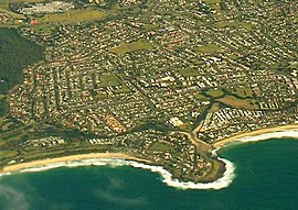
Barrack Heights is a suburb of the City of Shellharbour in New South Wales, Australia in the local government area of the same name. Many institutions are located in Barrack Heights, including Shellharbour Public Hospital, Shellharbour Private Hospital, Warilla Bowling Club, Warilla Sports Club and Warilla High School.
Barrack Heights is surrounded by the suburbs of Barrack Point, Blackbutt, Mount Warrigal, Oak Flats, Shellharbour, Shellharbour City Centre and Warilla.
Demography[]
The 2016 census revealed that 5,900 lived in the suburb of Barrack Heights. Indigenous peoples accounted for 5.0% of the population.[1]
Country of birth[]
- Australia - 4,327 (73.8%)
- England - 307 (5.2%)
- Macedonia - 178 (3.0%)
- Italy - 58 (1.=%)
- Scotland - 49 (0.8%)
- Germany - 44 (0.8%)
Language spoken at home[]
- English - 4,773 (80.9%)
- Macedonian - 253 (4.3%)
- Italian - 72 (1.2%)
- Spanish - 63 (1.1%)
- Greek - 52 (0.9%)
- Croatian - 51 (0.9%)
References[]
- ^ a b Australian Bureau of Statistics (27 June 2017). "Barrack Heights (State Suburb)". 2016 Census QuickStats. Retrieved 14 July 2017.

This Shellharbour geography article is a stub. You can help Wikipedia by . |
Categories:
- City of Shellharbour
- Suburbs of Wollongong
- Illawarra region geography stubs