Basail Upazila
Basail
বাসাইল | |
|---|---|
Upazila | |
 Basail Location in Bangladesh | |
| Coordinates: 24°13′N 90°3′E / 24.217°N 90.050°ECoordinates: 24°13′N 90°3′E / 24.217°N 90.050°E | |
| Country | |
| Division | Dhaka Division |
| District | Tangail District |
| Area | |
| • Total | 157.78 km2 (60.92 sq mi) |
| Population (2011) | |
| • Total | 159,870 |
| Time zone | UTC+6 (BST) |
1920 | |
| Website | basail |

Basail (Bengali: বাসাইল) is an upazila of Tangail District in the Division of Dhaka, Bangladesh.
Geography[]
Basail is located at 24°13′00″N 90°03′00″E / 24.2167°N 90.0500°E. It has 27481 households and total area 157.78 km2.
Demographics[]
As of the 2011 Bangladesh census, Basail has a population of 159870. Males constitute 50.97% of the population, and females 49.03%. Basail has an average literacy rate of 50.4% (7+ years).[1]
Administration[]
Basail Upazila is divided into six union parishads: Basail, Fulki, Habla, Kanchanpur, Kaoaljani, and Kashil. The union parishads are subdivided into 72 mauzas and 107 villages.[2]
Education[]
According to Banglapedia, Basail Govinda Government High School, founded in 1945, is a notable secondary school.[3]
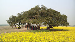
Pictures[]
 .
.  .
. 
See also[]
- Upazilas of Bangladesh
- Districts of Bangladesh
- Divisions of Bangladesh
References[]
- ^ "Population Census Wing, BBS". Archived from the original on 2005-03-27. Retrieved November 10, 2006.
- ^ "District Statistics 2011: Tangail" (PDF). Bangladesh Bureau of Statistics. Archived from the original (PDF) on 13 November 2014. Retrieved 14 July 2014.
- ^ Salim, Nurur Rahman (2012). "Basail Upazila". In Islam, Sirajul; Jamal, Ahmed A. (eds.). Banglapedia: National Encyclopedia of Bangladesh (Second ed.). Asiatic Society of Bangladesh.
| Upazila/Thana: | ||
|---|---|---|
Headquarters: Dhaka | ||
| Dhaka District |  | |
| Faridpur District | ||
| Gazipur District | ||
| Gopalganj District | ||
| Kishoreganj District | ||
| Madaripur District | ||
| Manikganj District | ||
| Munshiganj District |
| |
| Narayanganj District | ||
| Narsingdi District | ||
| Rajbari District |
| |
| Shariatpur District |
| |
| Tangail District | ||
This Dhaka Division location article is a stub. You can help Wikipedia by . |
- Basail Upazila
- Upazilas of Tangail District
- Dhaka Division geography stubs