Pakundia Upazila
Pakundia
পাকুন্দিয়া | |
|---|---|
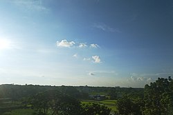
 The skyline of Pakundia | |
 Pakundia Location in Bangladesh | |
| Coordinates: 24°19′44″N 90°40′54″E / 24.32889°N 90.68167°ECoordinates: 24°19′44″N 90°40′54″E / 24.32889°N 90.68167°E | |
| Country | |
| Division | Dhaka Division |
| District | Kishoreganj District |
| Formed as thana | 1922 |
| Turned into upazila | 1983 |
| Area | |
| • Total | 180.52 km2 (69.70 sq mi) |
| Population (2001) | |
| • Total | 237,218 |
| • Density | 1,300/km2 (3,400/sq mi) |
| Time zone | UTC+6 (BST) |
| Postal code | 2326 |
| Website | pakundia |

Pakundia (Bengali: পাকুন্দিয়া) is an upazila (subdistrict) in Kishoreganj District, Dhaka Division, Bangladesh.[1] Its total land area is 180.52 square kilometres (69.70 square miles). It has a population of 237,218 residents. It was formed in 1922 as a thana. On the 14th of September 1983, it was turned into an upazila.[1]
Geography[]
Pakundia is located at 24°19′44″N 90°40′54″E / 24.32889°N 90.68167°E. It has 39,924 households and total area 180.52 square kilometres (69.70 square miles).
Demographics[]
As of the 1991 Bangladesh census, Pakundia has a population of 210,355. Males are 51.26% of the population, and females 48.74%. This Upazila's eighteen up population is 103,661. Pakundia has an average literacy rate of 40.8% (7+ years), and the national average of 42.4% literate.[2]
Administration[]
Pakundia Upazila is divided into Pakundia Municipality, and nine union parishads: Barudia, Chandipasha, Char Faradi, Egarasindur, Hosendi, Jangalia, Narandi, Patuabhanga, and Sukhia. The union parishads are subdivided into 97 mauzas and 150 villages.[3]
Pakundia Municipality is subdivided into 9 wards and 25 mahallas.[3]
Education[]

Notable people[]
- ABM Zahidul Haq, former Bangladesh Deputy Minister of Shipping and Member of Parliament (MP), founder of Pakundia Adarsha Mohila College
See also[]
- List of upazilas in Bangladesh
References[]
- ^ Jump up to: a b Alam, Md. Jahangir. "Pakundia Upazila". Banglapedia. Retrieved 26 July 2015.
- ^ "Population Census Wing, BBS". Archived from the original on 2005-03-27. Retrieved November 10, 2006.
- ^ Jump up to: a b "District Statistics 2011: Kishoreganj" (PDF). Bangladesh Bureau of Statistics. Archived from the original (PDF) on 13 November 2014. Retrieved 14 July 2014.
- ^ "Institute Basic Information". Bangladesh Open Data. Archived from the original (XLS) on 22 September 2020.
External links[]
 Media related to Pakundia Upazila at Wikimedia Commons
- Upazilas of Kishoreganj District


