Faridpur District
Faridpur District
ফরিদপুর জেলা Fatehabad | |
|---|---|
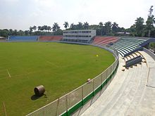
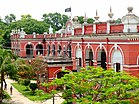  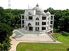 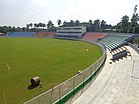 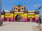  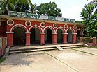 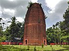 From top: Faridpur Judge Court, Circuit House, Muslim Mission Masjid, Sheikh Jamal Stadium, Sheikh Rasel Amusement Park, Patrail Masjid, Faridpur Zilla School and Mathurapur Deul | |
 Location of Faridpur District in Bangladesh | |
 Expandable map of Faridpur District | |
| Coordinates: 23°30′N 89°50′E / 23.50°N 89.83°ECoordinates: 23°30′N 89°50′E / 23.50°N 89.83°E | |
| Country | |
| Division | Dhaka Division |
| Seat | Faridpur |
| Government | |
| • Deputy Commissioner | Atul Sarker |
| • District Council Chairman | Md. Lokman Mridha |
| • Chief Executive Officer | Md. Abdur Rashid [1] |
| Area | |
| • Total | 2,072.72 km2 (800.28 sq mi) |
| Elevation | 12 m (39 ft) |
| Population (2011 census) | |
| • Total | 1,912,969 |
| Demonym(s) | Faridpuri, Foridpuri, Dhakaiya, Dhakai |
| HDI (2018) | 0.596[2] medium · 11th of 21 |
| Website | www |

Faridpur (Bengali: ফরিদপুর জেলা) is a district in south-central Bangladesh. It is a part of the Dhaka Division.[3] It is bounded by the Padma River to its northeast. The district is named after the municipality of Faridpur. Historically, the town was known as Fatehabad. It was also called Haveli Mahal Fatehabad.
History[]


The town of Fatehabad was located by a stream known as the Dead Padma, which was 32 kilometres (20 mi) from the main channel of the Padma River. Sultan Jalaluddin Muhammad Shah established a mint in Fatehabad during his reign in the early 15th century. Fatehabad continued to be a mint town of the Bengal Sultanate until 1538. In Ain-i-Akbari, it was named as Haweli Mahal Fatehabad during the reign of Emperor Akbar in the Mughal Empire. The Portuguese cartographer João de Barros mentioned it as Fatiabas. The Dutch map of Van den Brouck described it as Fathur.[4]
Its first mention in Bengali literature was by Daulat Uzir Bahram Khan in his adaption of Layla and Majnun.[4] The medieval poet Alaol was born in Faridpur.[5]
Fathabad was a strategically important base in south and southwestern Bengal. It was a well-developed urban centre. The town was home to important Mughal government officials, including generals, civil servants and jagirdars. During the reign of Emperor Jahangir in the 17th century, local zamindars Satrajit and Mukund resisted the Mughal government. By the 19th century, the town was renamed as Faridpur in honour of the Sufi saint Shah Fariduddin Masud, a follower of the Chishti order of Ajmer.[4] Haji Shariatullah and Dudu Miyan led the conservative Faraizi movement in Faridpur during the early 19th century.
The Faridpur District was established by the British in 1815. The Faridpur Subdivision was a part of Dacca Division in the Bengal Presidency established by the East India Company. The municipality of Faridpur was established in 1869.[6] The subdivision covered modern day Faridpur, Rajbari, Madaripur, Shariatpur and Gopalganj districts (collectively known as Greater Faridpur). It was included in Eastern Bengal and Assam during the British Raj between 1905 and 1912.
Faridpur was a rail terminus for the Bengal Provincial Railway and the Eastern Bengal Railway, connecting Calcutta with the important Goalanda ghats, from where ships travelled to Colonial Assam and British Burma.[6][7] British Faridpur was the birthplace of several nationalist leaders of the subcontinent, including Ambica Charan Mazumdar, Humayun Kabir, Maulvi Tamizuddin Khan and Sheikh Mujibur Rahman. The acclaimed American engineer Fazlur Rahman Khan was also born in the region.
Faridpur saw intense fighting during the Bangladesh Liberation War in 1971.[8] It was one of original 18 subdivisions of Bangladesh at the time of independence. In 1984, the devolution reforms of President Hussain Muhammad Ershad divided the old subdivision into five districts. In 2015, the Government of Bangladesh announced plans to establish a Faridpur Division.
Politics and local government[]
The district has 9 upazilas, 4 municipalities, 36 wards, 100 mahallahs, 79 unions and 1,899 villages. The district has four parliamentary constituencies in the Jatiyo Sangshad. The Faridpur District Council is the highest tier of local government.
List of upazilas[]
The district's nine upazilas:[3]
- Alfadanga Upazila
- Bhanga Upazila
- Boalmari Upazila
- Charbhadrasan Upazila
- Faridpur Sadar Upazila
- Madhukhali Upazila
- Nagarkanda Upazila
- Sadarpur Upazila
- Saltha Upazila
Demographics[]
As of the 2011 census, the population is 1,912,969. Muslims are 90.49%, Hindus are 9.43%.
Economy[]

Faridpur is an important centre of the jute trade and hilsa fish trade. Its industrial sector features numerous jute mills, sugar mills and a 50 MW thermal power plant.[6][10]
In terms of transport, Faridpur is an important hub of the Bangladesh Railway, with its tracks connected to the Indian Railways in West Bengal. It is linked by road with Kushtia, Meherpur, Khulna, Barisal, and Jessore.[6]
Culture and sport[]
Faridpur District has a rich heritage of folk music, including Baul, Marami, Bichar, Murshidi-Marfati, Fakirali, Gazirgan, Kabigan, Jarigan music. However many of these traditions are extinct. Major festivals include Eid, Nabanna, Pous Utshab, Rathjatra, Dol Purnima Utshab and Durga Puja. Folk festivities are held on the occasion of Annaprashana, Muharram, Bengali weddings, Jamai Shasthi, Bhadra Mangal Chandi. Folk games of the district include Dariabandha, boat racing, Ha-du-du and cock fighting.[8]
Major contemporary and historical publications include Jagaran, Ganaman (1370 BS), Chashi Barta, Idaning, Thikana, Bhorer Runner, Faridpur (1997), Kumar (2006); Weekly: Kalbhabna (2004), Pragotir Din (1995), Boalmari Sangbad, Al Helal, Bhanga Khabar; Fortnightly: Nazir Bangla Defunct: Faridpur Darpan (1861), Chitrakar (1283 BS), Kohinoor (1896), Sanjay (1900),' Aryakayastha (1318 BS), Faridpur Hitoishi (1329 BS), Faridpur Angina (1329 BS), Barta (1926), Muazzen (1335 BS), The Servant of Humanity (1960), Siraj (1932), Langal (1932), Sheba (1350 BS), Khedmat (1373 BS), Jubashakti (1972), Weekly Bangladesh (1972), Satyajug (1975), Faridpur Barta (1979), Aakal (1979), Samachar (1980) and Bangla Sangbad (1982).[8]
Education[]
There are several state owned colleges in the district. Several venerable British Raj-era educational institutions are located in the region, including the Rajendra College (1918), Government Saroda Sundori Mohila College (1966) Faridpur District School (1840), Government Girls High School (1910), Madhukhali Pilot High School, George Academy (1911), M N Academy (1916), Bakiganj Islamia Madrasa (1922), Hitoishi High School (1889), Bhanga Pilot High School (1889), Karakdi Rambihari Multilateral High School (1901) and Krishnapur High School (1910). The Faridpur Medical College was established in 1985. The Faridpur Engineering College was established in 2010. was established in 1889.[8]
See also[]
- Upazilas of Bangladesh
- Districts of Bangladesh
- Divisions of Bangladesh
References[]
- ^ http://www.faridpur.gov.bd
- ^ "Sub-national HDI - Area Database - Global Data Lab". hdi.globaldatalab.org. Retrieved 18 March 2020.
- ^ Jump up to: a b Masud Reza (2012). "Faridpur District". In Sirajul Islam and Ahmed A. Jamal (ed.). Banglapedia: National Encyclopedia of Bangladesh (Second ed.). Asiatic Society of Bangladesh.
- ^ Jump up to: a b c "Fathabad - Banglapedia". en.banglapedia.org.
- ^ "Alaol - Banglapedia". en.banglapedia.org.
- ^ Jump up to: a b c d https://global.britannica.com/place/Faridpur
- ^ "The legend behind Goalondo Steamer Chicken - Times of India". The Times of India.
- ^ Jump up to: a b c d "Faridpur District - Banglapedia". en.banglapedia.org.
- ^ "Bangladesh Population & Housing Census 2011" (PDF). Retrieved 6 July 2021.
- ^ "Faridpur 50 Megawat [sic] Power Plant 2011". bd.geoview.info. Archived from the original on 12 February 2019.
External links[]
| Wikimedia Commons has media related to Faridpur District. |
- "Faridpur". in Encyclopædia Britannica

| show Authority control |
|---|
- Faridpur District
- Districts of Bangladesh
- Districts of Bangladesh established before 1971