Meherpur District
Meherpur District
মেহেরপুর | |
|---|---|
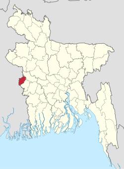 Location of Meherpur District in Bangladesh | |
 Expandable map of Meherpur District | |
| Coordinates: 23°45′N 88°42′E / 23.75°N 88.70°ECoordinates: 23°45′N 88°42′E / 23.75°N 88.70°E | |
| Country | |
| Division | Khulna Division |
| Government | |
| • | DR. MOHAMMED MONSUR ALAM KHAN |
| Area | |
| • Total | 716.08 km2 (276.48 sq mi) |
| Population (2011) | |
| • Total | 655,392 |
| • Density | 920/km2 (2,400/sq mi) |
| Demonym(s) | Meherpur |
| Time zone | UTC+06:00 (BST) |
| Postal code | 7100 |
| HDI (2019) | 0.644[1] medium · 5th of 20 |
| Website | meherpur |

Meherpur (Bengali: মেহেরপুর, pron: meɦeɾpuɾ) is the northwestern district of Khulna Division in southwestern Bangladesh. It is bordered by the Indian state of West Bengal to the west, and by the Bangladeshi districts of Kushtia and Chuadanga to the east.[2] The district has an area of 716.08 square kilometres (276.48 sq mi).
History[]
According to Dr Ashraf Siddiqui, the district is named after the 16th century dervish Meher Ali Shah. The Meherpur Municipality is one of the oldest municipalities in Bangladesh which was established on 1859 when Meherpur was a part of the Nadia district.
The was formed and solemnly sworn in Meherpur's Baidyanathtala village (later renamed as Mujibnagar), on 17 April 1971. The entire Proclamation ceremony was organised by local leaders under the supervision of Momeen Chowdhury and MM Rustom Ali.[3] The first provisional government of Bangladesh was formed here under the leadership of Tajuddin Ahmed & Syed Nazrul Islam. After that day on 18 April 1971, the Pakistani Army killed 8 people in Amjhupi village. Previously a subdivision of the Kushtia District, Meherpur became a district in 1983.[2]
Administration[]
Meherpur district is divided into three upazilas: Gangni Upazila, Meherpur Sadar Upazila and Mujibnagar Upazila.
Economy[]
Main sources of income: Agriculture 68.95%, non-agricultural labourer 3.24%, industry 0.87%, commerce 13.83%, transport and communication 2.21%, service 3.81%, construction 1.03%, religious service 0.14%, rent and remittance 0.59% and others 5.33%.[1][4]
Points of interest[]
- Bhatpara Neelkuthi is a ruined indigo factory built in 1778.[5]
- Mujibnagar, the place where Bangladesh's first government was created
Demographics[]
According to 2011 Bangladesh census, Meherpur District had a population of 655,392. Males constituted 49.53% of the population and females 50.47. Muslims formed 97.766% of the population, Hindus 1.201%, Christians 1.011%, and others 0.022%. Meherpur District had a literacy rate of 46.27% for the population 7 years and above.[6]
Literacy rate and educational institutions[]
Average literacy 37.8%; male 39.9%, female 35.6%. Educational institutions: college 7, vocational institute 3, secondary school 60, primary school 200, madrasa 11. Noted educational institutions: (1962), (1983), (1983), (1984), (1995), Meherpur Government High School (1854), (1859), (1937), (1940), (1945), (2020).
See also[]
References[]
| Wikimedia Commons has media related to Meherpur District. |
- ^ "Sub-national HDI - Area Database - Global Data Lab". hdi.globaldatalab.org. Retrieved 2020-03-18.
- ^ Jump up to: a b Md Abu Hasan Farooque (2012). "Meherpur District". In Islam, Sirajul; Miah, Sajahan; Khanam, Mahfuza; Ahmed, Sabbir (eds.). Banglapedia: the National Encyclopedia of Bangladesh (Online ed.). Dhaka, Bangladesh: Banglapedia Trust, Asiatic Society of Bangladesh. ISBN 984-32-0576-6. OCLC 52727562. Retrieved 9 September 2021.
- ^ Sajahan Miah (2012). "Proclamation of Independence". In Sirajul Islam and Ahmed A. Jamal (ed.). Banglapedia: National Encyclopedia of Bangladesh (Second ed.). Asiatic Society of Bangladesh.
- ^ "Meherpur District - Banglapedia". en.banglapedia.org. Retrieved 2018-03-24.
- ^ Alam, M. R. (15 October 2016). "Lack of renovation puts Bhatpara Neelkuthi on verge of ruination". The Daily Observer. Dhaka.
- ^ "Bangladesh Population and Housing Census 2011: Zila Report – Meherpur" (PDF). Table P01 : Household and Population by Sex and Residence, Table P05 : Population by Religion, Age group and Residence, Table P09 : Literacy of Population 7 Years & Above by Religion, Sex and Residence. Bangladesh Bureau of Statistics (BBS), Ministry of Planning, Government of the People’s Republic of Bangladesh. Retrieved 9 December 2018.

| show Authority control |
|---|
This Khulna Division location article is a stub. You can help Wikipedia by . |
- Meherpur District
- Districts of Bangladesh
- Khulna Division geography stubs