Jhenaidah District
Jhenaidah
ঝিনাইদহ | |
|---|---|
| Jhenaidah District | |
       From top:Payra chattar, Jhenaidah NunGola Masjid, Jhenaidah Golakata Mosque, Pir Pukur Masjid, Pathaghar Dhibi, Jor Bangla Masjid, Khorer Dhibi and Jhenaidah Textile Engineering College | |
| Nickname(s): Jhinaidoho, Jhineda | |
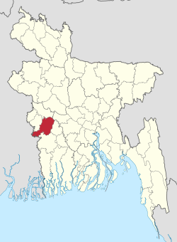 Location of Jhenaidah District in Bangladesh | |
 Expandable map of Jhenaidah District | |
| Coordinates: 23°32′N 89°00′E / 23.54°N 89.00°ECoordinates: 23°32′N 89°00′E / 23.54°N 89.00°E | |
| Country | |
| Division | Khulna Division |
| Government | |
| • Deputy Commissioner | Saroj Kumar Nath |
| Area | |
| • Total | 1,964.77 km2 (758.60 sq mi) |
| Population (2020) | |
| • Total | 2,052,000 |
| • Density | 1,000/km2 (2,700/sq mi) |
| Time zone | UTC+06:00 (BST) |
| HDI (2019) | 0.644[1] medium · 5th of 20 |

Jhenaidah (Bengali: ঝিনাইদহ) is a district in southwestern Bangladesh. It is a part of the Khulna Division. It has an area of 1,964.77 km2 (758.60 sq mi).[2] It is bordered by Kushtia District to the north, Jessore District and West Bengal, India to the south, Rajbari District and Magura District to the east, and Chuadanga District and West Bengal, India to the west. The largest city and headquarter of this district is Jhenaidah.[3] At the beginning of the British rule Jhenaidah was a police outpost and was turned into a thana in 1793. The Jhenaidah Sub division was established in 1862 and was turned into a district in 1984.[4]
Geography[]
Annual average temperature: maximum 37.1 °C (98.8 °F), minimum 11.2 °C (52.2 °F) Annual rainfall: 1,467 mm (57.8 in)[5]
Demographics[]
According to the 2011 Bangladesh census, Jhenaidah District had a population of 1,771,304. Males constituted 50.04% of the population and females 49.96%. Muslims formed 90.39% of the population, Hindus 9.48%, Christians 0.06% and others 0.08%. Jhenaidah had a literacy rate of 48.4% for the population 7 years and above.[6]
Jhenaidah district has 1,771,304 people as of 2011.[2] Density of the population is 901.5 inhabitants/km2.[7] As of 2020 its current population is 20,52,000 according to district record.
Administration[]
Deputy Commissioner: Soroj Kumar Nath[8]
Chairman of Zila Porishod: Kanak Kanti Das [2]
Subdivisions[]
There are six upazilas under this district:
- Jhenaidah Sadar Upazila
- Maheshpur Upazila
- Kaliganj Upazila
- Kotchandpur Upazila
- Shailkupa Upazila
- Harinakunda Upazila
City & towns[]
Jhenaidah district includes 1 municipal city Jhenaidah & 5 towns. All are governed by municipalities.
| Rank | City/town | Area (km2) | Population (2020) |
|---|---|---|---|
| 1 | Jhenaidah | 32.42 | 2,52,500 |
| 2 | Kaliganj | 15.83 | 64,200 |
| 3 | 20.16 | 56,000 | |
| 4 | 20.92 | 48,000 | |
| 5 | Maheshpur | 21.16 | 37,400 |
| 6 | 22.26 | 30,000 |
Education[]
- Jhenaidah Cadet College
- Naldanga Bhusan Shishu Academy
- Kanchannagar Model School & College, Jhenaidah
- Jhenaidah Government High School
- Jhenaidah Government Girls' High School
- Govt. K.C. College, Jhenaidah
- Shishu Kunja School & College, Jhenaidah
- Jhenaidah Government Veterinary College
- Institute Of Health Technology, Jhenaidah
- Jhenaidah Technical School and College
- Maheshpur High School
- Maheshpur Girls' School
- Joradah Secondary High School, Harinakundu
- Maheshpur Government Degree College
- Maheshpur Municipal Women's College
- Govt. Mahtab Uddin Degree College, Kaliganj
- Govt. Naldanga Bhushan Pilot secondary School, Kaliganj
- Solimunnesa Girls' High School, Kaliganj
- Shaheed Noor Ali College, Kaligonj
- Ramnagor College, Kaligonj
- Kolabazar Secondary High School, Kaliganj
- Kotchandpur Govt. Model Pilot Secondary School
- Kotchandpur Secondary Girls' School
- Govt. K.M.H. College, Kotchandpur
- Chandpara Government Primary School, Jhenaidah
- Jhenaidah Polytechnic Institute
Religion[]
The district is predominately Muslim, 89.6%. The next largest religion is Hinduism with 10.3%.[3]
Notable residents[]
- Abdul Hyee – a member of parliament, freedom fighter and commander during the Bangladesh Liberation War
- Bagha Jatin – an Indian Bengali revolutionary against British rule
- Birshrestha Hamidur Rahman – national hero, a sepoy in Bangladesh Army during the Bangladesh Liberation War
- Ila Mitra – activist, Peasants movement organizer of the Indian subcontinent, elected member of Vidhan Sabha (Provincial Assembly) four times between 1962 and 1978.
- Fakir Lalon Shah – a prominent Bengali philosopher, baul saint and social reformer
- Golam Mostofa (poet) – Bengali writer and poet
- Pagla Kanai – a Bengali mystic folk singer, baul and philosopher
- Jamal Nazrul Islam – mathematical physicist and cosmologist
- Abdur Rahman Speaker at the World Youth Forum Egypt, Representer Bangladesh in the glob.
- Zillur Rahman- educationist, former vice-chancellor of Jahangirnagar University
- Dr. Abdullah Jahangir,a former professor of Al-Hadith and Islamic studies department of Islamic University, Bangladesh and an international Islamic orator.[3]
Archeological heritage[]
- Biswabat, Bethuli
- Harihar Garh, Shailkupa
- Shailkupa Jami Mosque, Shailkupa
- Ram Gopal Mandir, Shailkupa
- Kharer Dighi Mosque, Kaliganj
- Jahajghata, Kaliganj
- Sawdaghar Dighi and Mosque
- Gorai Mosque, Kaliganj
- Jor Bangla Mosque, Kaliganj
- Galakata Dighi and Mosque, Kaliganj
- Cheragdani Dighi and Mosque
- Dighi of Sree Ram Raja
- Tombs of Ghazi, Kalu & Champabati, Kaliganj
- Dhol Samudra Dighi, Jhenaidah Sadar
- Naldangha Rajbari and Mandir, Kaliganj
- Manasa Mandir, Maheshpur
- Krishna Balaram Dev Bigraha Mandir, Kaliganj
- Neel Kuthi, Madhupur, Jhenaidah Sadar
- Miyar Dalan, Jhenaidah Sadar
- Noongola Mosque, Kaliganj
- Monahar Mosque, Kaliganj
- Pirpukur Mosque, Kaliganj
- Sukur Mallik Mosque, Kaliganj
- Satgachiya Mosque, Kaliganj
- Tombs of Pagla Kanai, Jhenaidah Sadar
- Dhannoharia Purbopara Jame Mosque (Dhannoharia, Jadabpur, Moheshpur, Jhenaidah)
References[]
- ^ "Sub-national HDI – Area Database – Global Data Lab". hdi.globaldatalab.org. Retrieved 18 March 2020.
- ^ Jump up to: a b "Jhenaidah (District (Zila))". Retrieved 3 May 2013.
- ^ Jump up to: a b BM Rezaul Karim (2012). "Jhenaidah District". In Sirajul Islam and Ahmed A. Jamal (ed.). Banglapedia: National Encyclopedia of Bangladesh (Second ed.). Asiatic Society of Bangladesh.
- ^ [1]
- ^ http://wikimapia.org/24901555/Jhenaidah-Dist-Town
- ^ "Bangladesh Population and Housing Census 2011: Zila Report – Jhenaidah" (PDF). Table P01: Household and Population by Sex and Residence, Table P05 : Population by Religion, Age group and Residence, Table P09 : Literacy of Population 7 Years & Above by Religion, Sex and Residence. Bangladesh Bureau of Statistics (BBS), Ministry of Planning, Government of the People's Republic of Bangladesh. Retrieved 17 December 2018.
- ^ http://www.citypopulation.de/php/bangladesh-admin.php?adm1id=44
- ^ মোঃ জাকির হোসেন [Md. Zakir Hossain]. Jhenaidah District. Bangladesh National Portal.
- ^ জনপ্রতিনিধিদের তালিকা [List of representatives]. Jhenaidah District. Bangladesh National Portal.
External links[]
| Wikimedia Commons has media related to Jhenaidah District. |

| show Authority control |
|---|
- Jhenaidah District
- Districts of Bangladesh