Habiganj District
This article needs additional citations for verification. (September 2015) |
Habiganj
হবিগঞ্জ | |
|---|---|
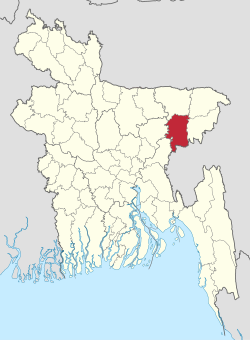 Location of Habiganj District in Bangladesh | |
 Expandable map of Habiganj District | |
| Country | |
| Division | Sylhet Division |
| Government | |
| • Deputy Commissioner | Muhammad Qamrul Hasan[1] |
| Area | |
| • Total | 2,636.59 km2 (1,017.99 sq mi) |
| Demonym(s) | Habiganji |
| Time zone | UTC+06:00 (BST) |
| Postal code | 3330-3374 |
| HDI (2019) | 0.573[2] medium · 20th of 20 |
| Website | www |

Habiganj (Bengali: হবিগঞ্জ, romanized: Hobigonj), formerly known as Habibganj (Bengali: হবিবগঞ্জ, romanized: Hobibgonj), is a district in north-eastern Bangladesh, located in the Sylhet Division. It was established as a district in 1984 as a successor to its subdivision status since 1867. It is named after its headquarters, the town of Habiganj.
History[]
Ancient[]
Prehistoric settlements were said to have been discovered in the Chaklapunji tea garden, near Chandirmazar of Chunarughat. Habiganj has also revealed a significant number of prehistoric tools from the bed of Balu Stream, a small ephemeral stream (water remains here only for a few hours after rainfall). Angularity and freshness of the fossil wood artifacts suggest that they did not come from a great distance and probably came from nearby hillocks. Typologically, technologically, and morphometrically, the artifacts are more or less the same as those found in the Lalmai, Comilla. The fossil wood assemblages of both of these areas are often classified into two groups: pre-neolithic assemblages without polished tools (hand axes, cleavers, scrapers, chopping tools, points etc.) and neolithic assemblages (hand axes, polished Celts, awls etc.).
The Hindu epic known as the Mahabharata mentions the marriage of Duryodhana of the Kauravas into a family that are thought to be inhabitants of present-day Habiganj.[3]
Early medieval[]


In medieval times, there were numerous petty kingdoms that were situated in what is now Habiganj District such as Azmardan, Baniachang and Tungachal. In 1254, the Governor of Bengal Malik Ikhtiyaruddin Iuzbak invaded the Azmardan Raj. He defeated the local Raja, and plundered his wealth.[4]
A feudal kingdom by the name of Tungachal was given to Epivishnu by Raja Upananda of Brahmachal in the 11th century. It was based in Rajapur in southern Habiganj. Following the murder of Upananda by the Gour Kingdom loyalists, Epivishnu refused to acknowledge Tungachal as a part of Gour. This led to a battle in 1258 on the banks of Ghungi Jurir Haor in Tungachal in which Epivishnu was murdered and Shandul was subsequently appointed as Tungachal's governor by Raja Govardhan of Gour. In response to Epivishnu's murder, the King of Tripura managed to annex Tungachal away from Gour and appointed Bhadra Janardan, Epivishnu's minister, to govern Tungachal. Janardan was deposed during the reign of Govinda of Gour and replaced by Achak Narayan.[5]
Following the Conquest of Sylhet in 1303, Syed Nasiruddin led a contingent of 12 leaders to capture Tungachal in 1304. Nasiruddin was the military commander of Shamsuddin Firuz Shah, the Sultan of Lakhnauti (in western Bengal). After the successful capture and defeat of Achak Narayan, Tungachal was renamed to Taraf and incorporated into Bangalah (Bengal). Taraf was transformed to an esteemed centre of study in the subcontinent.[6]
Late medieval[]
Between the thirteenth and early seventeenth centuries, parts of Habiganj were a part of the state of Nasirabad, based in Mymensingh.[7][8]
Syed Musa became the zamindar of Taraf in the 16th century. During his office, the King of Tripura Amar Manikya called upon the Baro-Bhuiyans to contribute labourers to aid in the digging of a reservoir tank. Musa refused to accept such subordination to the Twipra Kingdom. As a result, the emerged in 1581 leading to the imprisonment of Musa and his son Syed Adam Bairam.
By the middle of the 15th century, when all the divisions of Laur were united under the headship of Baniachang House (now of Muslim faith), it seems the Muslim area of Taraf passed under the control of Baniachung, which now became very powerful to include in its territory, the whole of present Sunamganj and Habiganj subdivisions. A town by the name of Habibganj was founded by Syed Habib Ullah who belonged to the Syed zamindar dynasty of Taraf. The word was later corrupted to Habiganj.
In Baniachang a battle occurred between the Baro-Bhuiyan zamindars of Baniachang (Anwar Khan and Husayn Khan) with the Mughal army in the 17th century, which can be found in the Bahrastan-i-Gayebi. Khwaja Usman fled Bukai Nagar Fort and established a shelter at Putijuri on the foot of the Giripal. He also established a fort at Putijuri, which was extremely important for defense. The Mughal army took the advantage when Khwaja Osman's brother was absent from the fort, leading to the successful annexation of Baniachang and Taraf into Mughal Bengal.[citation needed]
Modern[]
During the British Raj, Habiganj was established as a Thana (police precinct) in 1790, under Dhaka district (1779–1793).
In the second session of the Congress held in Calcutta in 1886, the Indian National Congress was able to attract representatives from Habiganj District.[citation needed] Until 1896, Habiganj's administrative centre was in Court Andar, Laskarpur. On 12 September 1874 it came under Sylhet district (part of Assam). Habiganj was declared as subdivision in 1867. On 7 April 1893, according to Notification #273 of Assam Provincial Government, Habiganj Thana (Administrative unit) was established. Habiganj was rejoined with East-Bengal (now Bangladesh) in 1911. Then the Office of the Circle Officer (Development) was established in 1960.
Habiganj is the historical place where the Mukti Bahini started their first guerrilla movement against oppression of Pakistani Army.[citation needed] On 4 April 1971, during Bangladesh Liberation War the senior army officers assembled at the headquarters of 2nd East Bengal at Teliapara, a semi hilly area covered by tea gardens where General MAG Osmani, Lieutenant Colonel Abdur Rob, Lieutenant Colonel Salahuddin Mohammad Reja, Major Kazi Nuruzzaman, Major Khaled Mosharraf, Major Nurul Islam, Major Shafat Jamil, Major Mainul Hossain Chowdhury, and others were present.[citation needed]
At this meeting four senior commanders were entrusted with the responsibility of operational areas. Sylhet-Brahmanbaria area was placed under the command of Major Shafiullah, Comilla-Noakhali area was given to Major Khaled Mosharraf while Chittagong-Chittagong Hill Tracts was given to Major Ziaur Rahman and Kushtia-Jessore area was placed under command of Major Abu Osman Chowdhury. In the meeting the organization concept of the freedom fighter forces and the command structure were chalked out under the command of General MAG Osmani.[9]
During the War of Liberation in 1971 an 18 hours direct encounter between the freedom-fighters and the Pakistani-army was held on 16 November 1971, in which freedom-fighter Jagatyoti and 11 villagers were killed by the Pakistani-army.[10][self-published source?]
On 1 March 1984 Habiganj was established as a District.[11] Md. Kamrul Hasan is the Deputy Commissioner.[12]
Demography[]
As per district administration report[13] the total population is 2,089,001 of 926,531 male and 904,022 female (50.6% male and 49.4% female). Category by religion 80.23% Muslim, 19.12% Hindu, 0.05% Buddhist, 0.13% Christian and 0.47% others. Life Expectancy: 56 years both male and female. Age Breakdown: 42% (under 15); 26% (15-29); 16% (30-44); 9% (45-59); 5% (60 and 60+); and 2% (not known). Birth Rate: 33.0 per 1,000. Death Rate: 11.4 per 1,000. Population growth rate: 21.6 per 1,000. Infant Mortality Rate: 98.0 per 1,000 live births.
Over 98% of the population are Bengalis while the remainder are Biharis, Khasias, Meiteis and Tripuris. The Twipra people are the original inhabitants of the state of Tripura. The Royal family of the Debbarma ruled the state of Tripura for more than 2,000 years till the kingdom was joined with the India in 1949. During the reign of Maharaj Gharib Nawaz (1709–1748), Meiteis arrived here from their homeland Manipur. The Khasi people migrated to Habiganj from Meghalaya where they arrived some 500 years ago.[citation needed]
Upazila[]

At present Habiganj consists of 9 upazilas, 6 municipalities, 54 wards, 78 union parishads, 124 mahallas, 1241 mouzas and 2076 villages.[14] The upazilas are:
- Ajmiriganj
- Baniachang
- Bahubal
- Chunarughat
- Habiganj Sadar
- Lakhai
- Madhabpur
- Nabiganj
- Shaistaganj
Geography[]
Habiganj is located at 24°22′30″N 91°25′00″E / 24.3750°N 91.4167°E. Its area is 2,636.58 km2 and bounded by Sunamganj District to the north, Tripura of India and Maulvibazar District to the east, Balaganj Upazila of Sylhet to the north-east, Brahmanbaria and Kishoreganj districts to the west.[14]
 WikiMiniAtlas
This part of Bangladesh is characterized by alluvial plains which are dissected by various connecting rivers as well as streams, lakes; and it is vulnerable to both flood and drought. The land is devoted mainly to agriculture due to its fertile alluvial soils.
Land[]
Cultivated agricultural land: 1,54,953 hectare (60.22% of the total agricultural land). Forestland 95 11,644 hectare (4.53% of the total land). For crops 51.6% single-crop, 38.7% double-crop and 9.7% triple-crop; fallow 521 hectares. Its rivers include Barak, Bheramahana, Gopala, Kalni, Kalishiri, Khowai, Korangi, Kushiara, Meghna River(lower), Ratna, Shwasanali, shutki, sonai, Korangi, Shutang, Tentulia, Jhingri, Bizna and Yojnal.
Economy[]
- Tea Gardens: 24 covering total area 15,703.24 hectare.
- Rubber gardens: 3 Rupaichhara-Bahubal (1981). Half of this garden is situated in Habiganj and the rests are in Shreemangal, total area 2,000 acres (8.1 km2). Shahjibazar-Chunarughat(1978) area 2,004 acres (8.11 km2), Shatgaon Rubber garden (1971) area 200 acres (0.81 km2).
Rashidpur gas field (1960), Bibiana gas field (1998) and Habiganj gas field (1963). The approximate stock of these gas fields is 5.5 Trillion Cubic Feet. Habiganj gas field lies in Madhabpur Upazila. This field was also discovered by Pakistan Shell Oil Company in 1963. The structure measures 12x5 square km with a vertical closure of 300 m which has a roughly sub-meridian axis tilted slightly eastward at the northern end. Total recoverable gas reserve of this field re-estimated by Hydrocarbon Unit is 3,852.30 billion cubic feet (1.09085×10¹¹ m3). Commercial gas production from this field was commenced in 1968 and till 31 August 2006 total 1,364.474 billion cubic feet (3.86376×10¹⁰ m3) or 35.42 percent of reserves has been recovered.
Education[]
There are total 16 Colleges of which 1 (Honors) College, 3 Government colleges, 1 Polytechnic institute; 13 (further education) Colleges, 6 (government) and 99 (non-government) High Schools; 14 Junior Schools; 732 (government) and 711 (non-government) Primary Schools; 96 Madrasah; and 6 Satellite (temporary) Schools in this district.[13]
Literature and culture[]
Habigang is famous for folk Literature: Mahuya Sundari and Dhupar Path.
Local newspapers: Daily Habiganj Express, Daily Pravakar, Pratidener Bani, weekly Swadhikar, Swadeshbarta, Drishtikon, Daily Khowai, Habiganj Samachar, Janatar Dalil, Parikrama, fortnightly Prayas, The Daily Habiganjer Ayna and Mritika.
Defunct local newspapers: monthly Moitri (1909), weekly Projapati (1909), Sree Sree Sonar Gauranga (1329 BS), Palli Bani (1940), weekly Shahid (1948), weekly Jagaran (1955), monthly Avijatrik (1966).
Sports[]
The is the largest stadium in Habiganj. The 25,000-capacity venue is used for cricket and football.
Notable people[]
- Swami Santadas Kathiababa Maharaj - the first Nimbarka Sampradaya Mahanta of Bengal.
- Tara Kishore Chowdhury was the first Graduate of Habiganj district passed B.A and was a judge of Calcutta High Court.
- Dayananda Dev was a devotee and guru of Hinduism.
- Sirajul Hossain Khan, Former Minister (1985-1990), MP, Journalist and former general secretary, east Pakistan journalist union, leftist politician.
- Bipin Chandra Pal, nationalist leader
- Major General Mohammad Abdur Rab (Bir Uttam), Chief of Staff of Liberation Forces
- Shah Kibria, Former Finance Minister of Bangladesh, d. 2005
- Dewan Farid Gazi, Veteran politician (Awami League) and freedom fighter/activist, Former Minister of Bangladesh
- Major General Chitta Ranjan Dutta- Bir Uttam
- Jagat Joity Das - Bir Bikrom
- Enamul Haque Mostafa Shahid, Veteran politician (Awami League) and freedom fighter/activist, Former Social Welfare Minister of Bangladesh, d. 2016
- Mukhlesur Rahman Chowdhury, former advisor to the President of Bangladesh and minister
- Hemango Biswas, Nationalist Leader, poet and singer
- Syed A. B. Mahmud Hossain, Chief Justice of Bangladesh
- Justice Syed Husain, Chief Justice (since 27 January 2004)
Archaeological heritage[]

- Ancient Rajbari (1737–38) at Puranbagh, Baniachang
- Bagala Matar Mandir, Habiganj
- Baniachong village (the biggest village in Asia)
- Bibir Dargah Mosque, Baniachang
- Bithangal Akhra, Baniachang
- Dorga-tila, Mira-tila and Tangee-tila, Nabiganj
- Foltoli-tila and water fountain, Nabiganj
- Jami Mosque, Bahubal
- Kalibari, Habiganj Sadar
- Kuri-tila, Black-stone and an Ancient Rajbari, Dinarpur, Nabiganj
- Mashulia Akhra, Habiganj Sadar
- Shankarpasha Shahi Masjid
- Murarband Dargah Sharif, Chunarughat
- Hujra Khana of Syed Nasir Uddin, Murarbandar Dargah Sharif, Chunarughat.[15]
- Putijuri Jami Mosque, Bahubal
- Ramakrishna Ashram, Habiganj Sadar
- Rashidpur Tea Garden, Bahubal Upazila
- Shagor Dighi, Baniachong
- Shajeerbazar, Chunarughat
- Sham-baoul Akhra and Doulotpur Akhra, Baniachang
- War of Liberation Mass Grave, Nabiganj
- War of Liberation Memorial Monument, Nabiganj
See also[]
- Taraf Kingdom
- Districts of Bangladesh
References[]
| Wikimedia Commons has media related to Habiganj District. |
- ^ pmis.mopa.gov.bd/pmis/Forms/dclist.php
- ^ "Sub-national HDI - Area Database - Global Data Lab". hdi.globaldatalab.org. Retrieved 2020-03-18.
- ^ Chowdhury, Iftekhar Ahmed (7 September 2018). "Sylhetis, Assamese, 'Bongal Kheda', and the rolling thunder in the east". The Daily Star. Retrieved 2 January 2019.
- ^ Stewart, Charles (1813). The History of Bengal. London.
- ^ Nath, Rajmohan (1948). The back-ground of Assamese culture. A. K. Nath. p. 118.
- ^ Syed Mustafa Kamal (Feb 2011). সিলেট বিভাগের ভৌগোলিক ঐতিহাসিক রুপরেখা (in Bengali). Sylhet: Shaykh Faruq Ahmad, Palash Seba Trust. p. 92.
- ^ Irani, Ayesha A. (5 December 2011). Sacred biography, translation, and conversion ; The Nabīvaṃśa of Saiyad Sultān and the making of Bengali Islam, 1600-present (PhD). University of Pennsylvania. Archived from the original on 2016-09-13. Retrieved 2016-09-03.
- ^ প্রাচীন তরফ রাজ্যের সংক্ষিপ্ত ইতিবৃত্ত. Daily Sylheter Songbad (in Bengali). 17 November 2015.
- ^ "Attack on Kalachara". Victory Day Special. The Daily Star. Archived from the original on 2009-11-16. Retrieved 2009-11-16.
- ^ "History of Habiganj". My Habiganj. Archived from the original on 2009-12-14. Retrieved 2009-11-15.
- ^ এক নজরে হবিগঞ্জ [Habiganj at a glance]. Habiganj District (in Bengali). Bangladesh National Portal.
- ^ জেলা প্রশাসকের প্রোফাইল [DC Profile]. Habiganj District (in Bengali). Bangladesh National Portal.
- ^ Jump up to: a b [1][dead link]
- ^ Jump up to: a b Jayanta Sing Roy (2012). "Habiganj District". In Islam, Sirajul; Miah, Sajahan; Khanam, Mahfuza; Ahmed, Sabbir (eds.). Banglapedia: the National Encyclopedia of Bangladesh (Online ed.). Dhaka, Bangladesh: Banglapedia Trust, Asiatic Society of Bangladesh. ISBN 984-32-0576-6. OCLC 52727562. Retrieved 9 September 2021.
- ^ মুড়ারবন্দ তরফ রাজ্যের প্রথম রাজধানী ও সৈয়দ বংশের উৎসস্থল. Shaistaganj.com. Retrieved 2016-11-08.

| show Authority control |
|---|
- Habiganj District
- Districts of Bangladesh