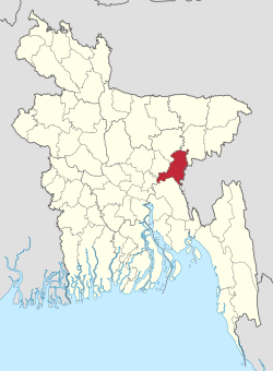
Brahmanbaria District
Brahmanbaria
ব্রাহ্মণবাড়িয়া | |
|---|---|
 | |
| Nickname(s): Baunbaira | |
 Expandable map of Brahmanbaria District | |
| Coordinates: 23°59′N 91°07′E / 23.983°N 91.117°ECoordinates: 23°59′N 91°07′E / 23.983°N 91.117°E | |
| Country | |
| Division | Chittagong Division |
| Capital | Brahmanbaria |
| Government | |
| • Deputy Commissioner | Hayat-ud-Dowllah Khan |
| Area | |
| • Total | 1,927.11 km2 (744.06 sq mi) |
| Population (2011 census)[1] | |
| • Total | 2,840,498 |
| • Density | 1,500/km2 (3,800/sq mi) |
| Demonym(s) | Brahmanbarian |
| Time zone | UTC+06:00 (BST) |
| Postal code | 3400 |
| HDI (2018) | 0.614[2] medium · 7th of 21 |
| Website | www |

Brahmanbaria (Bengali: ব্রাহ্মণবাড়িয়া, romanized: Brahmôṇbaṛiya) is a district in eastern Bangladesh located in the Chittagong Division. Geographically, it is mostly farmland and is topographically part of the Gangetic Plain. It is bounded by the districts of Kishoreganj and Habiganj to the north, Narsingdi District and Narayanganj to the west, Comilla to the south, and the Indian state of Tripura to its east.
History[]

Brahmanbaria was a part of Samatata region of the ancient Bengal.[3] The historic name of Brahmanbaria was Rang (রং). During the Sena period of Bengal, King Ballala Sena invited a Brahmin family to come and live in Rang as there was a deficiency of Hindu priests. In the 14th century, a Qadi by the name of Syed Mahmud came to Rang to propagate the religion of Islam to its inhabitants. The Brahman family willingly accepted Islam. They decided gave up their position as the Priests of Rang, and migrated to Nabinagar to start a new life. Rang was named as Brahmanbaria (lit. Brahmins leaving in the local dialect of the district) after this incident.[4] The area Mahmud resided in was named Kazipara (Kazi being a variant of Qadi) after him, and his mazar (mausoleum) remains there.[5]
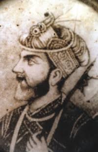
The leader of the Baro-Bhuiyan zamindars, Isa Khan, had his first and temporary capital situated in Sarail.[6] During the Mughal era, Brahmanbaria was famous for producing quality cloth muslin.[7][8]
Brahmanbaria was made one of the three subdivisions of Comilla District by the British colonialists in 1790.[9] The Brahmanbaria Municipality was established in 1868. During the 19th century, Brahmanbaria produced great nationalist leaders like Nawab Syed Shamsul Huda, who became president of the All India Muslim League in 1921 and Barrister Abdur Rasul, a front ranking leader of Indian National Congress.[10] When the Swadeshi movement began in the wake of the 1905 Partition of Bengal, Brahmanbaria-born revolutionary Ullaskar Datta Aviram was convicted for throwing bomb explosion and was deported to the Andamans. It became part of East Pakistan in 1947. Upon encouragement of Oli Ahad, a Brahmanbarian Bengali Language Movement leader, the movement obtained momentum in this district in 1952.[11][12]
During the Bangladesh Liberation War in 1971, Mohammad Mostafa Kamal faced a heroic death in an encounter with the Pakistani army at Daruin in Akhaura.[13] One of the most distinguished Brahmanbarian military generals Shakil Ahmed was murdered in the Bangladesh Rifles revolt in 2009.[14][15] In 2015, a pot of 200-year-old coins was found in the district's Akhaura Upazila. There were nearly 500 coins at the Temple of Durga in Mogra Union and contained images of British queen Elizabeth I and were from 1804, 1814 and 1836. According to the police, the coins were handed over to the Department of Archaeology.[16]
Administration and demographics[]


Brahmanbaria District, previously a subdivision of Comilla district (formerly Tippera district till 1960), was established in 1984. The district has 4 municipalities, 39 wards, 97 mahallas, 9 upazilas, 98 union parishads, 1081 moussakas and 1329 villages.
According to the 2011 Bangladesh census, Brahmanbaria District had 538,937 households and a population of 2,840,498.[1]
The administrative seat and largest city is Brahmanbaria. The towns of Akhaura and Ashuganj also rank in the top three of the district.
Upazilas[]
Brahmanbaria district is divided into nine upazilas (subdistricts) as below:
- Brahmanbaria Sadar Upazila
- Kasba Upazila
- Akhaura Upazila
- Ashuganj Upazila
- Bancharampur Upazila
- Bijoynagar Upazila
- Nasirnagar Upazila
- Nabinagar Upazila
- Sarail Upazila
Parliamentary constituencies[]
There are six Jatiyo Shangshad constituencies in the district. These constituencies and the current Members of Parliament are:[17]
- National seat no 243 Brahmanbaria-1 (Current MP, Bodruddoza Md. Farhad Hossain)
- National seat no 244 Brahmanbaria-2 (Current MP, Advocate Abdus Sattar Bhuiyan)
- National seat no 245 Brahmanbaria-3 (Current MP, R. A. M. Obaidul Muktadir Chowdhury)
- National seat no 246 Brahmanbaria-4 (Current MP, Anisul Huq, Minister of Law)
- National seat no 247 Brahmanbaria-5 (Current MP, Mohammad Ebadul Karim Bulbul)
- National seat no 248 Brahmanbaria-6 (Current MP, AB Tajul Islam)
District Magistrates[]
Deputy Commissioner (DC), or District Magistrate, is the chief administrative and revenue officer of Brahmanbaria District. The following is a list of those that held this office:

Economy[]

Brahmanbaria is one of the fastest growing districts in the country. The major industries of Brahmanbaria District have been: agriculture, fishing, power and electricity, and natural gas. 30% of its population is below the poverty threshold.[18] It has a labour force of 1,800,000 that are skilled in agricultural, industrial, and service sectors. As of 2010, it had an unemployment rate of 3.8%.
Power and gas[]

Brahmanbaria's Titas gas is the largest gas field of Bangladesh. It supplies natural gas to Dhaka and most other parts of the nation. Currently the government is drilling new wells.[19]
In some other parts of Brahmanbaria, gas was found. It resulted in an abrupt fall in the price of gas.[20] Many parts of the country people are using gas in many illegal ways. Now the government is trying to solve that issue.[21]
Transport[]

This district has the largest railway junction in the country at Akhaura.[22] It connects to Kulaura and Chhatak with the Akhaura–Kulaura–Chhatak line, to Laksam and Chittagong with the Akhaura–Laksam–Chittagong line, and to Tongi and Bhairab with the Tongi–Bhairab–Akhaura line. There are about ten railway stations in the district. Recently the government of India shipped machines of the Palatana project from Kolkata to Agartala by using the Ashuganj river port on Meghna in Brahmanbaria district.[23] Rail networks linking it to other parts of the country include the Parabat Express and Kalni Express. Brahmanbaria connects with the Asian Highway Network through the N2 highway and there is also the prominent N102 highway. To connect with India, government of both Bangladesh and India is building 15 km railway from Akhaura to Agartala.[24]
Prime Minister of Bangladesh Sheikh Hasina gave the Government of India permission to use the Port of Ashuganj.[25] In addition, Akhaura Station will be connected to Agartala.[26]
Tourism[]
Brahmanbaria has a number of tourist attractions and sites dating back many centuries. The Kharampur Mazar Sharif is a mausoleum complex located in Akhaura which attracts hundreds of visitors. It contains the tomb of Syed Ahmad Gesudaraz, a 14th-century Islamic preacher who took part in the Conquest of Sylhet before settling in Kharampur where he was martyred. During the dewani of Shahbaz Khan in 1650, the Hatirpul was constructed. It was a bridge built over the canal mainly for elephant pass. The Mughal dewans used to communicate by the elephant in this road and also took rest near this bridge. In 1662, the Arifil Mosque was constructed by Shah Arif in Sarail. There are unknown tombs located near the mosque, supposedly the wives of Isa Khan. The 18th century Haripur Barabari was a residential palace located in Nasirnagar and many movies have been filmed there. The India-Bangladesh Border Haat located in Kasba is a weekly marketplace and allows communication with the people of the neighbouring country. Sports fans assemble at the Niaz Mohammad Stadium which was constructed in 1934.
Criticism[]
In 2015, Brahmanbaria faced problems of road blocks due to political agitation.[27] The situation did not last very long before being resolved. This region also faced with clashing between two groups. In 2015 a man was killed for facing problems between two groups.[28] Former Chief Justice of Bangladesh, Surendra Kumar Sinha had said while he was delivering his speech in Brahmanbaria that smuggling was hurting the national the economy.[29] Gold and dollar are going out of the country, he said.
Notables[]
References[]
- ^ Jump up to: a b "Population Census 2011: Brahmanbaria Table C-01" (PDF). Bangladesh Bureau of Statistics. Archived from the original (PDF) on 23 September 2015. Retrieved 11 July 2014.
- ^ "Sub-national HDI - Area Database - Global Data Lab". hdi.globaldatalab.org. Retrieved 2020-03-18.
- ^ Douglas A. Phillips; Charles F. Gritzner (2007). Bangladesh. Infobase Publishing. p. 32. ISBN 978-1-4381-0485-0.
- ^ ব্রাহ্মণবাড়িয়া সদর উপজেলার পটভূমি. Brahmanbaria Sadar Upazila (in Bengali).
- ^ কাজী মাহমুদ শাহ (রহ) মাজার. Brahmanbaria Sadar Upazila (in Bengali).
- ^ AA Sheikh Md Asrarul Hoque Chisti (2012). "Isa Khan". In Islam, Sirajul; Miah, Sajahan; Khanam, Mahfuza; Ahmed, Sabbir (eds.). Banglapedia: the National Encyclopedia of Bangladesh (Online ed.). Dhaka, Bangladesh: Banglapedia Trust, Asiatic Society of Bangladesh. ISBN 984-32-0576-6. OCLC 52727562. Retrieved 9 September 2021.
- ^ Eaton, Richard Maxwell (1996), The Rise of Islam and the Bengal Frontier, 1204–1760, University of California Press, p. 202, ISBN 978-0-520-20507-9
- ^ Abdul Karim (2012). "Muslin". In Islam, Sirajul; Miah, Sajahan; Khanam, Mahfuza; Ahmed, Sabbir (eds.). Banglapedia: the National Encyclopedia of Bangladesh (Online ed.). Dhaka, Bangladesh: Banglapedia Trust, Asiatic Society of Bangladesh. ISBN 984-32-0576-6. OCLC 52727562. Retrieved 9 September 2021.
- ^ Siddiqi, Mamun (2012). "Comilla District". In Islam, Sirajul; Jamal, Ahmed A. (eds.). Banglapedia: National Encyclopedia of Bangladesh (Second ed.). Asiatic Society of Bangladesh.
- ^ "Nasirnagar Upazilla". Bangladesh National Portal.
- ^ "Language warrior Oli Ahad dead". bdnews24. Retrieved 21 October 2012.
- ^ "Oli Ahad no more". The Daily Star. Dhaka, Bangladesh. 21 October 2012. p. 1. Retrieved 2012-10-21.
- ^ Chandan, Md Shahnawaz Khan. "A Hero's Tale". The Daily Star. Retrieved 18 June 2015.
- ^ "My friend . . . the scholar-soldier". The Business Standard (Opinion). 25 February 2020.
- ^ https://www.youtube.com/watch?v=c6hqtD9Iox8
- ^ "200-year-old coins recovered". Dhaka Tribune.
- ^ বাংলাদেশ (Bangladesh) জাতীয় তথ্য বাতায়ন - গণপ্রজাতন্ত্রী বাংলাদেশ সরকার - People's Republic of Bangladesh. bangladesh.gov.bd.
- ^ "Zila level povmap estimates, 2010" (PDF). Bangladesh Bureau of Statistics.[permanent dead link]
- ^ "Titas Starts New Well Drilling". Energy Bangla.
- ^ "Regulator to look into unusual fall in prices of Titas Gas stocks". The Daily Star.
- ^ "Titas struggles to remove illegal gas connections". Dhaka Tribune.
- ^ "AKA/Akhaura Junction Railway Station Map/Atlas". India Rail Info.
- ^ "Bangladesh to ink pact with India for 100MW power from Tripura". The Times of India.
- ^ "India, Bangladesh business set to grow through ports, waterways". The Economic Times.
- ^ Press Trust of India (3 May 2014). "B'desh agrees to allow India use waterways to Ashuganj port". Business Standard.
- ^ "Government approves Rs 1,000 crore for India-Bangladesh rail link". The Economic Times.
- ^ "CNG drivers block Brahmanbaria highways". Prothom Alo. 2 September 2015. Archived from the original on 17 January 2017. Retrieved 15 February 2018.
- ^ "Man killed in Brahmanbaria clash". Dhaka Tribune.
- ^ "Smuggling hurting economy: SK Sinha". The Daily Star.
External links[]
| Wikimedia Commons has media related to Brahmanbaria District. |
| Wikivoyage has a travel guide for Brahmanbaria District. |
| show Destinations from Brahmanbaria District |
|---|

| show Authority control |
|---|
- Brahmanbaria District
- Districts of Chittagong Division
- Districts of Bangladesh