Brahmanbaria
This article needs additional citations for verification. (May 2019) |
Brahmanbaria
ব্রাহ্মণবাড়িয়া (Brahmanbaria) | |
|---|---|
District Capital | |
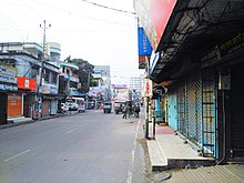
 Brahmanbaria city. | |
| Nickname(s): Baunbaira | |
 Brahmanbaria Location in Brahmanbaria | |
| Coordinates: 23°57′56″N 91°06′29″E / 23.965593°N 91.107997°ECoordinates: 23°57′56″N 91°06′29″E / 23.965593°N 91.107997°E | |
| Country | Bangladesh |
| Division | Chittagong Division |
| District | Brahmanbaria District |
| Establishment | Late 1700 CE |
| Municipality | 1769 |
| Administrative District | 1984 |
| Government | |
| • Type | Pourashava |
| • City Mayor | Nayar Kabir |
| Area | |
| • Total | 27 km2 (10.4 sq mi) |
| Elevation | 15 m (49.2 ft) |
| Population (2015)[4] | |
| • Total | 268,279 |
| • Density | 10,000/km2 (26,000/sq mi) |
| Demonym(s) | Brahmanbarian |
| Time zone | UTC+6 (BST) |
| Postal code | 3400[5] |
| National Calling Code | +880 |
| Local Calling Code | +88-0851 |

Brahmanbaria[6] (Bengali: ব্রাহ্মণবাড়িয়া, romanized: Brāhmaṇabāṛiẏā)[7] is a city of Bangladesh and the capital of Brahmanbaria Sadar Upazila as well as Brahmanbaria District. It is the second largest city after Cumilla in eastern Bangladesh[8] and one of the oldest municipalities in Bangladesh, established in 1769. Brahmanbaria was declared a district headquarters in 1984. Its municipality area has a population of 2,70,000 in 2020. It is the 17th largest city in Bangladesh.
History[]

During the Indo-Pakistan War of 1971 for the liberation of Bangladesh, when Pakistan Army planners predicted India would launch its main attack in the east along the Akhaura–Brahmanbaria axis, it had no brigades available to cover this area, and Pakistan Army moved its 27th brigade from Mymensingh to Akhaura after retaining two battalions of 27th brigade at Mymensingh to form the 93rd Brigade to defend Mymensingh.[9] Pakistan Army's 93,000 troops unconditionally surrendered to the Indian Army and India's local ally Mukti Bahini on 16 December 1971.[10] This day and event is commemorated as the Bijoy Dibos (Bengali: বিজয় দিবস) in Bangladesh and Vijay Diwas in India.[11][12]
Administration[]
Brahmanbaria was given city status in 1984. The city boundaries contain Sadar Municipality, 12 Wards, 78 Mahallas, and 36 villages.[13]
Geography and climate[]

Brahmanbaria is located in the East-Central region of Bangladesh. Its nearby cities are Dhaka, Cumilla, Narayanganj and Agartala. This city is in the bank of Titas River. Also there is Meghna River in the west of Brahmanbaria.[14][better source needed]
Brahmanbaria has a tropical wet and dry climate.
| Climate data for Brahmanbaria | |||||||||||||
|---|---|---|---|---|---|---|---|---|---|---|---|---|---|
| Month | Jan | Feb | Mar | Apr | May | Jun | Jul | Aug | Sep | Oct | Nov | Dec | Year |
| Average high °C (°F) | 25 (77) |
28 (82) |
32 (90) |
33 (91) |
33 (91) |
32 (90) |
32 (90) |
32 (90) |
32 (90) |
31 (88) |
29 (84) |
27 (81) |
31 (87) |
| Daily mean °C (°F) | 18 (64) |
22 (72) |
26 (79) |
28 (82) |
28 (82) |
29 (84) |
29 (84) |
29 (84) |
28 (82) |
27 (81) |
22 (72) |
22 (72) |
25 (77) |
| Average low °C (°F) | 10 (50) |
14 (57) |
19 (66) |
22 (72) |
23 (73) |
25 (77) |
25 (77) |
25 (77) |
24 (75) |
23 (73) |
17 (63) |
17 (63) |
20 (69) |
| Average precipitation mm (inches) | 14.4 (0.57) |
39.8 (1.57) |
72.8 (2.87) |
168.2 (6.62) |
315.4 (12.42) |
344.9 (13.58) |
367.9 (14.48) |
247.5 (9.74) |
197.6 (7.78) |
148.5 (5.85) |
30.4 (1.20) |
8.9 (0.35) |
1,956.3 (77.03) |
| Average precipitation days (≥ 0.1 mm) | 4 | 5 | 7 | 12 | 19 | 23 | 28 | 26 | 22 | 13 | 3 | 1 | 163 |
| Source: Worldweatheronline[15] | |||||||||||||
Notable residents[]
Brahmanbaria also produced actresses like Zakia Bari Momo, who won LUX Channel I Superstar, Tasnova Hoque Elvin. Alamgir is evergreen actor of Cinema of Bangladesh. He start working in mid '80s and he is still an actor.[16] Brahmanbaria has other people like Al Mahmud, Cricketer Mohammad Ashraful, Abdul Kadir and Syed Shamsul Haque who are poets. Nawaab Syed Shamsul Huda was a leader of the Muslim League. Ali Azam (politician) was a leader of Awami League. Shakil Ahmed was the director general of border guards, who had heavily secured the borders of Bangladesh.
Gallery[]

See also[]
- Economy of Brahmanbaria
- List of colleges and universities in Brahmanbaria
- Tourism in Brahmanbaria
- Chhanamukhi
Destinations[]
Destinations from Brahmanbaria City | ||||||||||||||||
|---|---|---|---|---|---|---|---|---|---|---|---|---|---|---|---|---|
| ||||||||||||||||
References[]
- ^ "Area, Population and Literacy Rate by Paurashava −2001" (PDF). Bangladesh Bureau of Statistics. Archived from the original (PDF) on 27 March 2005. Retrieved 18 September 2009.
- ^ "ব্রাহ্মণবাড়িয়া সদর উপজেলা".
- ^ "Bangladesh Elevation and Elevation Maps of Cities, Topographic Map Contour".
- ^ "ব্রাহ্মণবাড়িয়া সদর উপজেলা".
- ^ www.geopostcodes.com. "ZIP Code database of Bangladesh". Geopostcodes.com. Retrieved 11 June 2008.
- ^ "Wikivoyage". Map Data OpenStreetMap. Retrieved 11 July 2011.
- ^ "Government Official Name". Local government in Bangladesh. Archived from the original on 12 June 2018. Retrieved 17 December 2014.
- ^ "NGA GeoNames Database". National Geospatial-Intelligence Agency. Retrieved 14 July 2008.
- ^ Salik, Siddiq, Witness to Surrender, pp126
- ^ Team, Editorial (17 December 2017). "Why Do India Celebrate 'Vijay Diwas' On 16th December". SSBToSuccess. Retrieved 18 December 2017.
- ^ "About us". Liberation War Museum. Archived from the original on 8 November 2011. Retrieved 21 November 2011.
- ^ Team, Editorial (17 December 2017). "Why Do India Celebrate 'Vijay Diwas' On 16th December". SSBToSuccess. Retrieved 18 December 2017.
- ^ "National Web Portal of Bangladesh". Bangladesh National Web Portal. Archived from the original on 2 April 2014. Retrieved 17 December 2014.
- ^ Bangladesh Compendium of Environment Statistics. Bangladesh Bureau of Statistics, Statistics Division, Ministry of Planning, Government of the People's Republic of Bangladesh. 2009.
- ^ "Brahmanbaria, Bangladesh Travel Weather Averages (Worldweather)". Worldweatheronline. Retrieved 3 October 2015.
- ^ "Alamgir | Film Star | Online Dhaka Guide ( অনলাইন ঢাকা গাইড) - an Information Guide for Dhaka City".
External links[]

Largest cities or towns in Bangladesh "National Volume-3: Urban Area Report" (PDF), Population and Housing Census 2011, Bangladesh Bureau of Statistics, pp. 24–25, August 2014 | |||||||||||||||||||||||||||||||||||||||||||||||||
|---|---|---|---|---|---|---|---|---|---|---|---|---|---|---|---|---|---|---|---|---|---|---|---|---|---|---|---|---|---|---|---|---|---|---|---|---|---|---|---|---|---|---|---|---|---|---|---|---|---|
| |||||||||||||||||||||||||||||||||||||||||||||||||


- Populated places in Chittagong Division
- Cities in Bangladesh
- Brahmanbaria