Chuadanga District
Chuadanga
চুয়াডাঙ্গা | |
|---|---|
| Chuadanga District | |
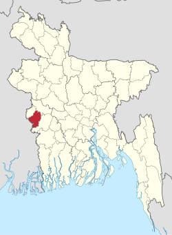 Location of Chuadanga District in Bangladesh | |
 Expandable map of Chuadanga District | |
| Coordinates: 23°36′N 88°42′E / 23.60°N 88.70°ECoordinates: 23°36′N 88°42′E / 23.60°N 88.70°E | |
| Country | |
| Division | Khulna Division |
| Government | |
| • Deputy Commissioner | Md. Nazrul Islam Sarkar |
| Area | |
| • Total | 1,174.10 km2 (453.32 sq mi) |
| Population (2011 census) | |
| • Total | 1,129,015 |
| • Density | 960/km2 (2,500/sq mi) |
| Time zone | UTC+06:00 (BST) |
| HDI (2019) | 0.644[1] medium · 5th of 20 |
| Website | www |

Chuadanga (Bengali: চুয়াডাঙ্গা, romanized: tʃuaɖaŋga), is a district of the western Khulna Division of Bangladesh. This was the first capital of Bangladesh (10 April 1971).
History[]
Chuadanga witnessed a number of uprisings during the British rule of India. The uprisings included Wahabi Movement (1831), Faraizi Movement(1838–47), Sepoy Rebellion (1857), Indigo Rebellion (1859–60), Khilafat Movement (1920), Swadeshi Movement (1906), Non-cooperation movement, Violation of Law and Salt Satyagraha (1920–40), and Quit India Movement or August Revolt (1942).[2]
Under British rule, Chuadanga was a sub-division within Nadia District. During partition, in 1947, excepting Krishnanagar thana (still under Nadia in West Bengal). History of Chuadanga can be found in Nadia District Gazetteer during British rule.[3] During Bangladesh Liberation War of 1971 Chuadanga was declared as the first capital of Bangladesh on 10 April. Chuadanga was the location of more than 100 battles between the Pakistan Army and the pro-independence Mukti Bahini.[2] There is a mass graveyard of the victims of the Bangladesh genocide during the Bangladesh Liberation war behind the Chuadanga Government Hospital.[2]
Geography[]
Chuadanga district has an area of 1,157.42 km2. It shares domestic borders with the Kushtia District on the northeast, Meherpur on the northwest,[4] and Jhenaidah on the south and southeast. On its southwest lies the Nadia District (in the state of West Bengal in India).[2] In January 2018, the district had the lowest temperature in Bangladesh.[5]

Administration[]
Until the Partition of India in 1947 Chuadanga sub-division was within Nadia district.
Administrator of Zila Porishod: Major (Rtd.) Alimuzzaman Zoarder[6]
Deputy Commissioner (DC): Gopal Chandra Das[7]
Subdivisions[]
Chuadanga district is divided into five Upazilas.
Demographics[]
According to 2011 Bangladesh census, Chuadanga District had a population of 1,129,015. Males constituted 50.03% of the population and females 49.97%. Muslims formed 97.459% of the population, Hindus 2.348%, Christians 0.141% and others 0.051%. Chuadanga District had a literacy rate of 44.15% for the population 7 years and above.[9]
The population of the district was 987,382 during the 2001 national survey with 50.82% male and female 49.18% compositions.[2]
Education[]
Notable educational institutions according to Banglapedia include the Victoria Jubilee Government High School (est. 1880), Titudaha Secondary School(est. 1994)Damurhuda Pilot High School (1913), Chuadanga Government Girls' High School (1914),
Alamdanga Pilot High School (1914), Natudaôho High School (1906), Carew's High School (1947), Gokulkhali High School (1947), Sarojgonj High School (1948), Jibonnôgor Pilot High School (1957), Chuadanga Government College (1962), SSV High School (Dingadha, 1968) and Hajar Duari School.Nilmoniganj High School(1967)[2]
A private university named First Capital University of Bangladesh, Chuadanga was established in 2012 and Primary Training Institute at Alamdanga Road, Chuadanga-7200.[10]
Economy[]
Most of this small district is dedicated to agriculture. Occupational distributions clearly show this with agriculture employing 68% of the labour force, while only 12% are involved in commerce. Total cultivable land amounts to 894.20 km2, of which 57% is under some sort of irrigation.[2] Cotton is a cash crop grown in the district and in 2013, cotton was cultivated in 4149 hectares.[11]

Besides agriculture the district is now experiencing industrial growth. Major industries include Zaman Group of Industries, Bangas bread and biscuit, Tallu Spinning mills Ltd, Khatun Plastic Limited (KPL), and Carew & Company Bangladesh Limited. Carew & Co (Bangladesh) Ltd(1933), which is situated at Darshana of Damurhuda Upazila of Chuadanga district. Sugar cane is cultivated in Darshana.[12] Carew & Company has a distillery also which is the lone spirit producing plant of Bangladesh, Carew & Company Bangladesh Limited is an enterprise of Bangladesh Sugar & Food Industries Corporation (BSFIC). BSFIC is an autonomous body of Ministry of Industries.[13][14]
Transportation[]
Chuadanga is connected to four of its neighbouring districts (Kushtia, Jessore, Jhenidah and Meherpur) through inter-district highways and connected to Jessore and Kushtia by railway. The district is connected to the rest of the country by three highways and a railway. There are 203 km of finished road, 211 km herring-bone and 132 km mud road. A total length of railway tracks of just over 50 km connects the three railway stations inside the district with the country's railway network. By 2013, five out of the ten stations in the district were shut down due to a lack of manpower. Some stations were turned into markets by Bangladesh Jubo League men.[15]
See also[]
References[]
- ^ "Sub-national HDI - Area Database - Global Data Lab". hdi.globaldatalab.org. Retrieved 18 March 2020.
- ^ Jump up to: a b c d e f g Ahmed, Rajib (2012). "Chuadanga District". In Islam, Sirajul; Jamal, Ahmed A. (eds.). Banglapedia: National Encyclopedia of Bangladesh (Second ed.). Asiatic Society of Bangladesh.
- ^ Nadia District Gazetteer.
- ^ "Meherpur women becoming solvent by rearing black Bengal goats | Dhaka Tribune". www.dhakatribune.com. Retrieved 13 March 2018.
- ^ "Mercury may dip further". The Daily Star. 6 January 2018. Retrieved 13 March 2018.
- ^ "AL men appointed administrators". The Daily Star. 16 December 2011. Retrieved 13 March 2018.
- ^ "20 districts get new DCs". The Daily Star. UNB. 11 June 2015.
- ^ https://bangla.bdnews24.com/bangladesh/article1679354.bdnews
- ^ "Bangladesh Population and Housing Census 2011: Zila Report – Chuadanga" (PDF). Table P01 : Household and Population by Sex and Residence, Table P05 : Population by Religion, Age group and Residence, Table P09 : Literacy of Population 7 Years & Above by Religion, Sex and Residence. Bangladesh Bureau of Statistics (BBS), Ministry of Planning, Government of the People’s Republic of Bangladesh. Retrieved 9 December 2018.
- ^ "FCUB Website".
- ^ "10 districts likely to have bumper cotton output". The Daily Star. 7 April 2013. Retrieved 13 March 2018.
- ^ "Sugarcane acreage falling on lower returns". The Daily Star. 21 December 2016. Retrieved 13 March 2018.
- ^ Alam, Niloy. "Carew: Serving liquor since 1897". dhakatribune.com. Dhaka Tribune. Retrieved 24 December 2017.
- ^ Siddique, Abu. "Carew: The discreet distillery". dhakatribune.com. Dhaka Tribune. Retrieved 24 December 2017.
- ^ "Half of Chuadanga rail stations shut down". The Daily Star. 5 August 2013. Retrieved 13 March 2018.
External links[]
| Wikimedia Commons has media related to Chuadanga District. |
| show |
|---|


| show Authority control |
|---|
- Chuadanga District
- Districts of Bangladesh
- Khulna Division