Beckwourth Pass
| Beckwourth Pass | |
|---|---|
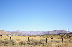 Beckwourth Pass as seen from the Feather River Route in the Sierra Valley looking east | |
| Elevation | 5,221 ft (1,591 m) |
| Traversed by | Feather River Route |
| Location | Plumas County |
| Range | Sierra Nevada (U.S.) |
| Coordinates | 39°47′30″N 120°6′28″W / 39.79167°N 120.10778°W |
 Location in California | |
| Reference no. | 336 |

Beckwourth Pass is the lowest mountain pass in the Sierra Nevada mountain range at an elevation of 5,221 feet (1,591 m).[1]
Beckwourth Pass is located at the eastern edge of Sierra Valley at Chilcoot-Vinton, California on the border between Plumas County and Lassen County, 20 miles (32 km) east of Portola, California and 25 miles (40 km) northwest of Reno, Nevada.
California State Route 70 crosses over Beckwourth Pass and the Feather River Route of the former Western Pacific, now Union Pacific Railroad beneath it via the Chilcoot Tunnel. Route 70 and the railroad line provide an alternate route between Sacramento, California and Reno, Nevada when Interstate 80 and the Overland Route, which cross the Sierra Nevada near Donner Pass, are impassable due to winter storms.
History[]
James Beckwourth is credited with the discovery of Beckwourth Pass in 1850. In 1851, he improved what was originally a Native American path into Sierra Valley to create his Beckwourth Trail. The trail ran from Truckee Meadows (what is now known as Sparks, Nevada) through the pass into California and on to Marysville.[2]
In late summer of 1851, James Beckwourth led the first wagon train of settlers along the Beckwourth Trail into Marysville.[3]
Between 1851 and 1854, the Beckwourth Trail was frequently traveled.[4] However, in 1854, use dropped sharply when the Beckwourth Trail became a toll road. The toll cost to move a ton of freight from Bidwell Bar to Quincy was about $18. This made using the Beckwourth Road an expensive enterprise and the use of the Beckwourth Trail declined. [5]
Between 1895 and 1916, the pass was used by the Sierra Valley & Mohawk Railway narrow gauge.[6] The abandoned right-of-way is still visible on the south, and eastern slope of the pass.
In 1906, the Chilcoot Tunnel at 6,002 feet (1,829 m) was constructed beneath Beckwourth Pass by the Western Pacific Railroad as part of its Feather River Route.[6] This line is now owned and operated by the Union Pacific Railroad.
In 1937, a bronze plaque was erected at Beckwourth Pass by the Native Daughters of the Golden West to commemorate the discoverer and the pioneers who passed along the trail.[7]
On August 8, 1939, Beckwourth Pass was designated as California Historical Landmark Number 336.
See also[]
- Ina Coolbrith
- Mount Ina Coolbrith
References[]
- ^ "California State Parks Office of Historical Preservation". Retrieved July 7, 2013.
- ^ "A Brief History of Plumas County, California". Archived from the original on September 23, 2015. Retrieved July 7, 2013.
- ^ "Beckwourth Trail, A Route to the Gold Country". Retrieved July 7, 2013.
- ^ *Morgan, Angel; Mitchell, Karen (2011), "The Beckwourth Emigrant Trail: Using Historical Accounts to Guide Archaeological Fieldwork in the Plumas National Forest" (PDF), California Archaeology - The SCA Journal, 1692 Mangrove Avenue, #153 Chico, CA 95926: Society for California Archaeology, 25: 1–14CS1 maint: location (link)
- ^ McIntosh, Clarence (June 1986). "Transportation in Plumas County Before the Railroad". Plumas Memories, Plumas Historial Society. Publication #51.
- ^ a b Myrick, David F. (1992). Railroads Of Nevada And Eastern California: Volume One. p. PA318. ISBN 9780874171938. Retrieved July 7, 2013 – via Google Books.
- ^ "Historical Markers of Plumas County, Las Plumas, Volume 34 No. 2, Quarterly Publication of the Plumas County Museum Association" (PDF). Retrieved July 7, 2013.
Sierra Nevada | |||||||||
|---|---|---|---|---|---|---|---|---|---|
| Peaks above 14,000 ft | |||||||||
| Other notable peaks (Peak list • First ascents) |
| ||||||||
| Passes | |||||||||
| Rivers | |||||||||
| Lakes | |||||||||
| Protected areas (main article) |
| ||||||||
| Communities | |||||||||
| Ski areas | |||||||||
| Trails | |||||||||

- California Trail
- Mountain passes of the Sierra Nevada (United States)
- Landforms of Plumas County, California
- Rail mountain passes of the United States
- California Historical Landmarks