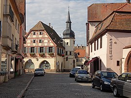
Benfeld
show This article may be expanded with text translated from the corresponding article in French. (December 2008) Click [show] for important translation instructions. |
Benfeld
Banfald | |
|---|---|
 The town hall in Benfeld | |
 Coat of arms | |
show Location of Benfeld | |
 Benfeld | |
| Coordinates: 48°22′16″N 7°35′42″E / 48.371019°N 7.5950335°ECoordinates: 48°22′16″N 7°35′42″E / 48.371019°N 7.5950335°E | |
| Country | France |
| Region | Grand Est |
| Department | Bas-Rhin |
| Arrondissement | Sélestat-Erstein |
| Canton | Erstein |
| Government | |
| • Mayor (2020–2026) | Jacky Wolfarth[1] |
| Area 1 | 7.79 km2 (3.01 sq mi) |
| Population (Jan. 2018)[2] | 5,756 |
| • Density | 740/km2 (1,900/sq mi) |
| Time zone | UTC+01:00 (CET) |
| • Summer (DST) | UTC+02:00 (CEST) |
| INSEE/Postal code | 67028 /67230 |
| Dialling codes | 0388 |
| Elevation | 155–162 m (509–531 ft) (avg. 160 m or 520 ft) |
| 1 French Land Register data, which excludes lakes, ponds, glaciers > 1 km2 (0.386 sq mi or 247 acres) and river estuaries. | |
Benfeld (French pronunciation: [bɛnfɛld]; Alsatian: Banfald [ˈbanfalt]) is a commune in the Bas-Rhin department in Grand Est in northeastern France. It is situated on the river Ill. In the nearby hamlet Ehl there is an archaeological site with the remains of the Gallo-Roman city Ellelum or Helvetum.
Population[]
|
|
Sights[]

Old town and city hall
The core of the town boasts a number of ancient buildings, chief among them the Renaissance town hall with its 1619 automata. The handsome 1846 synagogue survived the Nazi occupation.[3]
See also[]
References[]
| Wikimedia Commons has media related to Benfeld. |
- ^ "Répertoire national des élus: les maires". data.gouv.fr, Plateforme ouverte des données publiques françaises (in French). 2 December 2020.
- ^ "Populations légales 2018". INSEE. 28 December 2020.
- ^ "La Synagogue de Benfeld (Dep. Bas Rhin / Alsace / Unterelsass)".
Categories:
- Communes of Bas-Rhin
- Bas-Rhin geography stubs


