Bethel Township, Fayette County, Iowa
Bethel Township | |
|---|---|
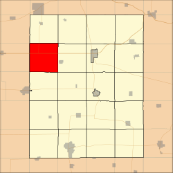 Location in Fayette County | |
| Coordinates: 42°57′10″N 92°01′05″W / 42.95278°N 92.01806°WCoordinates: 42°57′10″N 92°01′05″W / 42.95278°N 92.01806°W | |
| Country | |
| State | |
| County | Fayette |
| Area | |
| • Total | 36.12 sq mi (93.54 km2) |
| • Land | 36.09 sq mi (93.46 km2) |
| • Water | 0.03 sq mi (0.08 km2) 0.09% |
| Elevation | 1,115 ft (340 m) |
| Population (2010) | |
| • Total | 297 |
| • Density | 8.2/sq mi (3.2/km2) |
| Time zone | UTC-6 (CST) |
| • Summer (DST) | UTC-5 (CDT) |
| ZIP codes | 50674, 52147, 52171 |
| GNIS feature ID | 0467450 |

Bethel Township is one of twenty townships in Fayette County, Iowa, USA. As of the 2000 census, its population was 297.[1]
Geography[]
According to the United States Census Bureau, Bethel Township covers an area of 36.12 square miles (93.54 square kilometers); of this, 36.09 square miles (93.46 square kilometers, 99.91 percent) is land and 0.03 square miles (0.08 square kilometers, 0.09 percent) is water.
Unincorporated towns[]
(This list is based on USGS data and may include former settlements.)
Adjacent townships[]
- Eden Township (north)
- Auburn Township (northeast)
- Windsor Township (east)
- Center Township (southeast)
- Banks Township (south)
- Sumner No. 2 Township, Bremer County (southwest)
- Fredericksburg Township, Chickasaw County (west)
- Stapleton Township, Chickasaw County (northwest)
Cemeteries[]
The township contains these three cemeteries: Bethel, Pitts and Richfield.
Major highways[]
 U.S. Route 18
 Iowa Highway 193
School districts[]
- North Fayette Valley Community School District
- Sumner-Fredericksburg Community School District
Political districts[]
- Iowa's 1st congressional district
- State House District 18
- State Senate District 9
References[]
- United States Census Bureau 2008 TIGER/Line Shapefiles
- United States Board on Geographic Names (GNIS)
- United States National Atlas
External links[]
Municipalities and communities of Fayette County, Iowa, United States | ||
|---|---|---|
| Cities | ||
| Townships | ||
| Unincorporated communities | ||
| Footnotes | ‡This populated place also has portions in an adjacent county or counties | |
| ||
Categories:
- Townships in Fayette County, Iowa
- Townships in Iowa