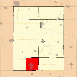
Jefferson Township, Fayette County, Iowa
Jefferson Township | |
|---|---|
 Location in Fayette County | |
| Coordinates: 42°41′11″N 91°54′11″W / 42.68639°N 91.90306°WCoordinates: 42°41′11″N 91°54′11″W / 42.68639°N 91.90306°W | |
| Country | |
| State | |
| County | Fayette |
| Area | |
| • Total | 36.46 sq mi (94.42 km2) |
| • Land | 36.37 sq mi (94.2 km2) |
| • Water | 0.09 sq mi (0.22 km2) 0.23% |
| Elevation | 1,106 ft (337 m) |
| Population (2010) | |
| • Total | 6,910 |
| • Density | 190/sq mi (73/km2) |
| Time zone | UTC-6 (CST) |
| • Summer (DST) | UTC-5 (CDT) |
| ZIP codes | 50655, 50662, 50671 |
| GNIS feature ID | 0468134 |
Jefferson Township is one of twenty townships in Fayette County, Iowa, USA. As of the 2010 census, its population was 6,910.[1]
Geography[]
According to the United States Census Bureau, Jefferson Township covers an area of 36.46 square miles (94.42 square kilometers); of this, 36.37 square miles (94.2 square kilometers, 99.77 percent) is land and 0.09 square miles (0.22 square kilometers, 0.23 percent) is water.
Cities, towns, villages[]
Adjacent townships[]
- Harlan Township (north)
- Smithfield Township (northeast)
- Scott Township (east)
- Buffalo Township, Buchanan County (southeast)
- Hazleton Township, Buchanan County (south)
- Fairbank Township, Buchanan County (southwest)
- Oran Township (west)
- Fremont Township (northwest)
Cemeteries[]
The township contains these three cemeteries: Oakdale, Otsego and Woodlawn.
Major highways[]
Airports and landing strips[]
- Mercy Hospital Heliport
Landmarks[]
- Levin Park
- Platt Park
- Red Gate Park
- Reedy Park
- Wings Park
School districts[]
- Oelwein Community School District
- West Central Community School District
Political districts[]
- Iowa's 1st congressional district
- State House District 18
- State Senate District 9
References[]
- United States Census Bureau 2008 TIGER/Line Shapefiles
- United States Board on Geographic Names (GNIS)
- United States National Atlas
External links[]
Categories:
- Townships in Fayette County, Iowa
- Townships in Iowa
