Putnam Township, Fayette County, Iowa
Putnam Township | |
|---|---|
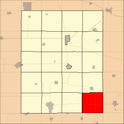 Location in Fayette County | |
| Coordinates: 42°41′14″N 91°40′01″W / 42.68722°N 91.66694°WCoordinates: 42°41′14″N 91°40′01″W / 42.68722°N 91.66694°W | |
| Country | |
| State | |
| County | Fayette |
| Area | |
| • Total | 36.56 sq mi (94.69 km2) |
| • Land | 36.54 sq mi (94.63 km2) |
| • Water | 0.02 sq mi (0.06 km2) 0.06% |
| Elevation | 1,109 ft (338 m) |
| Population (2010) | |
| • Total | 313 |
| • Density | 8.6/sq mi (3.3/km2) |
| Time zone | UTC-6 (CST) |
| • Summer (DST) | UTC-5 (CDT) |
| ZIP codes | 50606, 50607, 50650, 52076 |
| GNIS feature ID | 0468582 |

Putnam Township is one of twenty townships in Fayette County, Iowa, USA. As of the 2010 census, its population was 313.[1]
Geography[]
According to the United States Census Bureau, Putnam Township covers an area of 36.56 square miles (94.69 square kilometers); of this, 36.54 square miles (94.63 square kilometers, 99.94 percent) is land and 0.02 square miles (0.06 square kilometers, 0.06 percent) is water.
Unincorporated towns[]
(This list is based on USGS data and may include former settlements.)
Adjacent townships[]
- Fairfield Township (north)
- Sperry Township, Clayton County (northeast)
- Cass Township, Clayton County (east)
- Richland Township, Delaware County (southeast)
- Madison Township, Buchanan County (south)
- Buffalo Township, Buchanan County (southwest)
- Scott Township (west)
- Smithfield Township (northwest)
Cemeteries[]
The township contains Union Cemetery.
Major highways[]
School districts[]
- Oelwein Community School District
- Starmont Community School District
Political districts[]
- Iowa's 1st congressional district
- State House District 24
- State Senate District 12
References[]
- United States Census Bureau 2008 TIGER/Line Shapefiles
- United States Board on Geographic Names (GNIS)
- United States National Atlas
External links[]
Municipalities and communities of Fayette County, Iowa, United States | ||
|---|---|---|
| Cities | ||
| Townships | ||
| Unincorporated communities | ||
| Footnotes | ‡This populated place also has portions in an adjacent county or counties | |
| ||
Categories:
- Townships in Fayette County, Iowa
- Townships in Iowa