Beverīna Municipality
Beverīna Municipality
Beverīnas novads | |
|---|---|
 Flag  Coat of arms | |
 | |
| Country | |
| Formed | 2009 |
| Centre | Mūrmuiža |
| Government | |
| • Chairman | Jānis Fūrmanis (For The Municipality) |
| Area | |
| • Total | 300.68 km2 (116.09 sq mi) |
| • Land | 293.55 km2 (113.34 sq mi) |
| • Water | 7.13 km2 (2.75 sq mi) |
| Population (2021)[2] | |
| • Total | 2,948 |
| • Density | 9.8/km2 (25/sq mi) |
| Website | www |
Beverīna Municipality (Latvian: Beverīnas novads) is a former municipality in Vidzeme, Latvia. The municipality was formed in 2009 by merging Brenguļi Parish, Kauguri Parish and Trikāta Parish the administrative centre being Mūrmuiža.
On 1 July 2021, Beverīna Municipality ceased to exist as it was merged into Valmiera Municipality.[3]
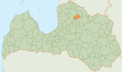
The municipality was geographically well positioned, bordering on Valmiera City, which is a city of republican importance. Beverīna County also shares borders with Burtnieki, Kocēni, Priekuļi, Smiltene and Strenči Counties.
Beverīna County is rich in valuable nature resources and culture and historical sites. Part of the county's territory is included in the Gauja National Park and Protected Landscape Area Ziemeļgauja. The River Gauja flows through all three civil parishes while its biggest tributaries the Abuls, Miegupe and Lisa not only provide great views, but are also closely related to historical events.
Population[]
| Parish | Population (year) |
|---|---|
| Brenguļi Parish | 858 (2018)[4] |
| Kauguri Parish | 1393 (2018) |
| Trikāta Parish | 896 (2018) |
See also[]
- Administrative divisions of Latvia (2009)
References[]
- ^ https://data.stat.gov.lv/pxweb/lv/OSP_PUB/START__ENV__DR__DRT/DRT010/; Central Statistical Bureau of Latvia; retrieved: 25 February 2021.
- ^ https://data.stat.gov.lv/pxweb/lv/OSP_PUB/START__POP__IR__IRS/IRD060/; Central Statistical Bureau of Latvia; retrieved: 15 June 2021.
- ^ [1] Law on Administrative Territories and Populated Areas
- ^ "Archived copy" (PDF). Archived from the original (PDF) on 2018-10-09. Retrieved 2018-11-20.CS1 maint: archived copy as title (link)
Coordinates: 57°30′N 25°27′E / 57.500°N 25.450°E

| Authority control: National libraries |
|---|
This Vidzeme location article is a stub. You can help Wikipedia by . |
- Beverīna Municipality
- Former municipalities of Latvia
- Vidzeme geography stubs