Engure Municipality
Engure Municipality
Engures novads | |
|---|---|
 Flag  Coat of arms | |
 | |
| Country | |
| Formed | 2009 |
| Centre | Smārde |
| Government | |
| • Chairman | Gundars Važa (NA) |
| Area | |
| • Total | 396.40 km2 (153.05 sq mi) |
| • Land | 365.55 km2 (141.14 sq mi) |
| • Water | 30.85 km2 (11.91 sq mi) |
| Population (2021)[2] | |
| • Total | 7,147 |
| • Density | 18/km2 (47/sq mi) |
| Website | www |
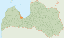
Engure Municipality (Latvian: Engures novads) is a municipality in Zemgale, Latvia. It borders Mērsrags municipality, Tukums municipality, Jūrmala and Gulf of Riga. The municipality was formed in 2009 by merging Engure parish, Smārde parish and Lapmežciems parish, with the administrative centre being Smārde. The population in 2020 was 7,124.[3]
Population[]
| Parish | Population (year) |
|---|---|
| Engure parish | 2518 (2018)[4] |
| Lapmežciems parish | 2324 (2018) |
| Smārde parish | 2557 (2018) |
See also[]
- Administrative divisions of Latvia (2009)
References[]
- ^ https://data.stat.gov.lv/pxweb/lv/OSP_PUB/START__ENV__DR__DRT/DRT010/; Central Statistical Bureau of Latvia; retrieved: 25 February 2021.
- ^ https://data.stat.gov.lv/pxweb/lv/OSP_PUB/START__POP__IR__IRS/IRD060/; Central Statistical Bureau of Latvia; retrieved: 15 June 2021.
- ^ "ISG020. Population number and its change by statistical region, city, town, 21 development centres and county". Central Statistical Bureau of Latvia. 2020-01-01. Retrieved 2021-02-12.
- ^ https://www.pmlp.gov.lv/lv/assets/documents/statistika/Iedz%C4%ABvot%C4%81ju%20re%C4%A3istrs%20st.%20uz%2001072018/ISPV_Pasvaldibas_iedzivotaju_skaits_pagasti.pdf
| show Former first-level administrative divisions of Latvia (2009–2021) |
|---|
Coordinates: 56°57′18″N 23°20′17″E / 56.95500°N 23.33806°E

| show Authority control |
|---|
This Courland location article is a stub. You can help Wikipedia by . |
Categories:
- Engure Municipality
- Municipalities of Latvia
- Courland geography stubs