Boismorand
Boismorand | |
|---|---|
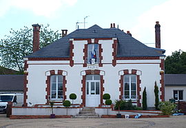 The town hall in Boismorand | |
 Coat of arms | |
show Location of Boismorand | |
 Boismorand | |
| Coordinates: 47°47′13″N 2°43′10″E / 47.7869°N 2.7194°ECoordinates: 47°47′13″N 2°43′10″E / 47.7869°N 2.7194°E | |
| Country | France |
| Region | Centre-Val de Loire |
| Department | Loiret |
| Arrondissement | Montargis |
| Canton | Gien |
| Government | |
| • Mayor (2020–2026) | Philippe Tagot[1] |
| Area 1 | 25.15 km2 (9.71 sq mi) |
| Population (Jan. 2018)[2] | 832 |
| • Density | 33/km2 (86/sq mi) |
| Time zone | UTC+01:00 (CET) |
| • Summer (DST) | UTC+02:00 (CEST) |
| INSEE/Postal code | 45036 /45290 |
| Elevation | 128–176 m (420–577 ft) |
| 1 French Land Register data, which excludes lakes, ponds, glaciers > 1 km2 (0.386 sq mi or 247 acres) and river estuaries. | |


Boismorand (French pronunciation: [bwamɔʁɑ̃]) is a commune in the Loiret department in north-central France.
Population[]
|
|
See also[]
- Communes of the Loiret department
References[]
- ^ "Répertoire national des élus: les maires". data.gouv.fr, Plateforme ouverte des données publiques françaises (in French). 2 December 2020.
- ^ "Populations légales 2018". INSEE. 28 December 2020.
| Wikimedia Commons has media related to Boismorand. |
| show Communes of the Loiret department |
|---|
| show Authority control |
|---|
This Loiret geographical article is a stub. You can help Wikipedia by . |
Categories:
- Communes of Loiret
- Loiret geography stubs