Braidwood, New South Wales
| Braidwood New South Wales | |||||||||||||||
|---|---|---|---|---|---|---|---|---|---|---|---|---|---|---|---|
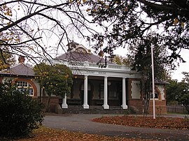 The Braidwood Courthouse, built in 1901 | |||||||||||||||
 Braidwood | |||||||||||||||
| Coordinates | 35°26′0″S 149°48′0″E / 35.43333°S 149.80000°ECoordinates: 35°26′0″S 149°48′0″E / 35.43333°S 149.80000°E | ||||||||||||||
| Population | 1,651 (2016 census)[1] | ||||||||||||||
| Postcode(s) | 2622 | ||||||||||||||
| Elevation | 643 m (2,110 ft) | ||||||||||||||
| Location | |||||||||||||||
| LGA(s) | Queanbeyan–Palerang Regional Council | ||||||||||||||
| Region | Southern Tablelands | ||||||||||||||
| County | St Vincent | ||||||||||||||
| Parish | Braidwood | ||||||||||||||
| State electorate(s) | Monaro | ||||||||||||||
| Federal Division(s) | Eden-Monaro | ||||||||||||||
| |||||||||||||||
| |||||||||||||||

Braidwood is a town in the Southern Tablelands of New South Wales, Australia, in Queanbeyan–Palerang Regional Council.[2][3] It is located on the Kings Highway linking Canberra with Batemans Bay. It is approximately 200 kilometres south west of Sydney, 60 kilometres inland from the coast, and fifty-five from Canberra. Braidwood is a service town for the surrounding district which is based on sheep and cattle grazing, and forestry operations.
First Nation's History[]
Braidwood is located within the Yuin Nation, on Walbanga Country. The Walbanga People speak dialects of the Thurga (Durga/Dhurga) language. [4]
The Walbanga Peoples relied on the plentiful supply of vegetables available in the tablelands, such as the tubers of the yam daisy, wattle-seeds, and orchid tubers. In September to May, fish and crayfish were eaten, while possums and larger grazing animals were hunted year round. The Walbanga People and neighbouring groups made annual trips in December and January from to the Bogong Mountains and Snowy Mountains to roast and eat bogong moths (Agrotis infusa).[5]
The lives of the Walbanga People were forever changed by the arrival and early settlement of Europeans in the 1820s. There were reports of the loss of water, fish and native animals essential to the First Nations's diet after the arrival of the settlers. The settlers also brought exotic diseases, particularly small pox, the influenza epidemic in 1846-7 and syphilis, which devastated the First Nation's people in the region, likely including the Walbanga People. The Walbanga and surrounding populations culture and traditional life was considered to have been destroyed by 1850. Bogong moth ceremonies, intertribal meetings and corroborees also ceased in the region.[6]
In 1872, First Nation's Peoples from the south coast and the highlands areas met in a large ceremonial gathering on the Braidwood goldfields, where they also held discussions about strategies to gain back access to their land. After the gathering, the local police officer, Martin Brennan, was approached by 62 members of the gathering, lead by 'Jack Bawn and Alick' who asked for his assistance, and Brennan recorded the following: "I asked Jack what they wanted. He replied, 'We have come to you to intercede for us in getting the Government to do something for us... I have assisted the police for many years, and we want to get some land which we can call our own in reality, where we can settle down, and which the old people can call their home.'..."
On 29 March 1873, Brennan sent the government a comprehensive report detailing the experiences, circumstances and the aspirations of the group. Shortly afterwards he received instructions to name forty acres of Crown Lands in whatever location Jack Bawn desired as an Aboriginal Reserve. However, Jack Bawn and his people were blocked from occupying the surveyed land due to the hostility from surrounding white farmers, but they continued to urge Brennan to press Authorities for the land. Brennan also recorded the following statement in regards to the First Nation's Peoples of the Braidwood and Coast Districts "...whose aspirations at all times were to be allowed some land which they might call their own...; which they might cultivate unmolested for the use of themselves and their families; and where the aborigines of the surrounding districts might meet periodically for the purpose of holding coroborees and other exhilarating games."[7]
As of the 2016 Census, there were less than 100 First Nations' Australians living in the Braidwood Region.[8]
Settler History[]
European explorers reached the district in 1822 (Kearns, Marsh and Packer). The area was first settled by Europeans in the 1820s, and the town was surveyed in 1839. The village was located near the headwaters of the Shoalhaven River. The settlement was built with the labour of convicts, and many of the buildings they built around the region are still standing.
Dr Wilson[]
The town was named after Dr Thomas Braidwood Wilson.[9] He had been a surgeon-superintendent of ships taking convicts to New South Wales and Van Diemen's Land (now known as Tasmania). He was first granted land in Van Diemen's Land in 1824, which he exchanged for land near Lake George in 1825. In addition he was given 2560 acres (10 km²) which he selected in the 'new country' on two tributaries of the Shoalhaven, Monkittee and Flood creeks. In 1833, the western end of Wilson's grant was resumed and reserved for a future village and a similar area added to the eastern end in compensation. He eventually controlled a total of 12,305 acres in the area.[10] He and his wife and children settled in the district in late 1836. He became a community leader and amongst other things contracted to build the first courthouse in 1837-38. In 1840 Wilson petitioned the government to build a road from Braidwood to Jervis Bay to enable faster and cheaper shipping of the wool clip to Sydney and, with Col. John Mackenzie, supplied the materials and labour for the Braidwood to Nerriga section.
In 1841 Braidwood Farm had 141 residents. Wilson was sent bankrupt due to a drought in the late 1830s and the subsequent depression. He died in November 1843. His land was sold for £2,000 to John Coghill, who now owned all the land on the south, east and north of the town. Coghill built the historic house Bedervale. However, before his death, Wilson had purchased the block immediately to the north of Braidwood. He was buried on this block, high on the hill overlooking the town.
A memorial and large pine tree mark the site of Wilson's grave, from which there are views of the town. The path to the grave is no longer open to the public.
First Royal Commission[]
Braidwood was the subject of Australia's first Royal Commission in 1867, inquiring into the activities of police officers and managers in the district, concerning the extent to which bushrangers had been shielded and assisted by police connivance and inactivity. The Commission identified several instances of misconduct and found the superintendent of police had failed to exercise 'strict and proper control over his men.'[11]
Gold discovered[]
Gold was discovered in 1851, and for the next two decades the district's population swelled to about 10,000. Supplies and produce to support the workforce on the gold fields came from as far afield as the Canberra region,[12] (though Canberra itself would not be founded until 1913). This prosperity lasted for several years, during which some substantial commercial buildings including banks and hotels were constructed.
Twentieth century[]
Braidwood was formerly the seat of the Tallaganda local government area. However, following restructuring of local government areas by the New South Wales Government, it is now part of Queanbeyan-Palerang Regional Council. The local paper is now called the Braidwood Times.
Through much of the 20th century, Braidwood was essentially in rural recession. Amongst other consequences, very little building work was carried out, and as a result the town entered the 21st century with much of its original streetscape and architecture intact. On 30 March 2006 the town and its setting were listed on the NSW State Heritage Register, following a period of unpleasant dispute between those wishing to preserve the town's charm and those wishing to develop it.
Braidwood is located equidistant from Bungendore and Tarago railway stations, a distance of approximately 40 kilometres. NSW TrainLink operate multiple direct services from both railways stations to Canberra, Sydney, and provides connections across the state. Murray's coach services operate daily between Bateman's Bay and Canberra including picking up and setting down passengers in Braidwood.
Heritage listings[]

Braidwood has a number of heritage-listed sites, including:
- Braidwood and Its Setting[13]
- Monkitee Street: Bedervale[14]
- Wallace Street: Braidwood District Historical Society Museum[15]
- Wallace Street: Mill Complex[16]
- 119 Wallace Street: Albion Hotel[17]
Climate[]
Braidwood has an oceanic climate (Cfb) with mild to warm summers and cold winters with frequent morning frost.
| hideClimate data for Braidwood | |||||||||||||
|---|---|---|---|---|---|---|---|---|---|---|---|---|---|
| Month | Jan | Feb | Mar | Apr | May | Jun | Jul | Aug | Sep | Oct | Nov | Dec | Year |
| Record high °C (°F) | 40.5 (104.9) |
41.1 (106.0) |
35.6 (96.1) |
29.4 (84.9) |
26.2 (79.2) |
20.0 (68.0) |
18.1 (64.6) |
21.7 (71.1) |
28.9 (84.0) |
30.0 (86.0) |
38.3 (100.9) |
38.3 (100.9) |
41.1 (106.0) |
| Average high °C (°F) | 25.9 (78.6) |
25.4 (77.7) |
23.1 (73.6) |
19.0 (66.2) |
15.0 (59.0) |
11.8 (53.2) |
11.3 (52.3) |
13.1 (55.6) |
16.4 (61.5) |
19.5 (67.1) |
22.2 (72.0) |
25.1 (77.2) |
19.0 (66.2) |
| Average low °C (°F) | 10.9 (51.6) |
11.1 (52.0) |
9.3 (48.7) |
5.9 (42.6) |
2.6 (36.7) |
0.7 (33.3) |
−0.2 (31.6) |
0.8 (33.4) |
2.7 (36.9) |
5.4 (41.7) |
7.6 (45.7) |
9.6 (49.3) |
5.5 (41.9) |
| Record low °C (°F) | 2.0 (35.6) |
2.8 (37.0) |
−1.4 (29.5) |
−2.8 (27.0) |
−6.6 (20.1) |
−8.3 (17.1) |
−9.2 (15.4) |
−8.3 (17.1) |
−5.6 (21.9) |
−2.8 (27.0) |
−0.6 (30.9) |
1.7 (35.1) |
−9.2 (15.4) |
| Average precipitation mm (inches) | 69.7 (2.74) |
67.1 (2.64) |
69.0 (2.72) |
54.6 (2.15) |
55.6 (2.19) |
66.3 (2.61) |
45.4 (1.79) |
48.3 (1.90) |
50.0 (1.97) |
61.9 (2.44) |
63.4 (2.50) |
65.0 (2.56) |
719.3 (28.32) |
| Average precipitation days | 8.8 | 8.3 | 8.7 | 7.5 | 7.6 | 8.7 | 7.8 | 8.1 | 8.8 | 8.9 | 8.8 | 8.5 | 100.5 |
| Source: [18] | |||||||||||||
Population[]
At the 2016 census, Braidwood had a population of 1,651. 78.5% of people were born in Australia and 87.2% of people only spoke English at home. The most common responses for religion were No Religion 32.4%, Catholic 24.0% and Anglican 20.5%.[1]
Media[]
Braidwood is served by local newspaper, the ,[19] which is owned by Australian Community Media.
Braidwood is home to community radio station . Operating under the name '', the station can be heard on 88.9 FM.[20] For commercial radio, Braidwood is in the Goulburn broadcast licence area[21] with 2GN heard on 1368 AM and Eagle FM on 93.5 FM. These stations have studios in Goulburn.
The town falls under the Southern NSW television licence area with stations transmitting from a tower on Mount Gillamatong, adjacent to the township.[22]
In popular culture[]
Film and television[]
The town has several times been used for film locations, including Robbery Under Arms (1920), Ned Kelly (1970), The Year My Voice Broke (1987), On our Selection (1995), Finding Joy (2003), (2009) and (2013).
Notable residents[]
- Deuchar Gordon, Australian pastoralist and president of the Australian Club
- Judith Wright, Australian poet and conservationist and Aboriginal rights campaigner
- John Chapman, Army Officer
See also[]
- Ralph Hush
- Christopher Eipper
- Quong Tart
References[]
- ^ Jump up to: a b Australian Bureau of Statistics (27 June 2017). "Braidwood (state suburb)". 2016 Census QuickStats. Retrieved 29 June 2017.

- ^ "Braidwood". Geographical Names Register (GNR) of NSW. Geographical Names Board of New South Wales. Retrieved 2 November 2017.
- ^ "Braidwood". OpenStreetMap. Retrieved 2 November 2017.
- ^ "Walbanga (NSW)".
- ^ "South Eastern Highlands – regional history". www.environment.nsw.gov.au. Retrieved 3 January 2021.
- ^ "South Eastern Highlands – regional history". www.environment.nsw.gov.au. Retrieved 3 January 2021.
- ^ Goodall, Heather (1990). "Land in Our Country: The Aboriginal Land Rights Movement in South-Eastern Australia, 1860 to 1914" (PDF). Aboriginal History. 14.
- ^ "Braidwood : Region Data Summary". itt.abs.gov.au. Retrieved 3 January 2021.
- ^ "Braidwood". Geographical Names Register (GNR) of NSW. Geographical Names Board of New South Wales. Retrieved 20 June 2009.
- ^ Philip Cox & Wesley Stacey (1973), Historic towns of Australia, Melbourne, Lansdowne, p.92. ISBN 0701801840
- ^ Report of the Commissioners, State of crime in the Braidwood District, 30 July 1867
- ^ Newman Chris (2004), Gold Creek, Reflections of Canberra's Rural Heritage, Gold Creek Homestead Working Group.
- ^ "Braidwood and Its Setting". New South Wales State Heritage Register. Office of Environment and Heritage. H01749. Retrieved 18 May 2018.
- ^ "Bedervale". New South Wales State Heritage Register. Office of Environment and Heritage. H00017. Retrieved 18 May 2018.
- ^ "Braidwood District Historical Society Museum". New South Wales State Heritage Register. Office of Environment and Heritage. H00149. Retrieved 18 May 2018.
- ^ "Mill Centre". New South Wales State Heritage Register. Office of Environment and Heritage. H00434. Retrieved 18 May 2018.
- ^ "Albion Hotel, 3 adjoining shops & stables". New South Wales State Heritage Register. Office of Environment and Heritage. H00304. Retrieved 18 May 2018.
- ^ "Climate statistics for Braidwood (Wallace Street)". Bureau of Meteorology. Retrieved 21 October 2018.
- ^ "Braidwood news, sport and weather | Braidwood Times". www.braidwoodtimes.com.au. Retrieved 14 January 2020.
- ^ "Home". Braidwood Community Radio 88.9 FM. Retrieved 14 January 2020.
- ^ "Goulburn Radio Licence Area". Commercial Radio Australia.
- ^ "ACMA - Search for broadcasters by postcode". channelfinder.acma.gov.au. Retrieved 14 January 2020.
External links[]
| Wikimedia Commons has media related to Braidwood, New South Wales. |
- Braidwood Show Society Inc. website
- Braidwood businesses, where to eat or stay
- Braidwood Central School website
- Heritage information about various buildings in Braidwood
- NSW Heritage listing for Braidwood Archived 23 July 2008 at the Wayback Machine
- Queanbeyan-Palerang Regional Council website
- The Braidwood Times Newspaper
| Authority control |
|
|---|
- Towns in New South Wales
- Braidwood, New South Wales
- Southern Tablelands
- Queanbeyan–Palerang Regional Council
- New South Wales State Heritage Register