Broadstairs railway station
Broadstairs | |
|---|---|
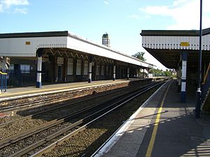 View of Main Platform | |
| Location | Broadstairs, District of Thanet England |
| Grid reference | TR391679 |
| Managed by | Southeastern |
| Platforms | 2 |
| Other information | |
| Station code | BSR |
| Classification | DfT category E |
| History | |
| Opened | 5 October 1863 |
| Passengers | |
| 2015/16 | |
| 2016/17 | |
| 2017/18 | |
| 2018/19 | |
| 2019/20 | |
| Notes | |
Passenger statistics from the Office of Rail and Road | |


Broadstairs railway station is on the Chatham Main Line in England, serving the seaside town of Broadstairs, Kent. It is 77 miles 9 chains (124 km) down the line from London Victoria and is situated between Margate and Dumpton Park.
The station and all trains that call are operated by Southeastern. Trains to London can run either way through the station, depending on the route either via Margate or Ramsgate.
History[]

The first proposal for a station at Broadstairs was by the South Eastern Railway (SER) in November 1859, who wanted to extend their existing station at Ramsgate towards Broadstairs at an estimated cost of £20,000. However, the scheme was refused permission by the station master at Ramsgate.[1]
Instead, the station was built by the Kent Coast Railway as part of an extension from Margate to Ramsgate Harbour.[2] It opened on 5 October 1863.[3] From the beginning, the line was operated by the London, Chatham & Dover Railway (LCDR), who bought the Kent Coast Railway on 1 July 1871.[2]
The station was run by the Southern Railway (SR) following the Railways Act 1921. Having inherited lines from the LCDR and SER, the SR decided to simplify services by constructing a new line linking Broadstairs directly to the current Ramsgate station, thus joining the stations together and forming a loop along Kent. This opened on 2 July 1926.[4]
Electric services began at Broadstairs on 15 June 1959.[4] Goods services were withdrawn from the station on 3 June 1963.[5] A high-speed service to London St Pancras began on 13 December 2009.[6]
Incidents[]
In 2015, a woman was killed by a train at the station.[7]
Services[]
As of December 2019 the typical off-peak service from the station is:[8][9]
- 1 tph to London St Pancras via Chatham and Ebbsfleet International (High Speed)
- 1 tph to London St Pancras via Ramsgate, Deal, Dover Priory, and Ashford International (High Speed)
- 1 tph to London St Pancras via Ramsgate, Canterbury West, Ashford International and Ebbsfleet International (High Speed)
- 1 tph to Margate (High Speed)
- 1 tph to London Victoria via Chatham and Bromley South (Main Line)
- 1 tph to Ramsgate (Main Line)
| Preceding station | Following station | |||
|---|---|---|---|---|
| Margate | Southeastern Chatham Main Line - Ramsgate Branch |
Dumpton Park | ||
| Margate | Southeastern High Speed 1 St Pancras International to St Pancras International Circular |
Ramsgate | ||
| Margate | Southeastern High Speed 1 London-Margate via Ashford |
Ramsgate | ||
| Disused railways | ||||
Line open, station closed |
London, Chatham and Dover Railway Chatham Main Line - Ramsgate Branch |
Ramsgate Harbour Line and station closed | ||
References[]
Citations
- ^ Gray 1990, p. 34.
- ^ Jump up to: a b McCarthy & McCarthy 2007, p. 30.
- ^ Butt 1995, p. 45.
- ^ Jump up to: a b McCarthy & McCarthy 2007, p. 66.
- ^ McCarthy & McCarthy 2007, p. 121.
- ^ "High Speed". Southeastern. Retrieved 9 March 2020.
- ^ Collins, Julia (11 August 2015). "Woman dies at Broadstairs rail station after being hit by train". kentonline.co.uk. Retrieved 20 January 2017.
- ^ "December 2019: London - Ashford, Folkestone, Dover and Margate" (PDF). Southeastern. 15 December 2019. Retrieved 9 March 2020.
- ^ "Timetable 2 - London to Medway Towns, Sittingbourne, Sheerness-on-Sea, Faversham, Dover and Ramsgate" (PDF). Southeastern. 15 December 2019. Retrieved 9 March 2020.
Sources
- Butt, R. V. J. (1995). The Directory of Railway Stations: details every public and private passenger station, halt, platform and stopping place, past and present (1st ed.). Sparkford: Patrick Stephens Ltd. ISBN 978-1-85260-508-7. OCLC 60251199.
- Gray, Adrian (1990). South Eastern Railway. Middleton Press. ISBN 978-0-906520-85-7.
- McCarthy, Colin; McCarthy, David (2007). Railways of Britain : Kent and Sussex. Ian Allan. ISBN 978-0-7110-3222-4.
External links[]
- Train times and station information for Broadstairs railway station from National Rail
- Broadstairs
- Railway stations in Kent
- Former London, Chatham and Dover Railway stations
- Railway stations in Great Britain opened in 1863
- Railway stations served by Southeastern