Buena Park, California
Buena Park, California | |
|---|---|
City | |
 The entrance to Knott's Berry Farm in Buena Park | |
 Seal | |
| Motto(s): "Center of the Southland" | |
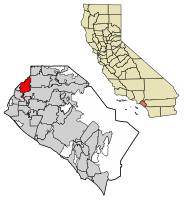 Location of Buena Park in Orange County, California. | |
 Buena Park, California Location in the United States | |
| Coordinates: 33°51′22″N 118°0′15″W / 33.85611°N 118.00417°WCoordinates: 33°51′22″N 118°0′15″W / 33.85611°N 118.00417°W | |
| Country | United States |
| State | California |
| County | Orange |
| Founded | 1887 |
| Incorporated | January 27, 1953[3] |
| Government | |
| • City council[1] | Mayor Connor Traut Mayor Pro Tem Sunny Park Arthur C. Brown Susan Sonne Dr. Elizabeth Swift |
| • City manager | James B. Vanderpool[2] |
| Area | |
| • Total | 10.55 sq mi (27.34 km2) |
| • Land | 10.53 sq mi (27.27 km2) |
| • Water | 0.03 sq mi (0.07 km2) 0.28% |
| Elevation | 75 ft (23 m) |
| Population | |
| • Total | 80,530 |
| • Estimate (2019)[7] | 81,788 |
| • Density | 7,767.88/sq mi (2,999.20/km2) |
| Time zone | UTC−8 (Pacific) |
| • Summer (DST) | UTC−7 (PDT) |
| ZIP codes | 90620–90624 |
| Area code | 714/657, 562 |
| FIPS code | 06-08786 |
| GNIS feature IDs | 1652676, 2409932 |
| Website | www |

Buena Park (/ˈbweɪnə/) is a city in northwestern Orange County, about 12 miles (20 km) northwest of downtown Santa Ana, the county seat. As of Census 2010 its population was 80,530. It is the location of several tourist attractions, including Knott's Berry Farm. It is located about 24 miles southeast of Downtown Los Angeles and is within the Los Angeles metropolitan area.
History[]
Original Spanish explorers settled on the enormous ranchos by land grants made by the King of Spain. Manuel Nieto of the Portolà expeditions received such a grant in 1783, which was divided by his heirs into five separate ranchos in 1834. One of them, 46,806-acre (189.42 km2) Rancho Los Coyotes, included the current site of the City of Buena Park. The rancho's adobe headquarters lay on what is now Los Coyotes Country Club's golf course.
The area was transferred from Spanish authority to Mexican rule in 1822 and ceded to the United States in 1848 at the end of the Mexican–American War. California was granted statehood in 1850. Americanization further expanded in the area after completion of the transcontinental railroad in 1869 and its connection to Los Angeles in 1875. By then, Abel Stearns had acquired Rancho Los Coyotes in consideration for loans made to Pio and Andrés Pico. In 1885, James A. Whitaker, a wholesale grocer from Chicago, purchased 690 acres (2.8 km2) of this land from Stearns. In 1887, Whitaker founded the City of Buena Park in conjunction with the railway development of what we now know as Orange County.
The exact derivation of the name Buena Park is uncertain. One theory is that Whitaker used the name of a Chicago suburb: Buena Park, Chicago, Illinois, although the community in Illinois was also named in 1887. Another theory relates to the artesian well and its park-like grounds once located at the current intersection of what are now Artesia and Beach Boulevards. Local settlers referred to the area as "Plaza Buena" which means "good park" in Spanish.
The city was incorporated on January 27, 1953.[8] An agricultural center when founded (particularly dairy, wine and citrus products), Buena Park is now primarily a residential suburb and commercial hub.
The Murder of Stuart Tay occurred in 1992.
In 2009, the body of swimsuit model and reality TV star Jasmine Fiore was found stuffed in a suitcase and dumped in an apartment building dumpster near the 7400 block of Franklin Street in northern Buena Park by a resident searching for recyclables.
Points of interest[]
Buena Park's E-Zone district, located along Beach Boulevard, is home to several well-known tourist destinations: the venerable Knott's Berry Farm theme park and its sister water park Knott's Soak City, Pirate's Dinner Adventure Show, and a Medieval Times dinner show.[9] The E-Zone has also been home to the Movieland Wax Museum, one of the largest of its kind in the world until it closed in 2005; a Ripley's Believe It or Not! museum (It closed on March 30, 2009.), across the street from the Wax Museum; and the Japanese Village and Deer Park on Knott Avenue.
Los Coyotes Country Club, located in the northeast of the city, boasts a 27-hole championship course originally designed by Billy Bell in 1957 and redesigned by Ted Robinson in 1998. The Los Coyotes LPGA Classic golf tournament has been hosted there.
The 105-acre Ralph B. Clark Regional Park (originally Los Coyotes Regional Park), nestled at the foot of the West Coyote Hills, is one of Orange County's prominent parks. Opened in 1981, it is home to an amphitheater, nature trails, and a stocked fishing pond, as well as the Interpretive Center, a small museum which features ice age fossil and local geology exhibits.
The City of Buena Park has its own local history park on Beach Blvd just south of Interstate 5. On these grounds, the city has preserved several historic buildings. These include the (which serves as the city's local history museum) the - possibly the oldest surviving structure from the area, the (which houses the California Welcome Center-Orange County) and the . The Buena Park Historical Society manages and maintains the historical content of the museum. The Dreger Clock, a 75-year-old multi-faced street clock, best known for the time it spent at Knott's Berry Farm, was installed in front of the Whitaker/Jaynes house overlooking Beach Blvd in September 2009 after a two-year restoration project.
A Nabisco factory on Artesia Boulevard was known for many years as a Buena Park landmark. The red "Nabisco" sign was visible from the I-5 Freeway, and visitors to the town could often smell cookies. The factory produced Honey Maid graham crackers, Ritz Crackers, and Nilla Wafers, among other Nabisco products, before shutting down in 2006.[10]
Geography and climate[]
According to the United States Census Bureau, the city has a total area of 10.6 square miles (27 km2). 10.5 square miles (27 km2) of it is land and 0.03 square miles (0.078 km2) of it (0.28%) is water. One of the things Buena Park citizens are proud of is that Buena Park is considered the center of the southland.
Buena Park is bisected by State Route 91 into North Buena Park and South Buena Park. It is bordered by Fullerton on the east, Anaheim on the southeast, Cypress on the southwest, Cerritos and La Palma on the west, and La Mirada on the north.
| hideClimate data for Buena Park, California | |||||||||||||
|---|---|---|---|---|---|---|---|---|---|---|---|---|---|
| Month | Jan | Feb | Mar | Apr | May | Jun | Jul | Aug | Sep | Oct | Nov | Dec | Year |
| Record high °F (°C) | 93 (34) |
91 (33) |
98 (37) |
105 (41) |
104 (40) |
109 (43) |
109 (43) |
105 (41) |
111 (44) |
111 (44) |
101 (38) |
92 (33) |
111 (44) |
| Average high °F (°C) | 70 (21) |
70 (21) |
73 (23) |
76 (24) |
80 (27) |
85 (29) |
90 (32) |
91 (33) |
89 (32) |
83 (28) |
76 (24) |
69 (21) |
79 (26) |
| Average low °F (°C) | 48 (9) |
49 (9) |
51 (11) |
54 (12) |
59 (15) |
63 (17) |
67 (19) |
68 (20) |
65 (18) |
60 (16) |
53 (12) |
47 (8) |
57 (14) |
| Record low °F (°C) | 25 (−4) |
33 (1) |
33 (1) |
38 (3) |
40 (4) |
46 (8) |
51 (11) |
52 (11) |
50 (10) |
39 (4) |
34 (1) |
28 (−2) |
25 (−4) |
| Average precipitation inches (mm) | 3.03 (77) |
3.25 (83) |
2.16 (55) |
0.87 (22) |
0.25 (6.4) |
0.09 (2.3) |
0.04 (1.0) |
0.05 (1.3) |
0.24 (6.1) |
0.75 (19) |
1.10 (28) |
2.05 (52) |
13.88 (353) |
| Source: [11][12][13] | |||||||||||||
Demographics[]
| Historical population | |||
|---|---|---|---|
| Census | Pop. | %± | |
| 1960 | 46,401 | — | |
| 1970 | 63,646 | 37.2% | |
| 1980 | 64,165 | 0.8% | |
| 1990 | 68,784 | 7.2% | |
| 2000 | 78,282 | 13.8% | |
| 2010 | 80,530 | 2.9% | |
| 2019 (est.) | 81,788 | [7] | 1.6% |
| U.S. Decennial Census[14] | |||
2010[]
The 2010 United States Census[15] reported that Buena Park had a population of 80,530. The population density was 7,631.0 people per square mile (2,946.3/km2). The racial makeup of Buena Park was 36,454 (45.3%) White (27.7% Non-Hispanic White),[16] 3,073 (3.8%) African American, 862 (1.1%) Native American, 21,488 (26.7%) Asian, 455 (0.6%) Pacific Islander, 14,066 (17.5%) from other races, and 4,132 (5.1%) from two or more races. Hispanic or Latino of any race were 31,638 persons (39.3%).
The Census reported that 79,716 people (99.0% of the population) lived in households, 553 (0.7%) lived in non-institutionalized group quarters, and 261 (0.3%) were institutionalized.
There were 23,686 households, out of which 10,367 (43.8%) had children under the age of 18 living in them, 13,570 (57.3%) were opposite-sex married couples living together, 3,789 (16.0%) had a female householder with no husband present, 1,746 (7.4%) had a male householder with no wife present. There were 1,167 (4.9%) unmarried opposite-sex partnerships, and 166 (0.7%) same-sex married couples or partnerships. 3,398 households (14.3%) were made up of individuals, and 1,386 (5.9%) had someone living alone who was 65 years of age or older. The average household size was 3.37. There were 19,105 families (80.7% of all households); the average family size was 3.67.
The population was spread out, with 20,361 people (25.3%) under the age of 18, 8,610 people (10.7%) aged 18 to 24, 22,688 people (28.2%) aged 25 to 44, 20,320 people (25.2%) aged 45 to 64, and 8,551 people (10.6%) who were 65 years of age or older. The median age was 35.1 years. For every 100 females, there were 97.4 males. For every 100 females age 18 and over, there were 94.5 males.
There were 24,623 housing units at an average density of 2,333.3 per square mile (900.9/km2), of which 13,428 (56.7%) were owner-occupied, and 10,258 (43.3%) were occupied by renters. The homeowner vacancy rate was 1.1%; the rental vacancy rate was 5.0%. 45,084 people (56.0% of the population) lived in owner-occupied housing units and 34,632 people (43.0%) lived in rental housing units.
According to the 2010 United States Census, Buena Park had a median household income of $64,205, with 11.1% of the population living below the federal poverty line.[17]
2000[]
As of the census of 2000, there were 78,282 people, 23,332 households, and 18,735 families residing in the city. The population density was 2,859.5/km2 (7,403.1/mi2). There were 23,826 housing units at an average density of 870.3/km2 (2,253.2/mi2). The racial makeup of the city was 52.99% White, 3.83% Black or African American, 0.96% Native American, 21.06% Asian, 0.51% Pacific Islander, 15.19% from other races, and 5.46% from two or more races. 33.50% of the population were Hispanic or Latino of any race.
There were 23,332 households, out of which 43.0% had children under the age of 18 living with them, 59.0% were married couples living together, 14.8% had a female householder with no husband present, and 19.7% were non-families. 14.4% of all households were made up of individuals, and 5.4% had someone living alone who was 65 years of age or older. The average household size was 3.32 and the average family size was 3.64.
In the city the population was spread out, with 29.4% under the age of 18, 9.7% from 18 to 24, 32.3% from 25 to 44, 19.2% from 45 to 64, and 9.3% who were 65 years of age or older. The median age was 32 years. For every 100 females, there were 98.3 males. For every 100 females age 18 and over, there were 94.9 males.
The median income for a household in the city was $50,336, and the median income for a family was $52,327. Males had a median income of $37,471 versus $30,287 for females. The per capita income for the city was $18,031. About 8.0% of families and 11.3% of the population were below the poverty line, including 13.8% of those under age 18 and 6.7% of those age 65 or over.
Economy[]
Top employers[]
According to the city's 2013 Comprehensive Annual Financial Report,[18] the top employers in the city are:
| # | Employer | # of employees |
|---|---|---|
| 1 | Knott's Berry Farm | 5,071 |
| 2 | Prologis | 800 |
| 3 | Leach | 483 |
| 4 | Access Business Group | 479 |
| 5 | PepsiCo | 477 |
| 6 | J. C. Penney | 382 |
| 7 | ADP | 358 |
| 8 | Yamaha | 342 |
| 9 | RIA Financial Services | 308 |
| 10 | City of Buena Park | 303 |
Supermarket chain 99 Ranch Market is based in Buena Park. A Nabisco factory built in 1965 once employed as many as 500 before being shut down; it was demolished in 2006.[19]
Government[]
Local government[]
Buena Park was incorporated as a General Law City on January 27, 1953. In November 2008, the voters adopted a City Charter. The City Charter is a written document approved by the electorate which acts as a “constitution” for the city. Amendments, revisions and repeals of a charter are subject to the vote of the people.
Buena Park operates under council–manager government, in which the City Council is the policy-making body and the City Manager is responsible for carrying out Council policy and everyday management of city functions. An elected City Council of five non-partisan members is elected at large and its chair acts as mayor.[20]
Current[when?] city council members are Mayor Connor Traut, Mayor Pro-Tem Sunny Park, Arthur C. Brown, Susan Sonne, and Elizabeth Swift.
State and federal representation[]
In the California State Senate, Buena Park is split between the 29th Senate District, represented by Democrat Josh Newman and the 32nd Senate District, represented by Democrat Bob Archuleta. In the California State Assembly, it is in the 65th Assembly District, represented by Democrat Sharon Quirk-Silva.[21]
In the United States House of Representatives, Buena Park is split between the 39th and 47th congressional districts,[22] which are represented by Young Kim (R–La Habra) and Alan Lowenthal (D–Long Beach), respectively.[23]
Politics[]
According to the California Secretary of State, as of October 22, 2018, Buena Park has 36,483 registered voters. Of those, 14,876 (40.78%) are registered Democrats, 10,008 (27.43%) are registered Republicans, and 10,332 (28.32%) have declined to state a political party/are independents.[24]
| Year | Democratic | Republican | Third Parties |
|---|---|---|---|
| 2020[25] | 56.52% 19,527 | 41.49% 14,337 | 1.99% 688 |
| 2016[26] | 56.43% 14,872 | 36.73% 9,679 | 6.85% 1,804 |
| 2012[27] | 54.07% 13,022 | 43.43% 10,459 | 2.50% 603 |
| 2008[28] | 53.05% 13,196 | 44.74% 11,130 | 2.21% 550 |
| 2004[29] | 44.10% 9,928 | 54.83% 12,343 | 1.07% 242 |
| 2000[30] | 47.05% 9,862 | 49.29% 10,332 | 3.66% 767 |
| 1996[31] | 44.08% 8,235 | 43.96% 8,212 | 11.96% 2,234 |
| 1992[32] | 35.21% 7,928 | 39.68% 8,935 | 25.11% 5,654 |
| 1988[33] | 35.21% 7,934 | 63.70% 14,353 | 1.08% 244 |
| 1984[34] | 26.86% 6,036 | 72.09% 16,203 | 1.05% 237 |
| 1980[35] | 28.04% 6,170 | 63.34% 13,940 | 8.62% 1,897 |
| 1976[36] | 44.52% 8,944 | 53.41% 10,730 | 2.07% 415 |
Postal service[]
The United States Postal Service Buena Park Post Office is at 7377 La Palma Avenue.[37]
Education[]
Buena Park is home to one of the 13 special district libraries in California. The Buena Park Library District is a single-purpose library district governed by an elected Board of Trustees, and has as its principal source of income through property tax proration. The library's early history is much like other communities: it operated on and off as a volunteer operation beginning in 1905 at several temporary locations with donated books. It was formally established as a library district through the efforts of the Buena Park Woman's Club in 1919. The current facility's construction was completed in early 1969 financed by a bond measure passed by the citizens of Buena Park on June 6, 1967. The community's library holds over 125,000 library materials.
The city is served by seven different school districts. Buena Park School District covers nearly the entire northern half of the city, which feeds into the Fullerton Joint Union High School District, while the districts of Centralia, Cypress, Magnolia, and Savanna serve the remainder of the city, feeding into the Anaheim Union High School District. Buena Park High School is the only high school within city limits. Kennedy, Savanna, Sunny Hills and Western high schools also all serve the city's students, but are in either Fullerton, La Palma or Anaheim.
Gordon H Beatty, Arthur F. Corey, Charles G. Emery (a 2011 Blue Ribbon Award winner[38]), Carl E. Gilbert, Mabel L. Pendleton and James A. Whitaker Elementary Schools along with Buena Park Junior High are the seven schools that make up the Buena Park School District.
Infrastructure[]
Emergency services[]
Fire protection in Buena Park is provided by the Orange County Fire Authority. Law enforcement is provided by the . Ambulance service is provided by Care Ambulance Service.
Transportation[]
Buena Park's main commercial artery is Beach Boulevard, (California State Route 39), running north–south and connecting the city's civic center, the E-Zone entertainment district, and Buena Park Downtown shopping center.
Three Caltrans state maintained highways run through the city. They include Interstate 5 (Santa Ana Freeway), California State Route 39 (Beach Boulevard) and California State Route 91 (Artesia Freeway). The freeways connect Buena Park with cities west–east and south–north respectively. The Orange County Transportation Authority provides public bus services, but most residents rely on cars. Also, one Los Angeles County Route runs through the city Los Angeles County Route N8 (La Mirada Boulevard), but only for a quarter of a mile. Other main arterials that run west–east include Ball Road, Lincoln Avenue (formerly California State Route 214), La Palma Avenue, Orangethorpe Avenue, Commonwealth Avenue, Artesia Boulevard, Malvern Avenue and Alondra Boulevard; south–north main arterials include Valley View Street, Knott Avenue, Western Avenue, Beach Boulevard (SR 39) and Stanton Avenue. Cerritos Avenue runs along the south edge of the city, Walker Street runs along the west edge of the city, Rosecrans Avenue runs along the north edge of the city and Magnolia Avenue runs along the east edge of the city.
Fullerton Municipal Airport is the closest airport, but the nearest airport with commercial service is Long Beach Airport, about 13 miles (21 km) to the southwest. Both Union Pacific (originally Southern Pacific) and BNSF railroad tracks cross the city. A Metrolink station in Buena Park opened in September 2007.[39]
See also[]
- Jesse Yarnell, newspaperman and ranch owner
References[]
- ^ "Council Members". City of Buena Park. Retrieved June 22, 2019.
- ^ "City Manager". City of Buena Park. Retrieved May 22, 2015.
- ^ "California Cities by Incorporation Date". California Association of Local Agency Formation Commissions. Archived from the original (Word) on November 3, 2014. Retrieved August 25, 2014.
- ^ "2019 U.S. Gazetteer Files". United States Census Bureau. Retrieved July 1, 2020.
- ^ "Buena Park". Geographic Names Information System. United States Geological Survey. Retrieved April 8, 2015.
- ^ "Buena Park (city) QuickFacts". United States Census Bureau. Archived from the original on November 20, 2013. Retrieved April 8, 2015.
- ^ Jump up to: a b "Population and Housing Unit Estimates". United States Census Bureau. May 24, 2020. Retrieved May 27, 2020.
- ^ "Buena Park California Profile and Resource Guide. Buena Park, California Facts and Information". Usacitiesonline.com. Retrieved June 1, 2020.
- ^ Merritt, Christopher, and Lynxwiler, J. Eric. Knott's Preserved: From Boysenberry to Theme Park, the History of Knott's Berry Farm, pp. 12-19, Angel City Press, Santa Monica, CA, 2010. ISBN 978-1-883318-97-0.
- ^ Erin Uy, "Old Nabisco factory crumbling", OC Register, September 23, 2006
- ^ "Records and Averages". Retrieved March 4, 2021.
- ^ "Buena Park, CA Monthly Weather". Retrieved March 4, 2021.
- ^ "Buena Park, California Climate Normals". Retrieved March 4, 2021.
- ^ "Census of Population and Housing". Census.gov. Retrieved June 4, 2015.
- ^ "2010 Census Interactive Population Search: CA - Buena Park city". U.S. Census Bureau. Archived from the original on July 15, 2014. Retrieved July 12, 2014.
- ^ "State & County QuickFacts". Archived from the original on November 20, 2013. Retrieved December 14, 2013.
- ^ "Archived copy". Archived from the original on November 20, 2013. Retrieved December 12, 2013.CS1 maint: archived copy as title (link)
- ^ "City of Buena Park CAFR". Archived from the original on September 8, 2014. Retrieved June 1, 2014.
- ^ Mello, Michael (September 29, 2010), "New life for Buena Park's old Nabisco site?", Orange County Register
- ^ City of Buena Park: City Structure Retrieved April 7, 2009
- ^ "Statewide Database". UC Regents. Archived from the original on February 1, 2015. Retrieved December 4, 2014.
- ^ "Communities of Interest - City". California Citizens Redistricting Commission. Archived from the original on September 30, 2013. Retrieved September 24, 2014.
- ^ "California's 47th Congressional District - Representatives & District Map". Civic Impulse, LLC. Retrieved September 25, 2014.
- ^ "CA Secretary of State – Report of Registration – October 22, 2018" (PDF). ca.gov. Retrieved February 16, 2019.
- ^ "Votes cast" (PDF). www.ocvote.com. Retrieved January 18, 2021.
- ^ "SOV.xls" (PDF). www.ocvote.com. 2016. Retrieved June 1, 2020.
- ^ "SOV.xls" (PDF). www.ocvote.com. 2012. Retrieved June 1, 2020.
- ^ "SOV.xls" (PDF). www.ocvote.com. 2008. Retrieved June 1, 2020.
- ^ "SOV.xls" (PDF). www.ocvote.com. 2013. Retrieved June 1, 2020.
- ^ "SOV.xls" (PDF). www.ocvote.com. 2000. Retrieved June 1, 2020.
- ^ associate-abigail-hall@archive.org. "Statement of vote : California. Secretary of State : Free Download, Borrow, and Streaming : Internet Archive". Retrieved June 1, 2020.
- ^ associate-abigail-hall@archive.org. "Statement of vote : California. Secretary of State : Free Download, Borrow, and Streaming : Internet Archive". Retrieved June 1, 2020.
- ^ Statement of the Vote. Sacramento, Calif. : The Secretary. 1968.
- ^ Statement of the Vote. Sacramento, Calif. : The Secretary. 1968.
- ^ Statement of the Vote. Sacramento, Calif. : The Secretary. 1968.
- ^ Statement of the Vote. Sacramento, Calif. : The Secretary. 1968.
- ^ "Post Office Location - BUENA PARK." United States Postal Service. Retrieved on December 6, 2008.
- ^ Blume, Howard (September 15, 2011). "Local campuses named national 'blue ribbon' schools". Los Angeles Times. Retrieved September 15, 2011.
- ^ "Archived copy" (PDF). Archived from the original (PDF) on September 12, 2006. Retrieved August 16, 2006.CS1 maint: archived copy as title (link)
External links[]
| Wikimedia Commons has media related to Buena Park, California. |
| Wikivoyage has a travel guide for Buena Park. |
| show Municipalities and communities of Orange County, California, United States |
|---|

| show Greater Los Angeles Area |
|---|

| show Destinations from Buena Park |
|---|
| show Authority control |
|---|
- Buena Park, California
- Cities in Orange County, California
- Incorporated cities and towns in California
- Populated places established in 1887
- Populated places established in 1953
- 1953 establishments in California