Bujaleuf
Bujaleuf | |
|---|---|
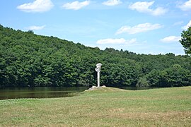 The Sainte-Hélène Lake, in Bujaleuf | |
 Coat of arms | |
show Location of Bujaleuf | |
 Bujaleuf | |
| Coordinates: 45°47′51″N 1°37′50″E / 45.79750°N 1.6306°ECoordinates: 45°47′51″N 1°37′50″E / 45.79750°N 1.6306°E | |
| Country | France |
| Region | Nouvelle-Aquitaine |
| Department | Haute-Vienne |
| Arrondissement | Limoges |
| Canton | Eymoutiers |
| Intercommunality | Portes de Vassivière |
| Government | |
| • Mayor (2020–2026) | Jean-Michel Bidaud[1] |
| Area 1 | 41.17 km2 (15.90 sq mi) |
| Population (Jan. 2018)[2] | 821 |
| • Density | 20/km2 (52/sq mi) |
| Time zone | UTC+01:00 (CET) |
| • Summer (DST) | UTC+02:00 (CEST) |
| INSEE/Postal code | 87024 /87460 |
| Elevation | 290–536 m (951–1,759 ft) |
| 1 French Land Register data, which excludes lakes, ponds, glaciers > 1 km2 (0.386 sq mi or 247 acres) and river estuaries. | |


Bujaleuf (French pronunciation: [byʒalœf]; Occitan: Bujaleu) is a commune in the Haute-Vienne department in the Nouvelle-Aquitaine region in western France.
See also[]
References[]
- ^ "Répertoire national des élus: les maires". data.gouv.fr, Plateforme ouverte des données publiques françaises (in French). 2 December 2020.
- ^ "Populations légales 2018". INSEE. 28 December 2020.
| Wikimedia Commons has media related to Bujaleuf. |
| show Authority control |
|---|
This Haute-Vienne geographical article is a stub. You can help Wikipedia by . |
Categories:
- Communes of Haute-Vienne
- Haute-Vienne geography stubs