Saint-Priest-Taurion
Saint-Priest-Taurion | |
|---|---|
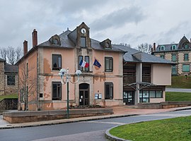 Town hall of Saint-Priest-Taurion | |
show Location of Saint-Priest-Taurion | |
 Saint-Priest-Taurion | |
| Coordinates: 45°53′15″N 1°24′03″E / 45.88750°N 1.4008°ECoordinates: 45°53′15″N 1°24′03″E / 45.88750°N 1.4008°E | |
| Country | France |
| Region | Nouvelle-Aquitaine |
| Department | Haute-Vienne |
| Arrondissement | Limoges |
| Canton | Saint-Léonard-de-Noblat |
| Government | |
| • Mayor (2020–2026) | Claudette Rossander[1] |
| Area 1 | 27.00 km2 (10.42 sq mi) |
| Population (Jan. 2018)[2] | 2,886 |
| • Density | 110/km2 (280/sq mi) |
| Time zone | UTC+01:00 (CET) |
| • Summer (DST) | UTC+02:00 (CEST) |
| INSEE/Postal code | 87178 /87480 |
| Elevation | 223–428 m (732–1,404 ft) |
| 1 French Land Register data, which excludes lakes, ponds, glaciers > 1 km2 (0.386 sq mi or 247 acres) and river estuaries. | |


Saint-Priest-Taurion (French pronunciation: [sɛ̃ pʁijɛ(st) toʁjɔ̃]; Occitan: Sent Prech) is a commune in the Haute-Vienne department in the Nouvelle-Aquitaine region in west-central France. Its area code is 87178 and, its zip code is 87480.
See also[]
References[]
- ^ "Répertoire national des élus: les maires". data.gouv.fr, Plateforme ouverte des données publiques françaises (in French). 2 December 2020.
- ^ "Populations légales 2018". INSEE. 28 December 2020.
| Wikimedia Commons has media related to Saint-Priest-Taurion. |
| show Authority control |
|---|
This Haute-Vienne geographical article is a stub. You can help Wikipedia by . |
Categories:
- Communes of Haute-Vienne
- Haute-Vienne geography stubs