Saint-Yrieix-la-Perche
Saint-Yrieix-la-Perche | |
|---|---|
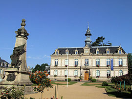 Town hall | |
 Coat of arms | |
show Location of Saint-Yrieix-la-Perche | |
 Saint-Yrieix-la-Perche | |
| Coordinates: 45°30′55″N 1°12′15″E / 45.5153°N 1.2042°ECoordinates: 45°30′55″N 1°12′15″E / 45.5153°N 1.2042°E | |
| Country | France |
| Region | Nouvelle-Aquitaine |
| Department | Haute-Vienne |
| Arrondissement | Limoges |
| Canton | Saint-Yrieix-la-Perche |
| Intercommunality | Pays de Saint-Yrieix |
| Government | |
| • Mayor (2020–2026) | Daniel Boisserie |
| Area 1 | 100.98 km2 (38.99 sq mi) |
| Population (Jan. 2018)[1] | 6,729 |
| • Density | 67/km2 (170/sq mi) |
| Time zone | UTC+01:00 (CET) |
| • Summer (DST) | UTC+02:00 (CEST) |
| INSEE/Postal code | 87187 /87500 |
| Elevation | 283–498 m (928–1,634 ft) (avg. 369 m or 1,211 ft) |
| 1 French Land Register data, which excludes lakes, ponds, glaciers > 1 km2 (0.386 sq mi or 247 acres) and river estuaries. | |


Saint-Yrieix-la-Perche (French pronunciation: [sɛ̃t‿iʁje la pɛʁʃ]; Occitan: Sent Iriès, Sent Irièg) is a commune in the Haute-Vienne department, region of Nouvelle-Aquitaine, France.
It is significant as the first place where kaolin was found in France, a discovery of great importance to French porcelain manufacturers.
Its name refers to Saint Yrieix (Aredius). Inhabitants are known as Arédiens.
See also[]
References[]
- ^ "Populations légales 2018". INSEE. 28 December 2020.
| Wikimedia Commons has media related to Saint-Yrieix-la-Perche. |
| show Authority control |
|---|
This Haute-Vienne geographical article is a stub. You can help Wikipedia by . |
Categories:
- Communes of Haute-Vienne
- Haute-Vienne geography stubs