Glanges
Glanges | |
|---|---|
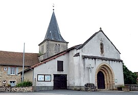 The church in Glanges | |
show Location of Glanges | |
 Glanges | |
| Coordinates: 45°40′16″N 1°27′14″E / 45.6711°N 1.4539°ECoordinates: 45°40′16″N 1°27′14″E / 45.6711°N 1.4539°E | |
| Country | France |
| Region | Nouvelle-Aquitaine |
| Department | Haute-Vienne |
| Arrondissement | Limoges |
| Canton | Eymoutiers |
| Government | |
| • Mayor (2020–2026) | Emilie Gillet[1] |
| Area 1 | 22.85 km2 (8.82 sq mi) |
| Population (Jan. 2018)[2] | 510 |
| • Density | 22/km2 (58/sq mi) |
| Time zone | UTC+01:00 (CET) |
| • Summer (DST) | UTC+02:00 (CEST) |
| INSEE/Postal code | 87072 /87380 |
| Elevation | 290–456 m (951–1,496 ft) |
| 1 French Land Register data, which excludes lakes, ponds, glaciers > 1 km2 (0.386 sq mi or 247 acres) and river estuaries. | |


Glanges (Occitan: Glanjas) is a commune in the Haute-Vienne department in the Nouvelle-Aquitaine region in west-central France.
Geography[]
The river Briance flows west through the northern part of the commune and forms part of its northeastern and northwestern borders.
See also[]
References[]
- ^ "Répertoire national des élus: les maires". data.gouv.fr, Plateforme ouverte des données publiques françaises (in French). 2 December 2020.
- ^ "Populations légales 2018". INSEE. 28 December 2020.
| Wikimedia Commons has media related to Glanges. |
| show Authority control |
|---|
This Haute-Vienne geographical article is a stub. You can help Wikipedia by . |
Categories:
- Communes of Haute-Vienne
- Haute-Vienne geography stubs