Eybouleuf
Eybouleuf | |
|---|---|
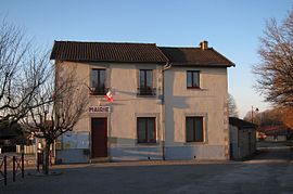 The town hall in Eybouleuf | |
show Location of Eybouleuf | |
 Eybouleuf | |
| Coordinates: 45°47′46″N 1°28′59″E / 45.7961°N 1.4831°ECoordinates: 45°47′46″N 1°28′59″E / 45.7961°N 1.4831°E | |
| Country | France |
| Region | Nouvelle-Aquitaine |
| Department | Haute-Vienne |
| Arrondissement | Limoges |
| Canton | Saint-Léonard-de-Noblat |
| Intercommunality | Noblat |
| Government | |
| • Mayor (2020–2026) | Sébastien Vincent[1] |
| Area 1 | 10.83 km2 (4.18 sq mi) |
| Population (Jan. 2018)[2] | 447 |
| • Density | 41/km2 (110/sq mi) |
| Time zone | UTC+01:00 (CET) |
| • Summer (DST) | UTC+02:00 (CEST) |
| INSEE/Postal code | 87062 /87400 |
| Elevation | 270–433 m (886–1,421 ft) |
| 1 French Land Register data, which excludes lakes, ponds, glaciers > 1 km2 (0.386 sq mi or 247 acres) and river estuaries. | |


Eybouleuf (Occitan: Esboleu) is a commune in the Haute-Vienne department in the Nouvelle-Aquitaine region in western France.
Inhabitants are known as Saccas.
See also[]
References[]
- ^ "Répertoire national des élus: les maires". data.gouv.fr, Plateforme ouverte des données publiques françaises (in French). 2 December 2020.
- ^ "Populations légales 2018". INSEE. 28 December 2020.
| Wikimedia Commons has media related to Eybouleuf. |
This Haute-Vienne geographical article is a stub. You can help Wikipedia by . |
Categories:
- Communes of Haute-Vienne
- Haute-Vienne geography stubs