Bushkill Township, Northampton County, Pennsylvania
Bushkill Township, Pennsylvania | |
|---|---|
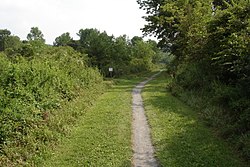 A trail in Jacobsburg Environmental Education Center a PA state park in Bushkill Township. | |
 Location of Pennsylvania in the United States | |
| Coordinates: 40°44′59″N 75°20′29″W / 40.74972°N 75.34139°WCoordinates: 40°44′59″N 75°20′29″W / 40.74972°N 75.34139°W | |
| Country | United States |
| State | Pennsylvania |
| County | Northampton |
| Area | |
| • Total | 25.25 sq mi (65.40 km2) |
| • Land | 24.93 sq mi (64.56 km2) |
| • Water | 0.32 sq mi (0.84 km2) |
| Elevation | 659 ft (201 m) |
| Population (2010) | |
| • Total | 8,178 |
| • Estimate (2016)[2] | 8,450 |
| • Density | 338.99/sq mi (130.89/km2) |
| Time zone | UTC-5 (EST) |
| • Summer (DST) | UTC-4 (EDT) |
| Area code(s) | 610 |
| FIPS code | 42-095-10400 |
| Website | www |

Bushkill Township is a township in Northampton County in the Lehigh Valley region of Pennsylvania, United States. Its population was 6,982 at the 2000 census.
Geography[]
According to the United States Census Bureau, the township has a total area of 25.3 square miles (66 km2), of which, 25.3 square miles (66 km2) of it is land and 0.1 square miles (0.26 km2) of it (0.20%) is water. It is in the Delaware watershed and drained by the Bushkill Creek, except for a very small area in the southwest drained by the Monocacy Creek into the Lehigh River. Blue Mountain forms its natural northern boundary. Its villages include Bushkill Center, Cherry Hill, Clearfield, Copella (also in Moore Township,) Katellen, and Rismiller. Its numbered routes include the 33 Expressway and 512.
Neighboring municipalities[]
- Moore Township (west)
- Upper Nazareth Township (south)
- Plainfield Township (east)
- Ross Township, Monroe County (north)
Demographics[]
| Historical population | |||
|---|---|---|---|
| Census | Pop. | %± | |
| 2000 | 6,982 | — | |
| 2010 | 8,178 | 17.1% | |
| 2016 (est.) | 8,450 | [2] | 3.3% |
| U.S. Decennial Census[3] | |||
As of the census[4] of 2000, there were 6,982 people, 2,333 households, and 2,011 families residing in the township. The population density was 276.1 people per square mile (106.6/km2). There were 2,406 housing units at an average density of 95.2/sq mi (36.7/km2). The racial makeup of the township was 98.27% White, 0.19% African American, 0.24% Native American, 0.39% Asian, 0.34% from other races, and 0.57% from two or more races. Hispanic or Latino of any race were 1.00% of the population.
There were 2,333 households, out of which 42.0% had children under the age of 18 living with them, 76.4% were married couples living together, 6.1% had a female householder with no husband present, and 13.8% were non-families. 11.1% of all households were made up of individuals, and 5.2% had someone living alone who was 65 years of age or older. The average household size was 2.99 and the average family size was 3.22.
In the township the population was spread out, with 28.1% under the age of 18, 5.9% from 18 to 24, 29.8% from 25 to 44, 26.9% from 45 to 64, and 9.3% who were 65 years of age or older. The median age was 38 years. For every 100 females, there were 101.0 males. For every 100 females age 18 and over, there were 99.2 males.
The median income for a household in the township was $63,966, and the median income for a family was $67,649. Males had a median income of $42,097 versus $30,275 for females. The per capita income for the township was $23,569. About 1.9% of families and 3.1% of the population were below the poverty line, including 1.3% of those under age 18 and 10.3% of those age 65 or over.
Public education[]
Bushkill Township is served by the Nazareth Area School District.
Public safety[]
The Bushkill Township Volunteer Fire Company provides Fire-Rescue, Basic and Advanced Life Support services to all residents and travelers within Bushkill Township.
References[]
- ^ "2016 U.S. Gazetteer Files". United States Census Bureau. Retrieved Aug 14, 2017.
- ^ a b "Population and Housing Unit Estimates". Retrieved June 9, 2017.
- ^ "Census of Population and Housing". Census.gov. Retrieved June 4, 2016.
- ^ "U.S. Census website". United States Census Bureau. Retrieved 2008-01-31.
External links[]
Municipalities and communities of Northampton County, Pennsylvania, United States | ||
|---|---|---|
| Cities |  | |
| Boroughs | ||
| Townships | ||
| CDPs | ||
| Other communities | ||
| Footnotes | ‡This populated place also has portions in an adjacent county or counties | |
| ||
- Townships in Northampton County, Pennsylvania
- Townships in Pennsylvania