Glendon, Pennsylvania
Borough of Glendon | |
|---|---|
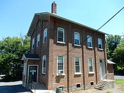 Glendon Borough Hall. | |
 Location of Glendon in Northampton County, Pennsylvania. | |
 Glendon Location of Glendon in Pennsylvania  Glendon Glendon (the United States) | |
| Coordinates: 40°39′44″N 75°14′09″W / 40.66222°N 75.23583°WCoordinates: 40°39′44″N 75°14′09″W / 40.66222°N 75.23583°W | |
| Country | United States |
| State | Pennsylvania |
| County | Northampton |
| Area | |
| • Total | 0.62 sq mi (1.60 km2) |
| • Land | 0.61 sq mi (1.59 km2) |
| • Water | 0.00 sq mi (0.00 km2) |
| Elevation | 230 ft (70 m) |
| Population (2010) | |
| • Total | 440 |
| • Estimate (2019)[2] | 358 |
| • Density | 582.11/sq mi (224.68/km2) |
| Time zone | UTC-5 (EST) |
| • Summer (DST) | UTC-4 (EDT) |
| ZIP code | 18042 |
| Area codes | 610 and 484 |
| FIPS code | 42-29568 |
Glendon is a borough in Northampton County, Pennsylvania, United States. Glendon is located in the Lehigh Valley region of the state.
The population of Glendon was 440 at the 2010 census.
Geography[]
Glendon is located at 40°39′44″N 75°14′9″W / 40.66222°N 75.23583°W (40.662152, -75.235758).[3]
According to the United States Census Bureau, the borough has a total area of 0.6 square miles (1.6 km2), all of it land.
Demographics[]
As of the census[5] of 2000, there were 367 people, 139 households, and 98 families residing in the borough. The population density was 573.7 people per square mile (221.4/km2). There were 150 housing units at an average density of 234.5 per square mile (90.5/km2). The racial makeup of the borough was 95.64% White, 0.82% African American, 1.36% Asian, 0.27% from other races, and 1.91% from two or more races. Hispanic or Latino of any race were 2.18% of the population.
There were 139 households, out of which 33.1% had children under the age of 18 living with them, 58.3% were married couples living together, 7.9% had a female householder with no husband present, and 28.8% were non-families. 23.0% of all households were made up of individuals, and 16.5% had someone living alone who was 65 years of age or older. The average household size was 2.64 and the average family size was 3.15.
In the borough the population was spread out, with 28.9% under the age of 18, 4.4% from 18 to 24, 30.2% from 25 to 44, 23.4% from 45 to 64, and 13.1% who were 65 years of age or older. The median age was 36 years. For every 100 females there were 109.7 males. For every 100 females age 18 and over, there were 107.1 males.
The median income for a household in the borough was $42,969, and the median income for a family was $45,417. Males had a median income of $37,813 versus $33,375 for females. The per capita income for the borough was $17,593. About 12.9% of families and 15.4% of the population were below the poverty line, including 28.4% of those under age 18 and 9.1% of those age 65 or over.
Public education[]
The Borough is served by the Wilson Area School District.
Gallery[]
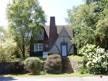
House on Franklin St.
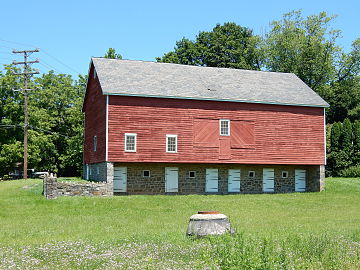
Barn on High St.


References[]
- ^ "2019 U.S. Gazetteer Files". United States Census Bureau. Retrieved July 28, 2020.
- ^ a b "Population and Housing Unit Estimates". United States Census Bureau. May 24, 2020. Retrieved May 27, 2020.
- ^ "US Gazetteer files: 2010, 2000, and 1990". United States Census Bureau. 2011-02-12. Retrieved 2011-04-23.
- ^ "Census of Population and Housing". U.S. Census Bureau. Retrieved 11 December 2013.
- ^ a b "U.S. Census website". United States Census Bureau. Retrieved 2008-01-31.
- ^ "Incorporated Places and Minor Civil Divisions Datasets: Subcounty Resident Population Estimates: April 1, 2010 to July 1, 2012". Population Estimates. U.S. Census Bureau. Archived from the original on June 11, 2013. Retrieved 11 December 2013.
| Wikimedia Commons has media related to Glendon, Pennsylvania. |
Places adjacent to Glendon, Pennsylvania | ||||||||||||||||
|---|---|---|---|---|---|---|---|---|---|---|---|---|---|---|---|---|
| ||||||||||||||||
Municipalities and communities of Northampton County, Pennsylvania, United States | ||
|---|---|---|
| Cities |  | |
| Boroughs | ||
| Townships | ||
| CDPs | ||
| Other communities | ||
| Footnotes | ‡This populated place also has portions in an adjacent county or counties | |
| ||
- Populated places established in 1843
- Boroughs in Northampton County, Pennsylvania
- 1843 establishments in Pennsylvania