Hellertown, Pennsylvania
Hellertown, Pennsylvania | |
|---|---|
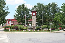 Detwiller Plaza in downtown Hellertown | |
 Location of Hellertown in Northampton County, Pennsylvania. | |
 Hellertown Location of Hellertown in Pennsylvania | |
| Coordinates: 40°35′03″N 75°20′17″W / 40.58417°N 75.33806°WCoordinates: 40°35′03″N 75°20′17″W / 40.58417°N 75.33806°W | |
| Country | United States |
| State | Pennsylvania |
| County | Northampton |
| Government | |
| • Mayor | David J. Heintzelman (D)[1] |
| Area | |
| • Total | 1.32 sq mi (3.41 km2) |
| • Land | 1.31 sq mi (3.40 km2) |
| • Water | 0.00 sq mi (0.01 km2) |
| Elevation | 322 ft (98 m) |
| Population (2010) | |
| • Total | 5,898 |
| • Estimate (2019)[3] | 5,831 |
| • Density | 4,444.36/sq mi (1,716.46/km2) |
| Time zone | UTC-5 (EST) |
| • Summer (DST) | UTC-4 (EDT) |
| ZIP Code | 18055 |
| Area code(s) | 610 and 484 |
| FIPS code | 42-33744 |
| Website | www |


Hellertown is a borough in Northampton County, Pennsylvania, United States. Hellertown is located in the Lehigh Valley region of the state, and geographically in the Lehigh Valley's Saucon Valley. The population of Hellertown was 5,898 at the 2010 census.
Hellertown is home to Lost River Caverns.
Geography[]
Hellertown is located at 40°35′3″N 75°20′17″W / 40.58417°N 75.33806°W (40.584099, -75.338139).[4]
According to the United States Census Bureau, the borough has a total area of 1.3 square miles (3.4 km2), all land.
Government and politics[]
Legislators[]
- State Representative Robert L. Freeman, Democrat, 136th district
- State Senator Lisa Boscola, Democrat, 18th district
- US Representative Susan Wild, Democrat, 7th district
Borough Council[]
Hellertown Borough elects seven council members at large.
- Thomas Rieger, President
- Philip Weber, Vice President
- James Hill
- Earl Hill
- Gil Stauffer
- Mike McKenna
- Matt Marcincin

Transportation[]
Pennsylvania Route 412 runs north-south through Hellertown on Main Street, heading north to Bethlehem and south into Bucks County, where it provides access to Pennsylvania Route 611. PA 412 has an interchange with Interstate 78 on the northern edge of Hellertown, which heads west to Allentown and Harrisburg and east to Easton and New York City.[5]
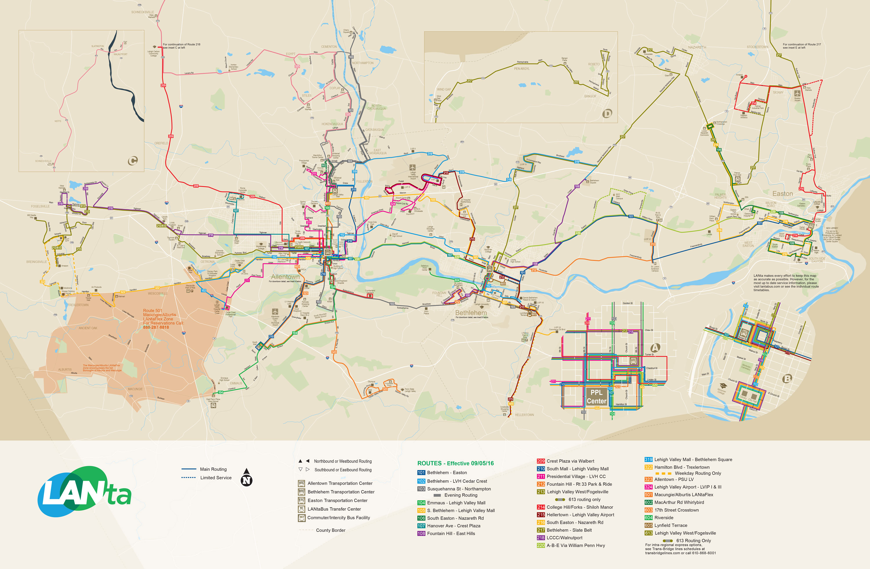
LANTA provides bus service to Hellertown along Route 215, which provides service Monday-Saturday north to Bethlehem and Lehigh Valley International Airport, and Route 105, which provides Sunday service north to Bethlehem and the Lehigh Valley Mall.[6] Klein Transportation and Trans-Bridge Lines provide bus service from Hellertown to New York City from a park and ride lot located at the interchange between I-78 and PA 412.[7][8] Hellertown formerly had commuter rail service along SEPTA's Bethlehem Line north to Bethlehem and south to Philadelphia at Hellertown station, but service ended in 1981.
Demographics[]
| Historical population | |||
|---|---|---|---|
| Census | Pop. | %± | |
| 1880 | 605 | — | |
| 1890 | 708 | 17.0% | |
| 1900 | 745 | 5.2% | |
| 1910 | 915 | 22.8% | |
| 1920 | 3,008 | 228.7% | |
| 1930 | 3,851 | 28.0% | |
| 1940 | 4,031 | 4.7% | |
| 1950 | 5,435 | 34.8% | |
| 1960 | 6,716 | 23.6% | |
| 1970 | 6,615 | −1.5% | |
| 1980 | 6,025 | −8.9% | |
| 1990 | 5,662 | −6.0% | |
| 2000 | 5,606 | −1.0% | |
| 2010 | 5,898 | 5.2% | |
| 2019 (est.) | 5,831 | [3] | −1.1% |
| Sources:[9][10][11] | |||
As of the census[10] of 2000, there were 5,606 people, 2,448 households, and 1,571 families residing in the borough. The population density was 4,180.8 people per square mile (1,615.3/km2). There were 2,570 housing units at an average density of 1,916.6 per square mile (740.5/km2). The racial makeup of the borough was 98.20% White, 0.30% African American, 0.07% Native American, 0.20% Asian, 0.68% from other races, and 0.55% from two or more races. Hispanic or Latino of any race were 2.48% of the population.
There were 2,448 households, out of which 24.7% had children under the age of 18 living with them, 51.2% were married couples living together, 10.3% had a female householder with no husband present, and 35.8% were non-families. 30.5% of all households were made up of individuals, and 17.2% had someone living alone who was 65 years of age or older. The average household size was 2.29 and the average family size was 2.85.
In the borough the population was distributed, with 20.2% under the age of 18, 6.6% from 18 to 24, 29.0% from 25 to 44, 21.2% from 45 to 64, and 23.1% who were 65 years of age or older. The median age was 42 years. For every 100 females there were 89.3 males. For every 100 females age 18 and over, there were 86.2 males.
The median income for a household in the borough was $39,651, and the median income for a family was $49,604. Males had a median income of $37,935 versus $26,322 for females. The per capita income for the borough was $20,119. About 4.1% of families and 4.6% of the population were below the poverty line, including 6.5% of those under age 18 and 3.3% of those age 65 or over.
Public education[]
Hellertown Borough and Lower Saucon Township are served by the Saucon Valley School District. Saucon Valley School District is made up of an elementary school, middle school and high school.
Media[]
Hellertown and adjacent Lower Saucon Township are covered by The Valley Voice as well as Saucon Source, a local news website that is updated daily with stories about local government, schools, business, development, crime, sports, events and more.[12]
Notable people[]
- Birthplace of [[Gary Eugene Bruder], Bishop of Oklahoma City-Tulsa
- Home of Allen Woodring, 1920 Olympic gold medalist in the 200m.
- Birthplace of the mathematician and professor Carl Benjamin Boyer[13]
- Home of Ted Poley, lead singer of the 1980s rock band Danger Danger
- Home of Glenn Hetrick, special make-up effects artist/designer
Mentioned in[]
- Solved episode titled "Sin" on Investigation Discovery network. This documentary profiles the murder of Hellertown resident Rhonda Smith, who was found dead in Trinity Lutheran Church at Springfield Township, Bucks County. (Original Airdate: August 31, 2009).
- Hellertown is mentioned in the Kurt Vonnegut novel Slaughterhouse Five, as well as Breakfast of Champions.
References[]
- ^ Deegan, Jim (17 May 2017). "Northampton County primary election results 2017". lehighvalleylive. Retrieved 1 January 2020.
- ^ "2019 U.S. Gazetteer Files". United States Census Bureau. Retrieved July 28, 2020.
- ^ Jump up to: a b "Population and Housing Unit Estimates". United States Census Bureau. May 24, 2020. Retrieved May 27, 2020.
- ^ "US Gazetteer files: 2010, 2000, and 1990". United States Census Bureau. 2011-02-12. Retrieved 2011-04-23.
- ^ Northampton County, Pennsylvania Highway Map (PDF) (Map). PennDOT. 2015. Retrieved January 17, 2016.
- ^ System Map (Map). LANTA. Retrieved February 14, 2018.
- ^ "Klein Transportation and OurBus announce introductory schedule and rates". Allentown, PA: WFMZ-TV. February 10, 2019. Retrieved February 10, 2019.
- ^ "Bieber sets new pick-up, drop-off point in New York City". Allentown, PA: WFMZ-TV. July 27, 2018. Retrieved July 28, 2018.
- ^ "Census of Population and Housing". U.S. Census Bureau. Retrieved 11 December 2013.
- ^ Jump up to: a b "U.S. Census website". United States Census Bureau. Retrieved 2008-01-31.
- ^ "Incorporated Places and Minor Civil Divisions Datasets: Subcounty Resident Population Estimates: April 1, 2010 to July 1, 2012". Population Estimates. U.S. Census Bureau. Archived from the original on 11 June 2013. Retrieved 11 December 2013.
- ^ "About Us - Saucon SourceSaucon Source". sauconsource.com. 2014-10-28. Retrieved 2017-01-14.
- ^ Dauben, Joseph Warren; Scriba, Christoph J. Writing the history of mathematics: its historical development, Birkhäuser, 2002. Cf. pp.380-381 for the biography of Boyer.
External links[]
| Wikimedia Commons has media related to Hellertown, Pennsylvania. |
 Hellertown travel guide from Wikivoyage
- Borough website
- Community website
- Hellertown Historical Society website
- Our Town, Hellertown, WLVT video
| show Municipalities and communities of Northampton County, Pennsylvania, United States |
|---|

| show Authority control |
|---|
- Populated places established in 1742
- Boroughs in Northampton County, Pennsylvania
- 1742 establishments in Pennsylvania