Bystřice pod Lopeníkem
This article includes a list of references, related reading or external links, but its sources remain unclear because it lacks inline citations. (January 2015) |
Bystřice pod Lopeníkem | |
|---|---|
Municipality | |
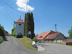 Belfry | |
 Flag  Coat of arms | |
 Bystřice pod Lopeníkem | |
| Coordinates: 48°58′9″N 17°46′16″E / 48.96917°N 17.77111°ECoordinates: 48°58′9″N 17°46′16″E / 48.96917°N 17.77111°E | |
| Country | |
| Region | Zlín |
| District | Uherské Hradiště |
| Area | |
| • Total | 13.42 km2 (5.18 sq mi) |
| Elevation | 365 m (1,198 ft) |
| Population (2006) | |
| • Total | 814 |
| • Density | 61/km2 (160/sq mi) |
| Postal code | 687 55 |

Bystřice pod Lopeníkem is a village and municipality (obec) in Uherské Hradiště District in the Zlín Region of the Czech Republic.
The municipality covers an area of 13.42 square kilometres (5.18 sq mi), and has a population of 814 (as at 3 July 2006).
Bystřice pod Lopeníkem lies approximately 26 kilometres (16 mi) south-east of Uherské Hradiště, 31 km (19 mi) south of Zlín, and 272 km (169 mi) south-east of Prague.
References[]
| Wikimedia Commons has media related to Bystřice pod Lopeníkem. |
| show Authority control |
|---|
This Zlín Region location article is a stub. You can help Wikipedia by . |
Categories:
- Villages in Uherské Hradiště District
- Zlín Region geography stubs