Dolní Němčí
Dolní Němčí | |
|---|---|
 Church of Saints Philip and James | |
 Flag  Coat of arms | |
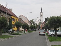
 Dolní Němčí Location in the Czech Republic | |
| Coordinates: 48°58′6″N 17°35′9″E / 48.96833°N 17.58583°ECoordinates: 48°58′6″N 17°35′9″E / 48.96833°N 17.58583°E | |
| Country | |
| Region | Zlín |
| District | Uherské Hradiště |
| First mentioned | 1358 |
| Government | |
| • Mayor | František Hajdůch |
| Area | |
| • Total | 9.91 km2 (3.83 sq mi) |
| Elevation | 256 m (840 ft) |
| Population (2020-01-01[1]) | |
| • Total | 2,977 |
| • Density | 300/km2 (780/sq mi) |
| Time zone | UTC+1 (CET) |
| • Summer (DST) | UTC+2 (CEST) |
| Postal code | 687 62 |
| Website | www |

Dolní Němčí (until 1925 Dolněmčí) is a municipality and village in Uherské Hradiště District in the Zlín Region of the Czech Republic. It has about 3,000 inhabitants.
Dolní Němčí lies approximately 15 kilometres (9 mi) south-east of Uherské Hradiště, 30 km (19 mi) south of Zlín, and 290 km (180 mi) south-east of Prague.
Culture and sport[]
There are many ensembles including foklor group NK Dolněmčan and football clubs designated for all age groups ranging from small children up to adults. Gamekeeping also has a long tradition as in the whole Zlín Region.
Twin towns – sister cities[]
Dolní Němčí is twinned with:[2]
 Myjava, Slovakia
References[]
- ^ "Population of Municipalities – 1 January 2020". Czech Statistical Office. 2020-04-30.
- ^ "Hodnotiaca správa programového rozpočtu mesta Myjava k 31. 12. 2018" (PDF). myjava.sk (in Slovak). Myjava. p. 20 (53). Retrieved 2019-09-05.
External links[]
| Wikimedia Commons has media related to Dolní Němčí. |
| Authority control: National libraries |
|---|
This Zlín Region location article is a stub. You can help Wikipedia by . |
Categories:
- Villages in Uherské Hradiště District
- Zlín Region geography stubs