Caraquet Parish, New Brunswick
Caraquet | |
|---|---|
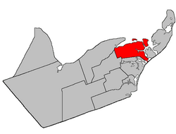 Location within Gloucester County, New Brunswick | |
| Coordinates: 47°43′39″N 64°52′30″W / 47.7275°N 64.875°W | |
| Country | |
| Province | |
| County | Gloucester |
| Erected | 1831 |
| Area | |
| • Land | 109.97 km2 (42.46 sq mi) |
| Population (2016)[1] | |
| • Total | 1,337 |
| • Density | 12.2/km2 (32/sq mi) |
| • Change 2011-2016 | |
| • Dwellings | 668 |
| Time zone | UTC-4 (AST) |
| • Summer (DST) | UTC-3 (ADT) |

Caraquet is a civil parish in Gloucester County, New Brunswick, Canada.[2]
All municipalities and LSDs are members of the Acadian Peninsula Regional Service Commission (APRSC).[3]
Origin of name[]
Historian William F. Ganong described the origin of the name as uncertain, the Mi'kmaq Caluget possibly being their pronunciation of a French name for the area.[4]
History[]
Caraquet was erected in 1831 from Saumarez Parish;[5] it originally included Shippegan Parish and Paquetville Parish.
In 1851 Shippegan was erected as its own parish.[6]
In 1897 Paquetville was erected as its own parish.[7]
Boundaries[]
Caraquet Parish is bounded:[2][8][9]
- on the north by the Caraquet River, Caraquet Bay, and Chaleur Bay;
- on the east by Baie de Shippagan, Baie Brûlé, Saint-Simon Inlet, Baie Saint-Simon-Sud (the line passing west of Île à William), a line from Baie-Saint-Simon-Sud to Baie de Petit-Pokemouche across the isthmus connecting Taylor Island to the mainland, and the Gulf of Saint Lawrence.
- on the south by the mouth of the Pokemouche River, Grande Anse, the rear line of a tier of grants along the Pokemouche River and Route 345 and its prolongation to a point 300 chains (6.035km) inland, then in a direct line to the northwestern corner of 255 on the western side of Lavigne Road, a bit south of the end of Chemin Gauvin est.
- on the west by the rear line of grants on the west side of Lavigne Road northwesterly three grants, then slightly more westerly to the rear line of grants on the southern side of Duval Road, then southwesterly to the southernmost corner of the tier of grants, then northwesterly along the western line of the Duval Road tier and its prolongation to the Caraquet River.
- Caraquet Island, Pokesudie, L'Îlette de Pokesudie, and Munro Island are all in Caraquet Parish.
Governance[]
The northern mainland of the parish is divided between three municipalities; from east to west, these are the village of Bas-Caraquet, the town of Caraquet, and the eastern part of the village of Bertrand. The remainder of the parish consists of four LSDs and part of a fifth. These LSDs are:
- Blanchard Settlement (August 4, 1987)[10] assesses for the additional services of street lighting and community services, both added in 1988. Consists of the community of Village-Blanchard (formerly Blanchard Settlement) and grants along the Waugh and Godin Roads.
- Inkerman Centre (extended into parish on April 21, 1987)[11] assesses for the additional service of street lighting. The portion in this parish consists of the grants south of the wetlands along Ruisseau à Jules and all of the parish south of those grants.
- Pokesudie (March 22, 1988)[12] assesses for the additional services of street lighting (added 1988) and community services. Consists of Pokesudie Island and Little Pokesudie Island. The community of Pokesudie is on the main island.
- St. Simon (September 22, 1971)[13] assesses for the additional services of street lighting and recreational facilities. Consists of grants east of the former CNR line and north of the wetlands along Ruisseau à Isaac. Includes the communities of Centre-Saint-Simon and Haut-Saint-Simon; the corresponding taxing authority is Saint-Simon.[14]
- The parish of Caraquet (established 1968).[15] Originally including all the unincorporated parts of the parish, it has been reduced to four mainland areas and two islands. The taxing authority is Par. de Caraquet.[14]
- Grants in the southwestern corner of the parish, along Thériault, Lavigne, and Haché Roads, containing more than five thousand acres.
- Wetlands along Ruisseau à Isaac and Ruisseau à Jules.
- Ten grants between the mouth of the Saint-Simon River and the southwestern corner of Bas-Caraquet, containing about nine hundred acres.
- A small area on the southern bank of the Saint-Simon River where the Caraquet boundary cuts through a peninsula, containing less than five acres.
- Munro Island
- Caraquet Island
Communities[]
Communities at least partly within the parish.[8][9][16] bold indicates an incorporated municipality
- Bas-Caraquet
- Middle Caraquet
- Morais
- Bertrand
- Thériault
- Caraquet
- Haut-Caraquet
- Le Bouthillier
- Pointe-Rocheuse
- Sainte-Anne-du-Bocage
- Centre-Saint-Simon
- Haut-Saint-Simon
- Pokesudie
- Village-Blanchard
Bodies of water[]
Bodies of water[a] at least partly within the parish.[8][9][16]
- Rivière à Brideau
- Petite rivière Caraquet
- Saint-Simon River
- Waugh River
- Caraquet Bay
- Caraquet Harbour
- Chaleur Bay
- Baie de Petit-Pokemouche
- Petit-Pokemouche Gully
- Pokemouche Gully
- Saint-Simon Inlet
- Baie Saint-Simon-Nord
- Baie Saint-Simon-Sud
- Shippegan Bay
- more than a half-dozen named lakes
Islands[]
Islands at least partly within the parish.[8][9][16]
- Caraquet Island
- Little Pokesudie Island (French L'Îlette de Pokesudie)
- Munro Island
- Pokesudie Island
Other notable places[]
Parks, historic sites, and other noteworthy places at least partly within the parish.[8][9][16]
Demographics[]
Parish population total does not include incorporated municipalities
Population[]
| Canada census – Caraquet Parish, New Brunswick community profile | |||
|---|---|---|---|
| 2016 | 2011 | 2006 | |
| Population: | 1,337 (-3.3% from 2011) | 1,382 (-8.5% from 2006) | 1,511 (-4.9% from 2001) |
| Land area: | 109.97 km2 (42.46 sq mi) | 109.20 km2 (42.16 sq mi) | 109.20 km2 (42.16 sq mi) |
| Population density: | 12.2/km2 (32/sq mi) | 12.7/km2 (33/sq mi) | 13.8/km2 (36/sq mi) |
| Median age: | 51.8 (M: 52.3, F: 51.1) | 48.3 (M: 48.6, F: 48.1) | 44.2 (M: 44.4, F: 43.9) |
| Total private dwellings: | 668 | 618 | 644 |
| Median household income: | $52,224 | $.N/A | $39,145 |
| Notes: 2011 income data for this area has been suppressed for data quality or confidentiality reasons. – References: 2016[17] 2011[18] 2006[19] earlier[20] | |||
|
|
| |||||||||||||||||||||||||||
| [21][22][1] | |||||||||||||||||||||||||||||
Language[]
| Canada Census Mother Tongue - Caraquet Parish, New Brunswick[21] | ||||||||||||||||||
|---|---|---|---|---|---|---|---|---|---|---|---|---|---|---|---|---|---|---|
| Census | Total | French
|
English
|
French & English
|
Other
| |||||||||||||
| Year | Responses | Count | Trend | Pop % | Count | Trend | Pop % | Count | Trend | Pop % | Count | Trend | Pop % | |||||
2011
|
1,365
|
1,340 | 98.17% | 25 | 1.83% | 0 | 0.00% | 0 | 0.00% | |||||||||
2006
|
1,500
|
1,450 | 96.67% | 40 | 2.67% | 0 | 0.00% | 10 | 0.66% | |||||||||
2001
|
1,575
|
1,565 | 99.36% | 10 | 0.64% | 0 | 0.00% | 0 | 0.00% | |||||||||
1996
|
1,720
|
1,675 | n/a | 97.38% | 35 | n/a | 2.04% | 10 | n/a | 0.58% | 0 | n/a | 0.00% | |||||
See also[]
Notes[]
- ^ Not including brooks, ponds or coves.
References[]
- ^ a b c "Census Profile, 2016 Census Caraquet, Parish [Census subdivision], New Brunswick". Statistics Canada. Retrieved September 10, 2019.
- ^ a b "Chapter T-3 Territorial Division Act". Government of New Brunswick. Retrieved 13 November 2020.
- ^ "Communities in each of the 12 Regional Service Commissions (RSC) / Les communautés dans chacune des 12 Commissions de services régionaux (CSR)" (PDF), Government of New Brunswick, July 2017, retrieved 2 February 2021
- ^ Ganong, William F. (1896). A Monograph of the Place-Nomenclature of the Province of New Brunswick. Royal Society of Canada. p. 225. Retrieved 17 March 2021.
- ^ "1 Wm. IV c. 19 An Act to erect Two new Parishes in the County of Gloucester.". Acts of the General Assembly of His Majesty's Province of New-Brunswick, Passed in the Year 1831. Fredericton: Government of New Brunswick. 1831. pp. 68–69. Retrieved 27 March 2021.
- ^ "14 Vic. Local Acts c. 1 An Act for erecting the Parish of Caraquet, in the County of Gloucester, into two separate Parishes.". Acts of the General Assembly of Her Majesty's Province of New Brunswick, Passed in the Year 1851. Fredericton: Government of New Brunswick. 1851. p. 1. Retrieved 27 March 2021. Local Acts have their own page numbering and follow page 56.
- ^ "60 Vic. c. 49 An Act to divide the Parish of Caraquet, in the County of Gloucester, into two Separate Parishes.". Acts of the General Assembly of Her Majesty's Province of New Brunswick. Passed in the Month of March, 1897. Fredericton: Government of New Brunswick. 1897. pp. 362–365. Available as a free ebook from Google Books.
- ^ a b c d e "No. 18". Provincial Archives of New Brunswick. Department of Natural Resources and Energy Development. Retrieved 8 June 2021. Remainder of parish on map 19 at same site.
- ^ a b c d e "035" (PDF). Transportation and Infrastructure. Government of New Brunswick. Retrieved 8 June 2021. Remainder of parish on mapbooks 036, 054–056, and 074–076 at same site.
- ^ Regulation 87-104 under the Municipalities Act.
- ^ Regulation 87-42 under the Municipalities Act.
- ^ Regulation 88-42 under the Municipalities Act.
- ^ "Regulation 71–97 under the Municipalities Act (O. C. 71–678)". The Royal Gazette. Fredericton. 129: 678. 29 September 1971.
- ^ a b "2021 Local Government Statistics for New Brunswick" (PDF). Department of Environment and Local Government. pp. 57–58. Retrieved 27 July 2021.
- ^ "Regulation 68–64 under the Municipalities Act (O. C. 68–592)". The Royal Gazette. Fredericton. 126: 407–408. 24 July 1968.
- ^ a b c d "Search the Canadian Geographical Names Database (CGNDB)". Government of Canada. Retrieved 6 July 2021.
- ^ "2016 Community Profiles". 2016 Canadian Census. Statistics Canada. February 21, 2017. Retrieved 2019-09-10.
- ^ "2011 Community Profiles". 2011 Canadian Census. Statistics Canada. July 5, 2013. Retrieved 2014-04-02.
- ^ "2006 Community Profiles". 2006 Canadian Census. Statistics Canada. March 30, 2011. Retrieved 2014-04-02.
- ^ "2001 Community Profiles". 2001 Canadian Census. Statistics Canada. February 17, 2012.
- ^ a b Statistics Canada: 1996, 2001, 2006, 2011 census
- ^ Caraquet, New Brunswick (Code 1315026) and Gloucester, New Brunswick (Code 1315) (table) 2011 Census of Population. (Statistics Canada).
External links[]
Places adjacent to Caraquet Parish, New Brunswick | ||||||||||||||||
|---|---|---|---|---|---|---|---|---|---|---|---|---|---|---|---|---|
| ||||||||||||||||
| Subdivisions |
|
|---|---|
| Cities | |
| Counties | |
| |
Coordinates: 47°43′39″N 64°52′30″W / 47.72750°N 64.87500°W
- Parishes of Gloucester County, New Brunswick
- Local service districts of Gloucester County, New Brunswick