Albert County, New Brunswick
Albert | |
|---|---|
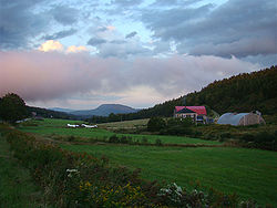 Farm landscape near Alma | |
 Location within New Brunswick | |
| Coordinates: 45°49′N 64°51′W / 45.82°N 64.85°WCoordinates: 45°49′N 64°51′W / 45.82°N 64.85°W | |
| Country | Canada |
| Province | New Brunswick |
| Established | 1845 |
| Area | |
| • Land | 1,807.88 km2 (698.03 sq mi) |
| Population (2016)[1] | |
| • Total | 29,158 |
| • Density | 16.1/km2 (42/sq mi) |
| • Pop 2011-2016 | |
| • Dwellings | 13,111 |
| Time zone | UTC-4 (AST) |
| • Summer (DST) | UTC-3 (ADT) |
| Area code(s) | 506 |

| Wikimedia Commons has media related to Albert County, New Brunswick. |
Albert County (2016 population 29,158)[1] is New Brunswick's third youngest county located on the Western side of the Petitcodiac River on the Chignecto Bay in the Bay of Fundy. Prior to the abolition of county government in 1967, the shire town was Hopewell Cape. The county was established in 1845 from parts of Westmorland County and Saint John County, and named after Prince Albert.[2]
The mineral albertite was discovered a few miles away in 1849, giving rise to Albert Mines.[3]
Census subdivisions[]
Communities[]
There are four municipalities within Albert County (listed by 2016 population):[4]
| Official Name | Status | Area km2 | Population | Parish |
|---|---|---|---|---|
| Riverview | Town | 35.45 | 19,667 | Coverdale |
| Hillsborough | Village | 12.83 | 1,277 | Hillsborough |
| Riverside-Albert | Village | 3.35 | 350 | Hopewell |
| Alma | Village | 47.60 | 213 | Alma |
Parishes[]
The county is subdivided into six parishes (listed by 2016 population):[4]
| Official Name | Area km2 | Population | municipalities | Unincorporated communities |
|---|---|---|---|---|
| Coverdale | 236.04 | 4,466 | Riverview (town) | / / / Lower Coverdale / / / Middle Coverdale / / Pine Glen / / / Stoney Creek / / Turtle Creek / Upper Coverdale |
| Hillsborough | 304.05 | 1,308 | Hillsborough (village) | Albert Mines / / / / / / Edgetts Landing / / / / / / / / Weldon |
| Elgin | 519.59 | 892 | / / Elgin / / / / / / / / Mapleton / / Midland / / / / | |
| Hopewell | 149.08 | 647 | Riverside-Albert (village) | / / / Curryville / Demoiselle Creek / Hopewell Cape / Hopewell Hill / / / / / Shepody |
| Harvey | 277.27 | 333 | Beaver Brook / / Cape Enrage / / / Harvey / / Little Ridge / / New Horton / / / Waterside / | |
| Alma | 222.62 | 213note | Alma (village) | / |
note 2016 population of the Village of Alma
Demographics[]
Population[]
| 2016 | 2011 | 2006 | |
|---|---|---|---|
| Population | 29,158 (+1.1% from 2011) | 28,846 (+4.7% from 2006) | 27,562 (+3.0% from 2001) |
| Land area | 1,807.88 km2 (698.03 sq mi) | 1,806.54 km2 (697.51 sq mi) | 1,806.12 km2 (697.35 sq mi) |
| Population density | 16.1/km2 (42/sq mi) | 16.0/km2 (41/sq mi) | 15.3/km2 (40/sq mi) |
| Median age | 45.0 (M: 44.0, F: 46.0) | 42.9 (M: 41.8, F: 43.9) | 41.0 (M: 40.2, F: 41.7) |
| Total private dwellings | 13,111 | 12,573 | 11,503 |
| Median household income | $66,521 | $60,952 | $54,297 |
|
|
| |||||||||||||||||||||||||||||||||||||||||||||||||||||||||||||||||||||||||||||||||
| [8][1] | |||||||||||||||||||||||||||||||||||||||||||||||||||||||||||||||||||||||||||||||||||
Language[]
| Canada Census Mother Tongue - Albert County, New Brunswick[8] | ||||||||||||||||||
|---|---|---|---|---|---|---|---|---|---|---|---|---|---|---|---|---|---|---|
| Census | Total | English
|
French
|
English & French
|
Non-official languages
| |||||||||||||
| Year | Responses | Count | Trend | Pop % | Count | Trend | Pop % | Count | Trend | Pop % | Count | Trend | Pop % | |||||
2016
|
28,930
|
26,105 | 90.24% | 1,995 | 6.90% | 235 | 0.81% | 535 | 1.85% | |||||||||
2011
|
28,590
|
26,135 | 91.41% | 1,845 | 6.45% | 200 | 0.70% | 410 | 1.43% | |||||||||
2006
|
27,260
|
25,130 | 92.19% | 1,575 | 5.78% | 65 | 0.24% | 490 | 1.80% | |||||||||
2001
|
26,470
|
24,640 | 93.09% | 1,440 | 5.44% | 115 | 0.43% | 275 | 1.04% | |||||||||
1996
|
26,255
|
24,665 | n/a | 93.94% | 1,300 | n/a | 4.95% | 100 | n/a | 0.38% | 190 | n/a | 0.72% | |||||
Access Routes[]
Highways and numbered routes that run through the county, including external routes that start or finish at the county limits:[9]
|
|
Protected areas and attractions[]

- Fundy National Park
- Chignecto North
- Headquarters
- Point Wolfe
- Visitors Centre
- Hopewell Rocks
- Cape Enrage
- Albert County Museum
Notable people[]
See also[]
References[]
- ^ a b c d "Census Profile, 2016 Census Albert, County, New Brunswick". Statistics Canada. Retrieved September 3, 2019.
- ^ Hamilton, William Baillie (1996). Place Names of Atlantic Canada. University of Toronto Press. p. 43. ISBN 0-8020-7570-3.
- ^ Hamilton, William (1978). The Macmillan Book of Canadian Place Names. Toronto: Macmillan. p. 70. ISBN 0-7715-9754-1.
- ^ a b c "2016 Community Profiles". 2016 Canadian Census. Statistics Canada. February 21, 2017. Retrieved September 3, 2019.
- ^ "2011 Community Profiles". 2011 Canadian Census. Statistics Canada. July 5, 2013. Retrieved March 31, 2014.
- ^ "2006 Community Profiles". 2006 Canadian Census. Statistics Canada. March 30, 2011. Retrieved March 31, 2014.
- ^ "2001 Community Profiles". 2001 Canadian Census. Statistics Canada. February 17, 2012.
- ^ a b Statistics Canada: 1996, 2001, 2006, 2011 census
- ^ Atlantic Canada Back Road Atlas ISBN 978-1-55368-618-7
External links[]
Places adjacent to Albert County, New Brunswick | |
|---|---|
Subdivisions of New Brunswick | |
|---|---|
| Subdivisions |
|
| Cities | |
| Counties | |
| |
- Albert County, New Brunswick
- Counties of New Brunswick