Riverside-Albert, New Brunswick
Riverside-Albert | |
|---|---|
Village | |
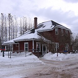 Former train station in Riverside-Albert | |
 Riverside-Albert Location of Riverside-Albert, New Brunswick | |
| Coordinates: 45°45′5.1″N 64°43′3.6″W / 45.751417°N 64.717667°WCoordinates: 45°45′5.1″N 64°43′3.6″W / 45.751417°N 64.717667°W | |
| Country | |
| Province | |
| County | Albert County |
| Parish | Hopewell Parish |
| Incorporated | 1966 |
| Government | |
| • Type | Village council |
| • Mayor | Jim Campbell |
| • Deputy Mayor | Arnold Morrissey |
| • Councillor | Peter Murphy |
| • Councillor | Kelly Wright |
| Area | |
| • Land | 5.74 km2 (2.22 sq mi) |
| Population (2016) | |
| • Total | 350 |
| • Density | 203.3/km2 (527/sq mi) |
| • Change 2006-11 | |
| Electoral districts | |
| • Federal | Fundy Royal |
| • Provincial | Albert |
| Time zone | UTC-4 (Atlantic (AST)) |
| • Summer (DST) | UTC-3 () |
| Canadian Postal code | E4H |
| Area code(s) | 506, 428 |
| Telephone Exchange | 882 |
| Highway | |
| Website | http://www.riverside-albert.ca |

Riverside-Albert (2016 pop.: 350) is a Canadian village in Hopewell Parish of Albert County, New Brunswick.
Riverside-Albert is located on the at the edge of the Shepody Marsh. The community of Harvey Parish is located across the river. It is approximately halfway between two major tourist destinations: Fundy National Park and the Hopewell Rocks.
A location place name. Post office called Albert from 1875; Riverside from 1875 to 1932; Riverside from 1932. Village incorporated in 1966.[1]
The Trans Canada Trail passes through Riverside-Albert.[2]
History[]
Notable people[]
Notable residents have included Abner Reid McClelan and Roscoe Fillmore.
See also[]
References[]
- ^ Hamilton, William (1978). The Macmillan Book of Canadian Place Names. Toronto: Macmillan. p. 84. ISBN 0-7715-9754-1.
- ^ Sentier NB Trails
| show Places adjacent to Riverside-Albert, New Brunswick |
|---|
| hide | |
|---|---|
| Subdivisions |
|
| Cities | |
| Towns | |
| Villages |
|
| Counties | |
| |
| show Authority control |
|---|
This New Brunswick location article is a stub. You can help Wikipedia by . |
Categories:
- Communities in Albert County, New Brunswick
- Villages in New Brunswick
- New Brunswick geography stubs