Drummond, New Brunswick
Drummond | |
|---|---|
Village | |
 | |
 Drummond Location within New Brunswick | |
| Coordinates: 47°02′07″N 67°41′07″W / 47.0353°N 67.6852°WCoordinates: 47°02′07″N 67°41′07″W / 47.0353°N 67.6852°W | |
| Country | Canada |
| Province | New Brunswick |
| County | Victoria |
| Parish | Drummond Parish |
| Government | |
| • Type | Village council |
| • Mayor | France Roussel |
| • Deputy Mayor | Michel St-Amand |
| Area | |
| • Land | 8.90 km2 (3.44 sq mi) |
| Population (2016)[1] | |
| • Total | 737 |
| • Density | 82.9/km2 (215/sq mi) |
| • Change 2011-16 | |
| Time zone | UTC-4 (Atlantic) |
| • Summer (DST) | UTC-3 (Atlantic) |
| Area code(s) | Area code 506 |
| Dwellings | 350 |
| Website | www |
Drummond is a Canadian village in Victoria County, New Brunswick. Its population as of the Canada 2016 Census was 737, with roughly 90% of its residents being Francophone.[1]
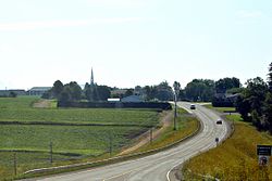
It is located in rolling farmland approximately 5 kilometres southeast of Grand Falls. Drummond's economy is centred on the potato industry, and cereal crops such as wheat, barley and oats are grown mainly through crop rotation. More than 50% of the potatoes grown are sold for processing to McCain Foods Limited, and 45% are grown as seed potatoes for inter-provincial and international export.
History[]
The village was first settled by Irish immigrants in the 1850s. It was named after Gordon Drummond, a Major in the British Army. Acadian settlement occurred during the latter half of the 19th century.
Demographics[]
| Year | Pop. | ±% |
|---|---|---|
| 2006 | 839 | — |
| 2011 | 775 | −7.6% |
| 2016 | 737 | −4.9% |
| [2][1] | ||
Notable people[]
- Ron Turcotte, who won the Triple Crown of Thoroughbred Racing in 1973, was born in Drummond.
See also[]
References[]
- ^ a b c d "Census Profile, 2016 Census: Drummond, Village [Census subdivision], New Brunswick". Statistics Canada. Retrieved October 1, 2019.
- ^ "2011 Census Profile: Drummond, New Brunswick". Statistics Canada. Retrieved October 1, 2019.
External links[]
- (in French) Village de Drummond
This New Brunswick location article is a stub. You can help Wikipedia by . |
- Communities in Victoria County, New Brunswick
- Villages in New Brunswick
- New Brunswick geography stubs