Hillsborough Parish, New Brunswick
Hillsborough | |
|---|---|
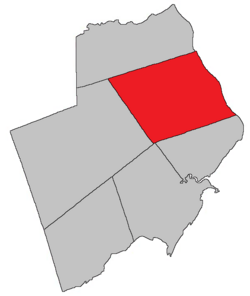 Location within Albert County. | |
| Coordinates: 45°55′N 64°42′W / 45.92°N 64.70°WCoordinates: 45°55′N 64°42′W / 45.92°N 64.70°W | |
| Country | |
| Province | |
| County | Albert County |
| Erected | 1786 |
| Area | |
| • Land | 304.05 km2 (117.39 sq mi) |
| Population (2016)[1] | |
| • Total | 1,308 |
| • Density | 4.3/km2 (11/sq mi) |
| • Change 2011-2016 | |
| • Dwellings | 649 |
| Time zone | UTC-4 (AST) |
| • Summer (DST) | UTC-3 (ADT) |

Hillsborough is a civil parish in eastern Albert County, New Brunswick, Canada.[2] It comprises one village and one local service district, both of which are members of the Southeast Regional Service Commission.[3]
The Census subdivision of the same name includes all of the parish except the village of Hillsborough.[1]
Origin of name[]
Hillsborough was probably named in honour of the Earl of Hillsborough,[4] First Lord of Trade in 1765.
History[]
Hillsborough was originally established in 1765 as a township within Nova Scotia, a grant of 100 000 acres to Robert Cummings and four others[5] that included modern Hillsborough Parish and most of Coverdale Parish. In 1786 the township's boundaries were explicitly used for the newly erected Hillsborough Parish.[6]
Boundaries[]
Hillsborough Parish is bounded:[2][7][8]
- on the north by the northern line of a grant to Albert E. Rogers on the Petitcodiac River, about 120 metres south of the mouth of Stoney Creek, and its prolongation inland to a point about 2.6 kilometres east of Little River;
- on the east by the Petitcodiac River;
- on the south by the southern line of a grant to William Carlisle on the Petitcodiac River, about 2 kilometres north of the junction of Grub Road with Route 114, and its prolongation southwesterly for to a point 12 miles (19 km) inland;
- on the west by a line running north 22º west[a] to the prolongation of the Rogers grant.
Evolution of boundaries[]
Originally the western line of Hillsborough extended north to the Petitcodiac River west of Upper Coverdale.
In 1828 all of the parish north of a line running west from the mouth of Stoney Creek was erected as Coverdale Parish.[10]
The northern boundary was moved slightly south in 1850 to its modern starting point.[11] 1850 was also the first year the parish's southern and western boundaries were described without referring to the original boundaries of the pre-Loyalist township.
Municipality[]
The village of Hillsborough is on the Petitcodiac River, from south of Weldon Creek to north of Christopher Lane; the inland boundary is irregular, based partly on grant lines and partly on property lines of the late 1960s.[12]
Local service district[]
The local service district of the parish of Hillsborough includes the entire parish outside the village of Hillsborough.[13]
The LSD was established on 23 November 1966 to assess for fire protection[14] following the abolition of rural governments by the new Municipalities Act. First aid & ambulance services were added on 17 November 1976.[15]
Today the LSD assesses for community & recreation services in addition to the basic LSD services of fire protection, police services, land use planning, emergency measures, and dog control.[16] The taxing authority is 615.00 Hillsborough.
Communities[]
Communities at least partly within the parish;[7][8][17] bold indicates an incorporated municipality
- Albert Mines
- Baltimore
- Beech Hill
- Berryton
- Caledonia Mountain
- Dawson Settlement
- Demoiselle Creek
- Edgetts Landing
- Hillsborough
- Surrey
- Isaiah Corner
- Osborne Corner
- Rosevale
- Salem
- Shenstone
- Steeves Mills
- Steevescote
- Weldon
Bodies of water[]
Bodies of water[b] at least partly in the parish:[7][8][17]
- Petitcodiac River
- Stoney Creek
- Turtle Creek - East Branch, West Branch
- at least seven other named creeks
- Stanyard Lake
Islands[]
Islands at least partly in the parish:[7][8][17]
- Grays Island
Other notable places[]
Parks, historic sites, and other noteworthy places at least partly in the parish.[7][8][17]
- Big Meadows Protected Natural Area
- Caledonia Gorge Protected Natural Area
- Lewis Mountain Protected Natural Area
- Wilson Brook Protected Natural Area
Demographics[]
Population[]Parish population total does not include the village of Hillsborough
Language[]Mother tongue (2016)[1]
| |||||||||||||||||||||||||||||||||||||||
Access Routes[]
Highways and numbered routes that run through the parish, including external routes that start or finish at the parish limits:[20]
Notes[]
- ^ By the magnet of 1765,[2] when declination in the area was between 14º and 15º west of north.[9]
- ^ Not including brooks, ponds or coves.
References[]
- ^ a b c d e "Census Profile, 2016 Census: Hillsborough, Parish [Census subdivision], New Brunswick". Statistics Canada. Retrieved September 4, 2019.
- ^ a b c "Chapter T-3 Territorial Division Act". Government of New Brunswick. Retrieved 13 November 2020.
- ^ "Communities in each of the 12 Regional Service Commissions (RSC) / Les communautés dans chacune des 12 Commissions de services régionaux (CSR)" (PDF), Government of New Brunswick, July 2017, retrieved 1 February 2021
- ^ Ganong, William F. (1896). A Monograph of the Place-Nomenclature of the Province of New Brunswick. Royal Society of Canada. p. 240. Retrieved 17 March 2021.
- ^ Ganong, William F. (1899). A Monograph of Historic Sites in the Province of New Brunswick. Royal Society of Canada. p. 335. Retrieved 30 March 2021.
- ^ "26 Geo. III Chapter I. An Act for the better ascertaining and confirming the Boundaries of the several Counties within this Province, and for subdividing them into Towns or Parishes.". Acts of the General Assembly of His Majesty's Province of New-Brunswick, passed in the year 1786. Saint John, New Brunswick: Government of New Brunswick. 1786. pp. 3–12. Retrieved 20 March 2021.
- ^ a b c d e "No. 131". Provincial Archives of New Brunswick. Department of Natural Resources and Energy Development. Retrieved 2 June 2021. Remainder of parish on maps 132, 142, and 143 at same site.
- ^ a b c d e "379" (PDF). Transportation and Infrastructure. Government of New Brunswick. Retrieved 2 June 2021. Remainder of parish on mapbooks 380 and 399–401 at same site.
- ^ "Historical Magnetic Declination". National Oceanic and Atmospheric Administration. Retrieved 2 June 2021.
- ^ "9 Geo. IV c. 17 An Act to erect a part of the Parish of Hillsborough in the County of Westmoreland, into a distinct Town or Parish.". Acts of the General Assembly of His Majesty's Province of New-Brunswick, Passed in the Year 1828. Fredericton: Government of New Brunswick. 1828. p. 22. Retrieved 27 March 2021.
- ^ "13 Vic. c. 51 An Act to consolidate all the Laws now in force for the division of the Province into Counties, Towns and Parishes.". Acts of the General Assembly of Her Mjaesty's Province of New Brunswick, Passed in the Year 1850. Fredericton: Government of New Brunswick. 1850. pp. 142–152, 145–149. Retrieved 27 March 2021. Book was poorly proofread, resulting in title typo and reuse of page numbers 145–152.
- ^ "New Brunswick Regulation 85-6 under the Municipalities Act (O.C. 85-45)". Government of New Brunswick. Retrieved 12 December 2020.
- ^ "New Brunswick Regulation 84-168 under the Municipalities Act (O.C. 84-582)". Government of New Brunswick. Retrieved 12 December 2020.
- ^ "Regulation 66–41 under the Municipalities Act (O. C. 66–968)". The Royal Gazette. Fredericton. 124: 604–605. 21 December 1966.
- ^ "Regulation 76–148 under the Municipalities Act (O. C. 76–847)". The Royal Gazette. Fredericton. 134: 1194. 24 November 1976.
- ^ "2020 Local Government Statistics for New Brunswick" (PDF). Department of Environment and Local Government. p. 55. Retrieved 12 December 2020.
- ^ a b c d "Canadian Geographical Names Database". Government of Canada. Retrieved 8 June 2021.
- ^ Statistics Canada: 2001, 2006 census
- ^ 2011 Statistics Canada Census Profile: Hillsborough Parish, New Brunswick
- ^ Atlantic Canada Back Road Atlas ISBN 978-1-55368-618-7
Places adjacent to Hillsborough Parish, New Brunswick | |
|---|---|
| Subdivisions |
|
|---|---|
| Cities | |
| Counties | |
| |
- Parishes of Albert County, New Brunswick
- Local service districts of Albert County, New Brunswick