Dorchester Parish, New Brunswick
Dorchester | |
|---|---|
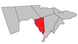 Location within Westmorland County, New Brunswick. | |
| Coordinates: 46°11′N 64°36′W / 46.19°N 64.60°W | |
| Country | |
| Province | |
| County | Westmorland County |
| Erected | 1787 |
| Area | |
| • Land | 90.13 km2 (34.80 sq mi) |
| Population (2016)[1] | |
| • Total | 429 |
| • Density | 4.8/km2 (12/sq mi) |
| • Change 2011-2016 | |
| • Dwellings | 215 |
| Time zone | UTC-4 (AST) |
| • Summer (DST) | UTC-3 (ADT) |

Dorchester is a civil parish in Westmorland County, New Brunswick, Canada.[2]
For governance purposes it is divided between the city of Dieppe;[3] the villages of Dorchester and Memramcook;[3] the Indian reserve of Fort Folly 1; and the local service district of the parish of Dorchester,[4] which further includes the special services area of Calhoun Road.
All governance units except the Indian reserve are members of the Southeast Regional Service Commission.[5]
Origin of name[]
The parish was named in honour of the Baron of Dorchester,[6] Governor General of British North America at the time and elder brother of Thomas Carleton, Governor of New Brunswick.
History[]
Dorchester was erected in 1787 from unassigned territory between Moncton and Sackville Parishes.[7] The parish included parts of modern Moncton, Sackville, and Shediac Parishes.
In 1827 part of Dorchester was included in the newly erected Shediac Parish.[8]
In 1835 all of Dorchester north of a line due east from the mouth of Fox Creek was transferred to Moncton Parish.[9]
In 1894 northern line was changed to a magnetic bearing running 6° 15' south of due east.[10] The 1894 boundaries were made retroactive to the erection of the parish.
Boundaries[]
Dorchester Parish is bounded:[2][11][12]
- on the north by a line running south 83º 45' east[a] from the southern side of the mouth of Fox Creek to a point about 5.75 kilometres past the Memramcook River;
- on the east and southeast by a line running south 11º west[b] about 24 kilometres to a point about 100 metres south of Route 106, on the prolongation of the southeast line of a grant to John Sherwood on Shepody Bay, then running along the prolongation and grant line to strike Shepody Bay at the junction of Ralph Stiles Road and Route 935;
- on the west by Shepody Bay and the Petitcodiac River.
Communities[]
Communities at least partly within the parish.[11][12][17] bold indicates an incorporated municipality or Indian reserve
- Calhoun
- Cherry Burton
- Dieppe
- Upper Dover
- Dorchester
- Dorchester Cape
- Fort Folly 1
- Middleton
- Taylor Village
- Upper Dorchester
- village of Memramcook
- Beaumont
- Belliveau Village
- Boudreau Village
- Breau Creek
- College Bridge
- Cormier Cove
- Dover
- Gautreau Village
- Gaytons
- La Hêtrière
- La Montagne
- Le Lac
- Little Dover
- McGinleys Corner
- Memramcook[c]
- Memramcook East
- Memramcook West
- Pré-d'en-Haut
- Saint-Joseph
Bodies of water[]
Bodies of water[d] at least partly within the parish.[11][12][17]
- Memramcook River
- Petitcodiac River
- Belliveau Creek
- Boudreau Creek
- Boyd Creek
- Breau Creek
- Cormier Cove Creek
- Downing Creek
- Grindstone Creek
- LeBlanc Creek
- McFarlane Creek
- Palmers Creek
- Rockwell Creek
- Steeves Creek
- Stony Creek
- Turner Creek
- Upper Creek
- Shepody Bay
- Folly Lake
- Memramcook Lake
Other notable places[]
Parks, historic sites, and other noteworthy places at least partly within the parish.[11][12][17][18]
- Dorchester Penitentiary
- Johnson's Mills Protected Natural Area
- Shepody Healing Centre
- Westmorland Institution
Demographics[]
Parish population total does not include the village of Dorchester, Memramcook, Fort Folly 1, and the portion within Dieppe
Population[]
|
Language[]Mother tongue (2016)[1]
| |||||||||||||||||||||||||||||||||||||||
Access routes[]
Highways and numbered routes that run through the parish, including external routes that start or finish at the parish limits:[21]
|
|
|
See also[]
Notes[]
- ^ By the magnet of 1894,[10] when declination in the area was between 21º and 22º west of north.[13] The Territorial Division Act clause referring to magnetic direction bearings was omitted in the 1952[14] and 1973 Revised Statutes.[2]
- ^ By the magnet of 1765,[15] when declination in the area was a bit more than 14º west of north.[16]
- ^ The community of Memramcook is part of the village of Memramcook.
- ^ Not including brooks, ponds or coves.
References[]
- ^ a b c d "Census Profile, 2016 Census: Dorchester, Parish [Census subdivision], New Brunswick". Statistics Canada. Retrieved October 5, 2019.
- ^ a b c "Chapter T-3 Territorial Division Act". Government of New Brunswick. Retrieved 13 November 2020.
- ^ a b "New Brunswick Regulation 85-6 under the Municipalities Act (O.C. 85-45)". Government of New Brunswick. Retrieved 23 July 2020.
- ^ "New Brunswick Regulation 84-168 under the Municipalities Act (O.C. 84-582)". Government of New Brunswick. Retrieved 23 July 2020.
- ^ "Communities in each of the 12 Regional Service Commissions (RSC) / Les communautés dans chacune des 12 Commissions de services régionaux (CSR)" (PDF), Government of New Brunswick, July 2017, retrieved 1 February 2021
- ^ Ganong, William F. (1896). A Monograph of the Place-Nomenclature of the Province of New Brunswick. Royal Society of Canada. p. 230. Retrieved 17 March 2021.
- ^ "27 Geo. III Chapter VII. An Act in Addition to an Act for the better ascertaining and confirming the Boundaries of the several Counties within this Province, and for Subdividing them into Towns or Parishes.". Acts of the General Assembly, of His Majesty's Province of New-Brunswick, Passed in the Year 1787. Saint John, New Brunswick: Government of New Brunswick. 1787. p. 147. Retrieved 27 March 2021.
- ^ "8 Geo. IV c. 13 An Act to erect the North-eastern part of the County of Westmoreland into a distinct Town or Parish, and also to authorize the appointment of Parish Officers at the November General Sessions in each year.". Acts of the General Assembly of His Majesty's Province of New-Brunswick, Passed in the Year 1827. Fredericton: Government of New Brunswick. 1827. pp. 28–30. Retrieved 27 March 2021.
- ^ "5 Wm. IV c. 15 An Act to alter the boundary line between certain Parishes in the County of Westmorland.". Acts of the General Assembly of His Majesty's Province of New-Brunswick, Passed in the Year 1835. Fredericton: Government of New Brunswick. 1835. p. 27. Retrieved 27 March 2021.
- ^ a b "57 Vic. c. 36 An Act to amend Chapter 2 of the Consolidated Statutes, of 'The division of the Province into Counties, Towns and Parishes,' so far as relates to the County of Westmorland.". Acts of the General Assembly of Her Majesty's Province of New Brunswick. Passed in the Month of April, 1894. Fredericton: Government of New Brunswick. 1894. pp. 162–163. Available as a free ebook from Google Books.
- ^ a b c d "No. 120". Provincial Archives of New Brunswick. Department of Natural Resources and Energy Development. Retrieved 24 June 2021. Remainder of parish on maps 132, 133, and 144 at same site.
- ^ a b c d "359" (PDF). Transportation and Infrastructure. Government of New Brunswick. Retrieved 24 June 2021. Remainder of parish on mapbooks 360, 380, 381, 400, and 401 at same site.
- ^ "Historical Magnetic Declination". National Oceanic and Atmospheric Administration. Retrieved 2 May 2021.
- ^ "Chapter 227 Territorial Division Act". The Revised Statutes of New Brunswick 1952 Volume III. Fredericton: Government of New Brunswick. 1952. pp. 3725–3771.
- ^ "13 Vic. c. 51 An Act to consolidate all the Laws now in force for the division of the Province into Counties, Towns and Parishes.". Acts of the General Assembly of Her Mjaesty's Province of New Brunswick, Passed in the Year 1850. Fredericton: Government of New Brunswick. 1850. pp. 142–152, 145–149. Book was poorly proofread, resulting in title typo and reuse of page numbers 145–152.
- ^ "Historical Magnetic Declination". National Oceanic and Atmospheric Administration. Retrieved 2 May 2021.
- ^ a b c "Search the Canadian Geographical Names Database (CGNDB)". Government of Canada. Retrieved 3 July 2021.
- ^ "Explore New Brunswick's Protected Natural Areas". GeoNB. Retrieved 3 July 2021.
- ^ Statistics Canada: 2001, 2006 census
- ^ 2011 Statistics Canada Census Profile: Dorchester Parish, New Brunswick
- ^ Atlantic Canada Back Road Atlas ISBN 978-1-55368-618-7
Places adjacent to Dorchester Parish, New Brunswick | |
|---|---|
| Subdivisions |
|
|---|---|
| Cities | |
| Counties | |
| |
Coordinates: 46°01′25″N 64°36′13″W / 46.023668°N 64.603729°W
- Parishes of Westmorland County, New Brunswick
- Local service districts of Westmorland County, New Brunswick